Inchaiden, Inchcadin, Inisadain
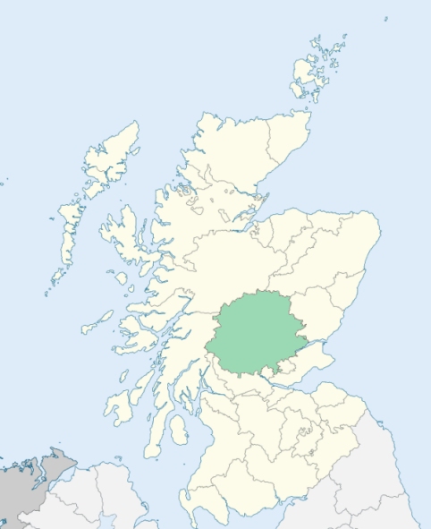
Kenmore is a parish in the district of Breadalbane, Perthshire. It comprises a main body and two detached sections. The main body is bounded on the north by Fortingall, on the east by Dull, and by detached parts of various parishes, on the south by Comrie, and on the west by Killin. It is intersected by parts of Weem and Killin, and extruded from connection with the upper part of Loch Tay by the intervention of parts of other parishes. One of its detached section lies between Fortingall and Killin, on the confines of Argyleshire. The western detached section is bounded by Loch Lyon and the main stream which that lake receives and disgorges. The eastern detached section forms the basin of the chief and lower part of the Quaich. (1867: The Imperial Gazetteer of Scotland, by John Marius Wilson).
Acharn, Ardeonaig, Ardtalnaig, Bridgend or Kendrochad, Blairmore, Carie, Cuiltrannich, Kenmore, Lawers, Stronfearnan
Breadalbane, Easter Shian
The parish of Kenmore had five detached parts:
No. 1. Daldravaig, a little to the west of Killin village, and almost wholly surrounded by the parish of Killin
No. 2. Corrycharmaig, in Glenlochay, west of Killin village
No. 3 Morenish and Carie, lying on both sides of Loch Tay towards its west end
No. 4. Shian, in Glenquaich
No. 5 Kenknock, at the head of Glenlochay, and extending northwards into Glenlyon
(a.) Kenmore detached No. 4 was transferred to the parish of Dull.
(b.) The part of Kenmore at Drummond Hill, lying in the basin of the River Lyon, was transferred to the parish of Fortingall.
(c.) Kenmore detached No. 5 was transferred partly to the parish of Fortingall and partly to the parish of Killin, the part in the basin of the River Lyon going to Fortingall and the remainder to Killin.
(d.) Kenmore detached No. 1 and Kenmore detached No. 2 were transferred to the parish of Killin.
(e.) Killin detached No. 2 was annexed to the parish of Kenmore, and Kenmore detached No. 3 was thus united with the main portion of the parish of Kenmore.
(f.) Weem detached No. 2 was annexed to the parish of Kenmore, and the part of Weem detached No. 4 which lies in the basin of Loch Tay was also annexed to Kenmore.
See affected properties and landholders. (1892: Boundary of counties and parishes in Scotland as settled by the Boundary Commissioners under the Local Government Act, 1889, by Hay Shennan)
PRE-REFORMATION GOVERNANCE:
POST-REFORMATION GOVERNANCE:
The ancient church of this parish was dedicated to St Aidan. Its site at Inisadain (Aidan's Meadow), on the north bank of the Tay, is now within the grounds of Taymouth Castle. At Kenmore, to which place the church has been moved, there was long held a Fair of St Peter. A parish church was built at Kenmore in 1579, but the old church was used occasionally until 1760, when the manse was removed from Inisadain. On the island of Ealean Adain (Aidan's Isle), near the east end of Loch Tay and not far from Kenmore, there was an early Celtic monastic foundation. At Carwhyn, in this parish, there is a mission chapel.
Disjoined Quoad Sacra Parishes:
Amulree. The name of this parish, Ath Mhalruibh (the ford of Malrubh), commemorates an ancient chapel of St Malrubh, which stood here beside the ford of the River Braan. Amulree was disjoined from Dull, Fowlis Wester, Kenmore, Little Dunkeld, Monzie, Weem, and Crieff on 15 July 1871. The church was begun in 1743, but owing to the (Jacobite) Rebellion in 1745, was not completed until 1752.
Includes ministers, licentiates, assistants, readers, and clerks.
Kenmore (QO)
Amulree (QS)
(1928: Fasti Ecclesiæ Scoticanæ, by Hew Scott, D. D.)
Parish registers turned over to the Registrar-General, as a result of the Registration of Births, Deaths, and Marriages (Scotland) Act of 1854. The letters B. D. and M. indicate Births (or Baptisms), Deaths (or Burials), and Marriages (or Proclamations of Banns) respectively. Numbers indicate separate volumes or books. Note: These records are by no means complete or without damage; consult the Detailed List of the Old Parochial Registers of Scotland (1872) to learn more about the condition of the records.
| OPR and RD Numbers | |||
|---|---|---|---|
| Date Range | Name | Number | Type |
| 1636-1854 | Kenmore | 360 | OPR |
| 1855-1971 | Kenmore | 360 | RD |
| 1972-2003 | Kenmore | 384 | RD |
| 2004-2005 | Kenmore, Perth and Kinross | 384 | RD |
| 2009 | Perth and Kinross, Kenmore | 384 | RD |
| 2026 | Perth and Kinross Council; Kenmore and District Community Council | ||
(2009: Parishes and Registration Districts of Scotland - Old and New, National Records of Scotland)
Local community councils (2026) are provided as a potential source of additional information for settlements within the original boundaries of the parish. (Source)
Statistics from informal and official censuses
Anderson, Cameron, Campbell, Carmichael, Dewar, Ferguson, Fraser, Robertson, Stewart, Walker
Note: Names appearing in research materials, other than censuses. Simple names (First name, surname only) have been omitted unless they appear associated with large properties. All women's names, and men's names with occupations, military ranks, or peerage titles are included.
By the Reverend Mr Colin MacVean, Minister.
"By a survey taken in 1794-5, the population amounts to 3463. Of these 1520 are males, and 1943 are females. In the parish are 63 weavers, 38 tailors, 36 wrights, 26 shoemakers, 20 flax-dressers, 10 smiths, 9 masons, 8 coopers, 4 hosiers, and 1 dyer. In the above list apprentices and journeymen are included. The only villages in the parish are Kenmore and Stronfernan, the latter of which was built a few years ago, and consists of about 24 families."
(This section contains excerpts, at times restructured or paraphrased, from an article appearing in Statistical Account of Scotland, Sir John Sinclair, 1791-1799)
Primary Sources:
Statistical Account of Scotland (1791-1799), Volume 17, p. 456
New Statistical Account of Scotland (1834-1845), Volume 10, p. 452
See Parish Page Sources for all source information and links.