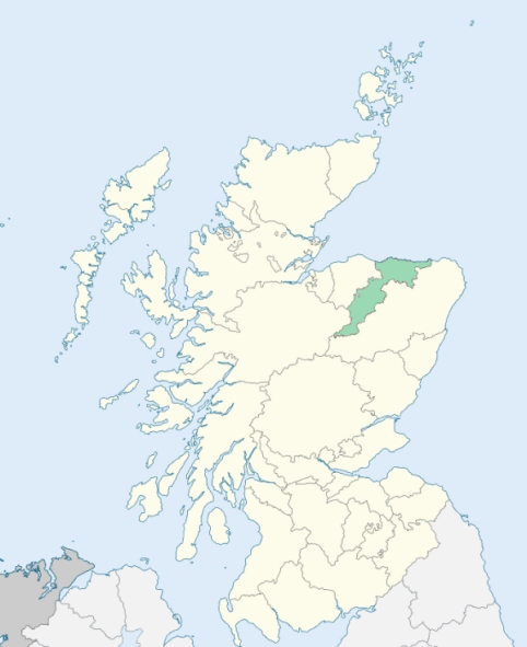
Alvah is a parish on the north-east border of Banffshire. It is bounded on the north-east and east by Aberdeenshire, and on the other sides by the parishes of Forglen, Marnoch, and Banff. (1867: The Imperial Gazetteer of Scotland, by John Marius Wilson).
Alvah, Auchenbadie, Blacktown, Cairnhill, Itlaw, Montblairy, Rosyburn, Ryland, Sandlaw, Upper Inverichny
Dunlugas, Gavenwood, Gellyburn, Montblairy, Montcoffer
There was a detached part of the county of Aberdeen which was also a detached part of the Aberdeenshire parish of King Edward, and which was surrounded by the county of Banff. It was situated near the town of Banff, and was surrounded by the Banffshire parishes of Alvah, Banff, and Gamrie. This detached part was transferred to the county of Banff, and was at the same time annexed to the parish of Alvah. See affected properties and landholders. (1892: Boundary of counties and parishes in Scotland as settled by the Boundary Commissioners under the Local Government Act, 1889, by Hay Shennan)
Transferred from the County of Aberdeen to the County of Banff: The parishes of Alvah, Gamrie, Inverkeithny, and Rothiemay. (1892: Boundary of counties and parishes in Scotland as settled by the Boundary Commissioners under the Local Government Act, 1889, by Hay Shennan)
PRE-REFORMATION GOVERNANCE:
POST-REFORMATION GOVERNANCE:
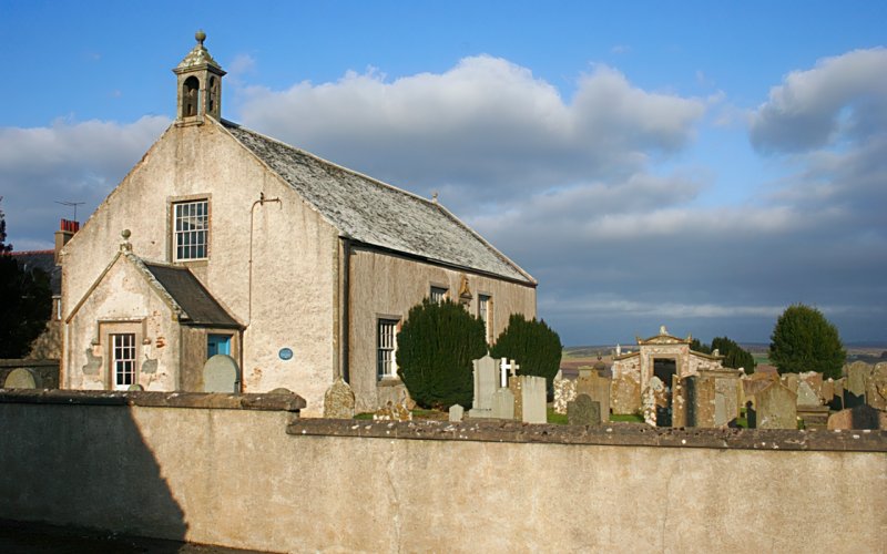
The church of Alvah was dedicated to St Colman. It belonged to the Abbey of Coupar in Angus. Within the bounds were the Wells of St Colman, St Breandan, and St Katherine. A church built in 1792 was considerably remodeled in 1882.
Disjoined Quoad Sacra Parishes:
Ord. A chapel was built here in 1836. The parish of Ord was disjoined from Banff, Alvah, Boyndie, and Marnoch, 5 July 1869.
Includes ministers, licentiates, assistants, readers, and clerks.
Alvah (QO)
Ord (QS)
(1928: Fasti Ecclesiæ Scoticanæ, by Hew Scott, D. D.)
Parish registers turned over to the Registrar-General, as a result of the Registration of Births, Deaths, and Marriages (Scotland) Act of 1854. The letters B. D. and M. indicate Births (or Baptisms), Deaths (or Burials), and Marriages (or Proclamations of Banns) respectively. Numbers indicate separate volumes or books. Note: These records are by no means complete or without damage; consult the Detailed List of the Old Parochial Registers of Scotland (1872) to learn more about the condition of the records.
| OPR and RD Numbers | |||
|---|---|---|---|
| Date Range | Name | Number | Type |
| 1717-1854 | Alvah | 146 | OPR |
| 1855-1954 | Alvah | 146 | RD |
| 1968-1971 | Aberchirder | 146 | RD |
| 1972-2000 | Aberchirder | 294 | RD |
| 2009 | Aberdeenshire, Banff | 293 | RD |
| 2026 | Aberdeenshire Council; Alvah and Forglen Community Council | ||
(2009: Parishes and Registration Districts of Scotland - Old and New, National Records of Scotland)
Local community councils (2026) are provided as a potential source of additional information for settlements within the original boundaries of the parish. (Source)
Statistics from informal and official censuses
Andrew, Chalmers, Grant, Innes, Morrison, Murdoch, Pirie, Rae, Simpson, Smith
Note: Names appearing in research materials, other than censuses. Simple names (First name, surname only) have been omitted unless they appear associated with large properties. All women's names, and men's names with occupations, military ranks, or peerage titles are included.
By the Reverend Mr George Sangster.
"In the year 1782, the number of parishioners, on an exact survey, was found to amount to 1070; which is very nearly the present state of it. Some years before it was rather greater. One principal cause of depopulation in this parish is, the eagerness of some improvers to take all their land under their own management; by which means mechanics, and even day-labourers are deprived of their crofts; and, as there are no villages within the parish, betake themselves to other places, where they can find accommodation.
The inhabitants are mostly employed in agriculture. There are several weavers and wrights, a few smiths and tailors, and often not one shoemaker. They are regular attenders of the Established Church."
(This section contains excerpts, at times restructured or paraphrased, from an article appearing in Statistical Account of Scotland, Sir John Sinclair, 1791-1799)
Primary Sources:
Statistical Account of Scotland (1791-1799), Volume 4, p. 393
New Statistical Account of Scotland (1834-1845), Volume 13, Section I, p. 144
See Parish Page Sources for all source information and links.