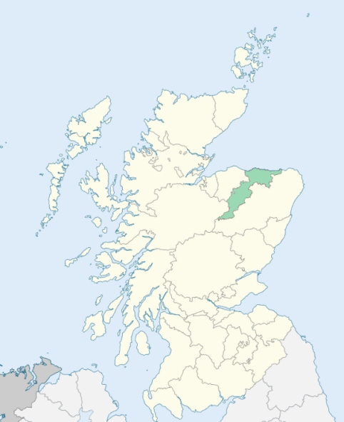
Rothiemay is a parish in Banffshire. It is bounded on the south and south-west by Aberdeenshire, and on other sides by the parishes of Grange, Marnoch, and Inverkeithny. (1867: The Imperial Gazetteer of Scotland, by John Marius Wilson).
Auchencrieve, Blackstobs, Coldholmes, Corskellie, Hassiehillock, Hauklaw, Inschcorsie, Knauchland, Losset, Mayen, Parroch, Retanoch or Retanach, Rothiemay or Milltown, Scraib, Turtory, Windshole or Winshole, Woodside
Transferred from the County of Aberdeen to the County of Banff: The parishes of Alvah, Gamrie, Inverkeithny, and Rothiemay. (1892: Boundary of counties and parishes in Scotland as settled by the Boundary Commissioners under the Local Government Act, 1889, by Hay Shennan)
PRE-REFORMATION GOVERNANCE:
POST-REFORMATION GOVERNANCE:
The church of Rothiemay was dedicated to St Drostan. It was a mensal kirk of the Bishop of Moray. Fairs of the Holy Rood, St Drostan, and St Denys were held at Rothiemay.
Includes ministers, licentiates, assistants, readers, and clerks.
(1928: Fasti Ecclesiæ Scoticanæ, by Hew Scott, D. D.)
Parish registers turned over to the Registrar-General, as a result of the Registration of Births, Deaths, and Marriages (Scotland) Act of 1854. The letters B. D. and M. indicate Births (or Baptisms), Deaths (or Burials), and Marriages (or Proclamations of Banns) respectively. Numbers indicate separate volumes or books. Note: These records are by no means complete or without damage; consult the Detailed List of the Old Parochial Registers of Scotland (1872) to learn more about the condition of the records.
| OPR and RD Numbers | |||
|---|---|---|---|
| Date Range | Name | Number | Type |
| 1601-1854 | Rothiemay | 165 | OPR |
| 1855-1959 | Rothiemay | 165 | RD |
| 2009 | Moray, Keith | 295 | RD |
| 2026 | Moray Council; Strathisla Community Council | ||
(2009: Parishes and Registration Districts of Scotland - Old and New, National Records of Scotland)
Local community councils (2026) are provided as a potential source of additional information for settlements within the original boundaries of the parish. (Source)
Statistics from informal and official censuses
Allan, Cruickshank, Duncan, Mackie, Milne, Morrison, Munro, Reid, Smith, Wilson
Note: Names appearing in research materials, other than censuses. Simple names (First name, surname only) have been omitted unless they appear associated with large properties. All women's names, and men's names with occupations, military ranks, or peerage titles are included.
By the Reverend Mr James Simmie.
"The number of inhabitants is 1125; of whom, 481 are males, 644 females. Of the inhabitants 1067 are of the Established Church; 25 are Episcopalians, 27 Seceders; and 6 Roman Catholics. There are 6 masons, 4 dikers, 10 wrights, 4 turners, 3 coopers, 4 smiths, 2 slaters, 3 flax-dressers, 27 weavers, 3 dyers, 13 shoemakers, 6 tailors, 7 shopkeepers, 3 innkeepers, and 2 butchers.
All the men who are not tradesmen and mechanics, are employed in agriculture; and tradesmen and mechanics, who are housekeepers, likewise cultivate a few acres for the accommodation of their families. The women, when they are not employed in the moss in summer, or the field in harvest, sometimes knit stockings, but commonly spin linen-yarn for the merchant, who buys it, by commission, for the manufacturer in Glasgow, Paisley, or some other distant part of the kingdom.
The inhabitants are, in person, slender rather than robust; in mind, acute and sensible. They excel their forefathers less in the luxuries of the table than elegance of dress; are generally very healthy; and live many of them 80, and some 90, years. Devoted to agriculture and the mechanical arts, they are very little inclined either to a military or a seafaring life. They are sober and industrious, respectful to superiors, obedient to the laws, charitable to the poor, and practice, among themselves, the virtues of integrity and friendship."
(This section contains excerpts, at times restructured or paraphrased, from an article appearing in Statistical Account of Scotland, Sir John Sinclair, 1791-1799)
Primary Sources:
Statistical Account of Scotland (1791-1799), Volume 19, p. 385
New Statistical Account of Scotland (1834-1845), Volume 13, Section I, p. 199
See Parish Page Sources for all source information and links.