Stow of Wedale
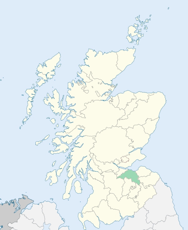
Stow is a parish, partly in Selkirkshire, but chiefly occupying the extremity of the long southeastern projection of Edinburghshire. It is bounded by the parishes of Heriot, Fala and Soutra, Channelkirk, Lauder, Melrose, Galashiels, Selkirk, Yarrow, and Innerleithen. (1867: The Imperial Gazetteer of Scotland, by John Marius Wilson).
Caitha, Crosslee, Clovenfords, Fountainhall, Kylochyett, Stow
Bowland, Burnhouse, Crookston, Pirn
The parish of Heriot has been altered in area through the addition of the detached part of the parish of Stow. This detached part was situated on the north-east border of Heriot parish. See affected properties and landholders. (1892: Boundary of counties and parishes in Scotland as settled by the Boundary Commissioners under the Local Government Act, 1889, by Hay Shennan)
PRE-REFORMATION GOVERNANCE:
POST-REFORMATION GOVERNANCE:
The church was dedicated to St Mary. Here was the southern seat of the Archibishop of St Andrews, called the Stow of Wedale. It had a right of sanctuary. Beside the ruin of the old church is Our Lady's Well.
Disjoined Quoad Sacra Parishes:
Caddonfoot. A chapel was opened here in 1863. The parish was disjoined quoad sacra from Galashiels, Innerleithen, Selkirk, Stow, and Yarrow in 1867.
Includes ministers, licentiates, assistants, readers, and clerks.
Stow (QO)
Caddonfoot (QS)
(1928: Fasti Ecclesiæ Scoticanæ, by Hew Scott, D. D.)
Parish registers turned over to the Registrar-General, as a result of the Registration of Births, Deaths, and Marriages (Scotland) Act of 1854. The letters B. D. and M. indicate Births (or Baptisms), Deaths (or Burials), and Marriages (or Proclamations of Banns) respectively. Numbers indicate separate volumes or books. Note: These records are by no means complete or without damage; consult the Detailed List of the Old Parochial Registers of Scotland (1872) to learn more about the condition of the records.
| OPR and RD Numbers | |||
|---|---|---|---|
| Date Range | Name | Number | Type |
| 1626-1854 | Stow | 699 | OPR |
| 1855-1968 | Stow | 699 | RD |
| 2009 | Scottish Borders, Galashiels | 810 | RD |
| 2026 | Scottish Borders Council; Parish of Stow Community Council | ||
(2009: Parishes and Registration Districts of Scotland - Old and New, National Records of Scotland)
Local community councils (2026) are provided as a potential source of additional information for settlements within the original boundaries of the parish. (Source)
Statistics from informal and official censuses
Boyd, Elliot, Grieve, Hall, Howden, Hume, Joyce, Kennedy, Shannon, Young
Note: Names appearing in research materials, other than censuses. Simple names (First name, surname only) have been omitted unless they appear associated with large properties. All women's names, and men's names with occupations, military ranks, or peerage titles are included.
By the Reverend Mr Robert Dawson.
"From a list taken in 1716 and 1717, of those above 8 years old, 1035; another in 1779, 1400 and upwards. This increase can only be attributed to the improvement of agriculture, no manufacture being yet established.
The people, in general, are healthy and robust, subject to few diseases. The greatest part of these arise from want of cleanliness and foul feeding, such as diseased sheep, and fish that come up at spawning time. Epidemical diseases have seldom proved fatal; but, of late years, there have been more consumptions and nervous complaints than formerly. This is perhaps to be attributed to the immoderate use of spirituous liquors, and the introduction of tea of the worst quality, drunk too hot, which may produce the most fatal effects on the nervous system."
(This section contains excerpts, at times restructured or paraphrased, from an article appearing in Statistical Account of Scotland, Sir John Sinclair, 1791-1799)
Primary Sources:
Statistical Account of Scotland (1791-1799), Volume 7, p. 133
New Statistical Account of Scotland (1834-1845), Volume 1, p. 398
See Parish Page Sources for all source information and links.