
Date: Pre-1929
Boundary: District designations as they appear in early census records
Date: 1930-1975
Boundary: Landward districts were created as a result of the Local Government (Scotland) Act 1929. They were formed by grouping parishes outside of Burghs (areas known as Landward) into districts with elected councils.
Date: 1975-1996
Boundary: Region and district designations as a result of the 1973 Local Government (Scotland) Act, with OPR parishes that fell into each district. The changes took effect on 15 May 1975, and were in place until 1996.
Date: Changes made as a result of the Local Government (Scotland) Act, 1889. Changes went into effect on 15 May 1891.
Orders made by the Boundary Commissioners for Scotland under Section 49 of the Local Government (Scotland) Act, 1889. Orders shall come into operation for the purposes of School Board elections on the 1st day of February 1891, and for all other purposes on the 15th day of May 1891.
Parishes of Ardrossan and Cumbrae, Counties of Ayr and Bute
The parish of Ardrossan was situated partly in the county of Ayr and partly in the county of Bute, the Buteshire portion being the island of Little Cumbrae. No change has been made on the county boundary, but the Buteshire part of the parish of Ardrossan has been transferred to the Buteshire parish of Cumbrae.
Transferred from the parish of Ardrossan, County of Ayr to the parish of Cumbrae, County of Bute:
Little Cumbrae Island - Earl of Eglinton & Winton (Proprietor)
Millport
Police Burgh: 1864
Small Burgh: 1929
Parish: Cumbrae
Region (Before 1975): Strathclyde
District (Before 1975): Cunninghame
Rothesay
Royal Burgh: 1401
Small Burgh: 1929
Parish: Rothesay
Region (Before 1975): Strathclyde
District (Before 1975): Argyll and Bute
See Parish Page Sources for all source information and links.
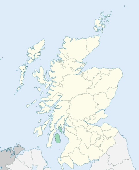
Location of Buteshire
View more maps at Wikipedia