Tippermuir, Tibbermuir
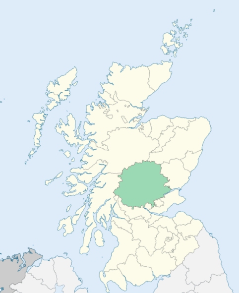
Tibbermore is a parish in the Perth proper district of Perthshire. It is bounded by Methven, Redgorton, Perth, Aberdalgie, Forteviot, and Findogask. (1867: The Imperial Gazetteer of Scotland, by John Marius Wilson).
Hillyland, Huntingtower, Ruthven, Ruthvenfield
The parish of Tibbermore had two detached parts, both of which were wholly surrounded by the parish of Perth. Tibbermore detached No. 2, situated at York Place, Perth, was situated wholly within the parliamentary and municipal boundary of the burgh of Perth, and the greater portion of Tibbermore detached No. 1 was also situated within the same boundary. The effect of the Order is to transfer to the parish of Perth the whole of Tibbermore detached no. 1 and so much of Tibbermore detached No. 2 as lies within the municipal boundaries of the burgh of Perth, and to transfer to the parish of Tibbermore that part of Perth parish which lay north of the Scouring Burn and west and north of the west and north burgh boundaries. See affected properties and landholders. (1892: Boundary of counties and parishes in Scotland as settled by the Boundary Commissioners under the Local Government Act, 1889, by Hay Shennan)
PRE-REFORMATION GOVERNANCE:
POST-REFORMATION GOVERNANCE:
The church of Tibbermore was dedicated to St Mary. It was a mensal parish of the Bishop of Dunkeld.
Includes ministers, licentiates, assistants, readers, and clerks.
(1928: Fasti Ecclesiæ Scoticanæ, by Hew Scott, D. D.)
Parish registers turned over to the Registrar-General, as a result of the Registration of Births, Deaths, and Marriages (Scotland) Act of 1854. The letters B. D. and M. indicate Births (or Baptisms), Deaths (or Burials), and Marriages (or Proclamations of Banns) respectively. Numbers indicate separate volumes or books. Note: These records are by no means complete or without damage; consult the Detailed List of the Old Parochial Registers of Scotland (1872) to learn more about the condition of the records.
| OPR and RD Numbers | |||
|---|---|---|---|
| Date Range | Name | Number | Type |
| 1694-1854 | Tibbermore | 395 | OPR |
| 1855-1954 | Tibbermore | 395 | RD |
| 2009 | Perth and Kinross, Perth | 390 | RD |
| 2026 | Perth and Kinross Council; Methven Community Council | ||
(2009: Parishes and Registration Districts of Scotland - Old and New, National Records of Scotland)
Local community councils (2026) are provided as a potential source of additional information for settlements within the original boundaries of the parish. (Source)
Statistics from informal and official censuses
Anderson, Cameron, Clark, Duff, Henderson, Miller, Robertson, Scott, Smith, Stewart
Note: Names appearing in research materials, other than censuses. Simple names (First name, surname only) have been omitted unless they appear associated with large properties. All women's names, and men's names with occupations, military ranks, or peerage titles are included.
By the Reverend Mr John Inglis, Minister.
"The number of souls in 1796 was 1280, of which 630 were males, and 650 were females. There were 271 families, 396 married persons, 20 widowers, and 33 widows. There were 11 masons, 21 wrights, 24 weavers, 6 shoemakers, 7 tailors, 114 male farm servants, and 65 female servants.
The sobriety of the people may be in some measure inferred from the single circumstance, that there is only one ale-house, or whisky-shop, in the parish. Their industry, too, may be accounted considerable, from what has been said of their agriculture and manufactures; and if their minister's report can be received as impartial evidence, they are no less distinguished by Christian charity, in the different branches of that cardinal virtue."
(This section contains excerpts, at times restructured or paraphrased, from an article appearing in Statistical Account of Scotland, Sir John Sinclair, 1791-1799)
Primary Sources:
Statistical Account of Scotland (1791-1799), Volume 17, p. 631
New Statistical Account of Scotland (1834-1845), Volume 10, p. 1029
See Parish Page Sources for all source information and links.