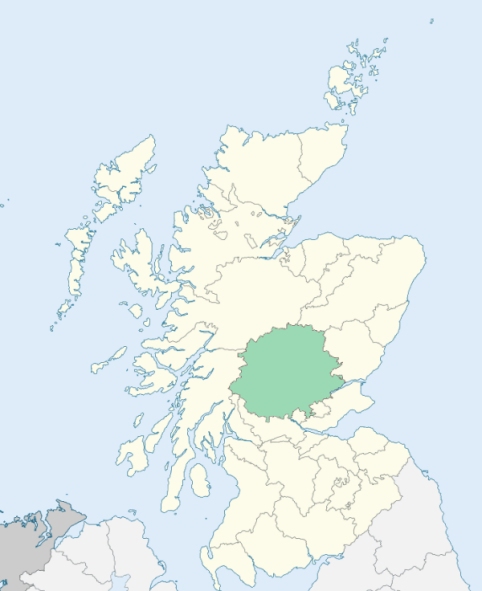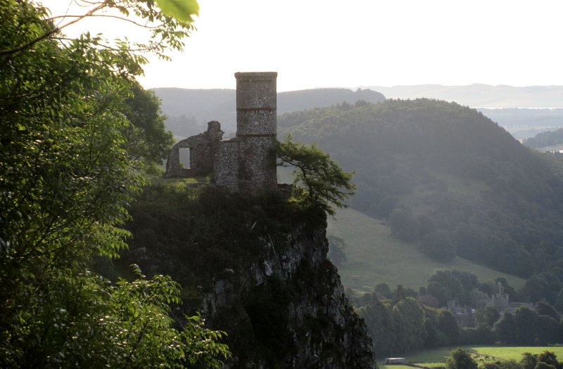
Kinnoull is a dispersed parish on the left bank of the river Tay in Perthshire. It consists of five parts, or four mutually detached sections. Its principal part, containing about seven-ninths of its entire population, lies immediately opposite the city of Perth, stretches two miles up and down the Tay, and is bounded on the north and north-east by Scone, and on the south-east and south by Kinfauns. Another section, called Balthayock, lies a mile to the west and is slightly connected at its northern extremity with a third section called Murrayshall. These two section, viewed as a continuous district, are surrounded by Scone, Kilspindie, and Kinfauns. Another section, called Balbeggie, lies 1¼ miles north-east of the nearest part of the Murrayshall section, and is bounded on the east by Kilspindie, and on all other sides by St Martins. The last section, called Inchyra, stretches along the Tay, 3 miles east of the first section, and 1 mile south of the section of Balthayock, and is bounded on the north-west and north by Kinfauns, and on the east by Kinfauns and St Madoes. (1867: The Imperial Gazetteer of Scotland, by John Marius Wilson).
Balbeggie, Barnhill, Bridgend, Gannochy, Inchyra, Kinnoull, Quarrymill, Walnut Grove
Barnhill, Belwood, Bonhard, Inchyra, Murrayshall, Seggieden
The parish of Kinnoull had three detached parts.
No. 1. Balthayock, adjoining the parishes of Kilspindie, Kinfauns, and Scone.
No. 2. Inchyra, between the parishes of Kinfauns and St Madoes
No. 3. Balbeggie, nearly surrounded by the parish of St Martins
(a.) Part of Kinnoull detached No. 1, was transferred to the parish of Scone.
(b.) Kinnoull detached No. 2 was divided between the parishes of Kinfauns and St Madoes.
(c.) Kinnoull detached No. 3 was transferred to the parish of St Martins.
(d.) Part of Scone was annexed to Kinnoull. The part of Kinnoull detached No. 1 was not affected and was thus united with the main portion of the parish of Kinnoull.
(e.) Part of Kinfauns was annexed to Kinnoull.
See affected properties and landholders. (1892: Boundary of counties and parishes in Scotland as settled by the Boundary Commissioners under the Local Government Act, 1889, by Hay Shennan)
PRE-REFORMATION GOVERNANCE:
POST-REFORMATION GOVERNANCE:
The church of Kinnoull was dedicated to St Constantine the King. It belonged to the Abbey of Cambuskenneth. Within the church there was a Chapel of St Ninian.
Includes ministers, licentiates, assistants, readers, and clerks.
(1928: Fasti Ecclesiæ Scoticanæ, by Hew Scott, D. D.)
Parish registers turned over to the Registrar-General, as a result of the Registration of Births, Deaths, and Marriages (Scotland) Act of 1854. The letters B. D. and M. indicate Births (or Baptisms), Deaths (or Burials), and Marriages (or Proclamations of Banns) respectively. Numbers indicate separate volumes or books. Note: These records are by no means complete or without damage; consult the Detailed List of the Old Parochial Registers of Scotland (1872) to learn more about the condition of the records.
| OPR and RD Numbers | |||
|---|---|---|---|
| Date Range | Name | Number | Type |
| 1618-1854 | Kinnoull | 369 | OPR |
| 1855-1857 | Kinnoull Burgh | 369-1 | RD |
| 1855-1857 | Kinnoull Landward | 369-2 | RD |
| 1858-1931 | Kinnoull | 369 | RD |
| 1932-1968 | Scone and Kinnoull | 394 | RD |
| 2009 | Perth and Kinross, Perth | 390 | RD |
| 2026 | Perth and Kinross Council; Bridgend, Gannochy and Kinnoull Community Council Scone and District Community Council | ||
(2009: Parishes and Registration Districts of Scotland - Old and New, National Records of Scotland)
Local community councils (2026) are provided as a potential source of additional information for settlements within the original boundaries of the parish. (Source)
Statistics from informal and official censuses
Anderson, Brown, Clark, Mitchell, Nicol, Robertson, Scott, Smith, Stewart, Thomson
Note: Names appearing in research materials, other than censuses. Simple names (First name, surname only) have been omitted unless they appear associated with large properties. All women's names, and men's names with occupations, military ranks, or peerage titles are included.
By the Reverend Mr Lewis Dunbar.
"In January 1795, the number of souls was 1465; of males 740, and of females 725. Of Presbyterian dissenters, of various denominations there were 190, of Episcopalians 18, and 2 families of Quakers. There were 57 weavers and their apprentices, 18 masons, 18 wrights, 16 inn-keepers, 17 shoemakers, 15 tailors, 5 smiths, 2 wheel-wrights, 6 carters, 3 sailors, 3 boatmen, 10 bakers, 6 butchers, 14 nursery men and gardeners, 3 saddlers, 6 shopkeepers or merchants, 2 coopers, 2 boat carpenters, 2 barbers, 2 dyers, and 1 excise officer.
About the year 1767, a nursery was begun in this parish that contains all kinds of fruit, and forest trees, evergreen and flowering shrubs, where more than 40 find constant employment.
The inhabitants of this parish, with a few exceptions, are sober, industrious, economical, and contented with their situations in life. They are in general, very regular in their attendance on the ordinances of religion: they are ready on every emergency to relieve the distresses, and alleviate the miseries of their fellow creatures, according to their abilities. And although there are different religious opinions among them, they live in peace and good neighbourhood."
(This section contains excerpts, at times restructured or paraphrased, from an article appearing in Statistical Account of Scotland, Sir John Sinclair, 1791-1799)
Primary Sources:
Statistical Account of Scotland (1791-1799), Volume 18, p. 540
New Statistical Account of Scotland (1834-1845), Volume 10, p. 993
See Parish Page Sources for all source information and links.