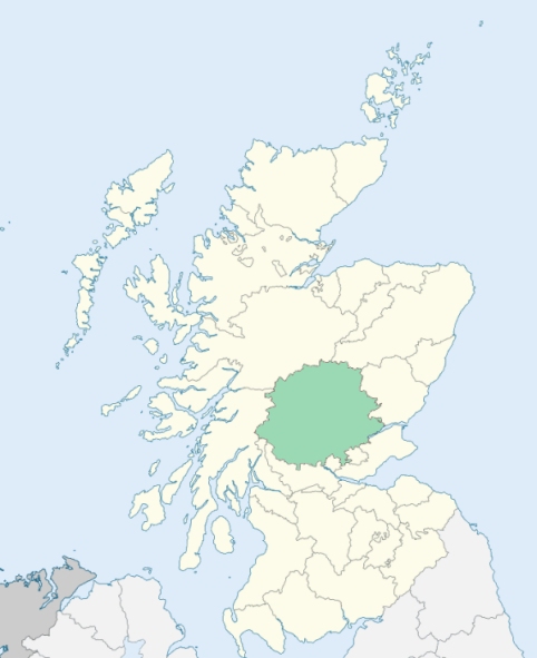
St Madoes is a small parish at the west end of the Carse of Gowrie, Perthshire. It is bounded by Kinfauns, Errol, the Firth of Tay, and the Inchyra district of Kinnoul. (1867: The Imperial Gazetteer of Scotland, by John Marius Wilson).
Chapelhill, Cotton or Cottown, Hawkstone, Inchyra, St Madoes
Inchyra
The eastern portion of Kinnoull detached No. 2 was annexed to St Madoes. See affected properties and landholders. (1892: Boundary of counties and parishes in Scotland as settled by the Boundary Commissioners under the Local Government Act, 1889, by Hay Shennan)
PRE-REFORMATION GOVERNANCE:
POST-REFORMATION GOVERNANCE:
The parish church was dedicated to St Aedh. At Pitfour, within the bounds, there is a Well of the Holy Trinity.
Includes ministers, licentiates, assistants, readers, and clerks.
(1928: Fasti Ecclesiæ Scoticanæ, by Hew Scott, D. D.)
Parish registers turned over to the Registrar-General, as a result of the Registration of Births, Deaths, and Marriages (Scotland) Act of 1854. The letters B. D. and M. indicate Births (or Baptisms), Deaths (or Burials), and Marriages (or Proclamations of Banns) respectively. Numbers indicate separate volumes or books. Note: These records are by no means complete or without damage; consult the Detailed List of the Old Parochial Registers of Scotland (1872) to learn more about the condition of the records.
| OPR and RD Numbers | |||
|---|---|---|---|
| Date Range | Name | Number | Type |
| 1591-1854 | St Madoes | 392 | OPR |
| 1855-1953 | St Madoes | 392 | RD |
| 2009 | Perth and Kinross, Perth | 390 | RD |
| 2026 | Perth and Kinross Council; West Carse Community Council | ||
(2009: Parishes and Registration Districts of Scotland - Old and New, National Records of Scotland)
Local community councils (2026) are provided as a potential source of additional information for settlements within the original boundaries of the parish. (Source)
Statistics from informal and official censuses
Brough, Campbell, Christie, Dunbar, Fraser, Gilmour, Murray, Reid, Robertson, Scott
Note: Names appearing in research materials, other than censuses. Simple names (First name, surname only) have been omitted unless they appear associated with large properties. All women's names, and men's names with occupations, military ranks, or peerage titles are included.
By the Reverend Mr David Black.
"The number of souls at present in the parish is about 300, of whom 130 are males, and 170 females. There are 3 principal farmers in the parish, and 10 smaller ones. The number of handicraftsmen is about 20, most of whom are employed in the salmon fishing on the Tay during the summer, and carry on their other occupations during the rest of the year. There are just 2 families of Seceders, and no other dissenters from the established Church. The number of inhabited houses is about 54.
The language spoken in this country is a dialect of the English; nor does there seem to be any very peculiar provincial accent. The names of places are chiefly derived from the Gaelic. The inhabitants of this parish are, in general, above the middle size, and of a stout, robust make. They are, upon the whole, sober, honest, and industrious, regular in their attendance upon public worship, and attentive to the duties of their stations."
(This section contains excerpts, at times restructured or paraphrased, from an article appearing in Statistical Account of Scotland, Sir John Sinclair, 1791-1799)
Primary Sources:
Statistical Account of Scotland (1791-1799), Volume 3, p. 568
New Statistical Account of Scotland (1834-1845), Volume 10, p. 607
See Parish Page Sources for all source information and links.