Lesmahago
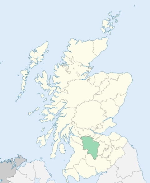
Lesmahagow is a parish in the north-west of the upper ward of Lanarkshire. It is bounded on the south-west by Ayrshire, and on other sides by the parishes of Avondale, Stonehouse, Dalserf, Carluke, Lanark, Carmichael, and Douglas. (1867: The Imperial Gazetteer of Scotland, by John Marius Wilson).
Abbey-Green, Auchenheath, Auchlochan, Bankend, Boghead, Crossford, Dillarburn, Dublin Row, Hazelbank, Kirkfieldbank or Kirkland, Kirkmuirhill, Lesmahagow or Abbeygreen, Linvale, Nethanfoot, New Trows, Turfholm
Blackwood, Corehouse, Harperfield, Kirkfield, Stockbriggs, Stonebyres
PRE-REFORMATION GOVERNANCE:
POST-REFORMATION GOVERNANCE:
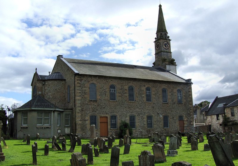
The church of Lesmahagow was dedicated to St Machuit, whose mission was seated here. Out of that mission grew the early Celtic Abbey of Lesmahagow, whose building stood on the Abbey Green. The parish church belonged to the later Tyronesian Priory of Lesmahagow. This monastery, a cell of Kelso Abbey, was founded by David I in 1144. It was dedicated to St Machuit, and in it the saint's relics were shown to pilgrims. King David granted the priory a right of sanctuary, and four crosses were erected marking the limits of protection thus given. In 1335 the monastery was burned by an English army. There were chapels in the parish at Chapelhill, Greenrig, and Blackwood. A fair was held at Lesmahagow on St Machuit's Day, the 15th of November. The parish church was rebuilt in 1804.
Disjoined Quoad Sacra Parishes:
Douglas Water. The church here belonged to the Reformed Presbyterians. At the union of that body with the Free Church in 1876, a minority joined the Church of Scotland, and procured a title to Douglas Water Church from Lucy, Countess of Home. A mission station was opened 17 March 1885, and the parish of Douglas Water was disjoined from Carmichael, Douglas, and Lesmahagow on 28 November 1892.
Kirkfieldbank. A church was built here in 1871. The parish of Kirkfieldbank was disjoined form Lesmahagow on 26 May 1884.
Includes ministers, licentiates, assistants, readers, and clerks.
Lesmahagow (QO)
Douglas Water (QS)
Kirkfieldbank (QS)
(1928: Fasti Ecclesiæ Scoticanæ, by Hew Scott, D. D.)
Parish registers turned over to the Registrar-General, as a result of the Registration of Births, Deaths, and Marriages (Scotland) Act of 1854. The letters B. D. and M. indicate Births (or Baptisms), Deaths (or Burials), and Marriages (or Proclamations of Banns) respectively. Numbers indicate separate volumes or books. Note: These records are by no means complete or without damage; consult the Detailed List of the Old Parochial Registers of Scotland (1872) to learn more about the condition of the records.
| OPR and RD Numbers | |||
|---|---|---|---|
| Date Range | Name | Number | Type |
| 1692-1854 | Lesmahagow | 649 | OPR |
| 1855-1894 | Lesmahagow | 649 | RD |
| 1895-1968 | Lesmahagow | 649-1 | RD |
| 1895-1968 | Kirkfieldbank | 649-2 | RD |
| 1921-1968 | Coalburn | 649-3 | RD |
| 1972-2004 | Lesmahagow | 585 | RD |
| 2005-2008 | Lesmahagow, South Lanarkshire | 585 | RD |
| 2009 | South Lanarkshire, Lesmahagow | 585 | RD |
| 2026 | (Lesmahagow) South Lanarkshire Council; Lesmahagow Community Council | ||
| 2026 | (Kirkfieldbank) South Lanarkshire, Royal Burgh of Lanark Community Council | ||
| 2026 | (Coalburn) South Lanarkshire Council; Coalburn Community Council | ||
(2009: Parishes and Registration Districts of Scotland - Old and New, National Records of Scotland)
Local community councils (2026) are provided as a potential source of additional information for settlements within the original boundaries of the parish. (Source)
Statistics from informal and official censuses
Brown, Hamilton, Muir, Pate, Robertson, Scott, Smith, Thomson, Watson, Wilson
Note: Names appearing in research materials, other than censuses. Simple names (First name, surname only) have been omitted unless they appear associated with large properties. All women's names, and men's names with occupations, military ranks, or peerage titles are included.
"By an exact enumeration of the inhabitants taken by the ministers this year, it appears there are, of houses or families in the villages 108, in the country there were 424. Of these there were 1340 males, and 1470 females, 2810 souls in all. Of these there are 181 gentlemen and husbandmen, 17 blacksmiths, 62 weavers, 16 shoemakers, 40 masons, 21 carpenters of all sorts, 26 tailors, 23 miners, 3 butchers, 54 day-labourers, 2 practitioners of medicine, and 1 dyer and fuller. There are 7 corn mills, 2 lint mills, and 1 fulling mill.
Many of the housewives not only manufacture the greatest part of the wearing apparel for their respective families, but have their wool and flax wrought up into yarn or cloth for sale in the neighbouring markets. Some of the weavers are employed in this way; others by the manufacturers in great towns, in weaving fine linen and cotton cloths.
The people are decent and regular; and few among them have been accused of enormities. Their bodies are, for the most part, stout, brawny, and active. The language spoken is the broad Scotch dialect, with this peculiarity, very observable to strangers, that the voice is raised, and the sound lengthened upon the last syllable of the sentence."
(This section contains excerpts, at times restructured or paraphrased, from an article appearing in Statistical Account of Scotland, Sir John Sinclair, 1791-1799)
Primary Sources:
Statistical Account of Scotland (1791-1799), Volume 7, p. 420
New Statistical Account of Scotland (1834-1845), Volume 6, p. 30
See Parish Page Sources for all source information and links.