Planmichael
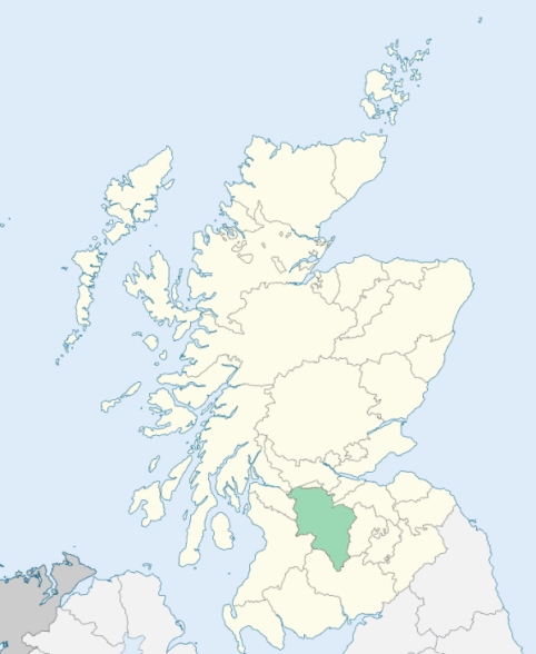
Carmichael is a parish situated on the banks of the Clyde and of Douglas Water immediately above their confluence, in the upper ward of Lanarkshire. It is bounded on the north by the parishes of Lanark and Pettinain, on the east by Covington, on the south by Wiston, and on the west by Douglas and Lesmahagow. (1867: The Imperial Gazetteer of Scotland, by John Marius Wilson).
Bridgend, Carmichael, Crookboat, Drumalban, Hyndford, Lochlyock, Netherton, Ponfeigh, Sandilands
Eastend
PRE-REFORMATION GOVERNANCE:
POST-REFORMATION GOVERNANCE:
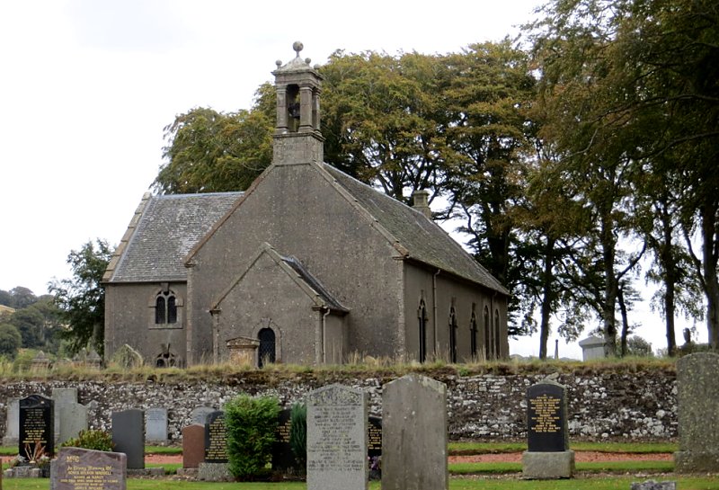
The parish church was dedicated to St Michael. Within the bound were St Michael's Well and St Michael's Bog. There was in the parish a chapel of St Bride. Carmichael Church was rebuilt in 1750 and again in 1905.
Disjoined Quoad Sacra Parishes:
Douglas Water. The church here belonged to the Reformed Presbyterians. At the union of that body with the Free Church in 1876, a minority joined the Church of Scotland, and procured a title to Douglas Water Church from Lucy, Countess of Home. A mission station was opened 17 March 1885, and the parish of Douglas Water was disjoined from Carmichael, Douglas, and Lesmahagow on 28 November 1892.
Includes ministers, licentiates, assistants, readers, and clerks.
Carmichael (QO)
Douglas Water (QS)
(1928: Fasti Ecclesiæ Scoticanæ, by Hew Scott, D. D.)
Parish registers turned over to the Registrar-General, as a result of the Registration of Births, Deaths, and Marriages (Scotland) Act of 1854. The letters B. D. and M. indicate Births (or Baptisms), Deaths (or Burials), and Marriages (or Proclamations of Banns) respectively. Numbers indicate separate volumes or books. Note: These records are by no means complete or without damage; consult the Detailed List of the Old Parochial Registers of Scotland (1872) to learn more about the condition of the records.
| OPR and RD Numbers | |||
|---|---|---|---|
| Date Range | Name | Number | Type |
| 1694-1854 | Carmichael | 630 | OPR |
| 1855-1968 | Carmichael | 630 | RD |
| 2009 | South Lanarkshire, Lanark | 583 | RD |
| 2026 | South Lanarkshire Council; Carmichael Community Council | ||
(2009: Parishes and Registration Districts of Scotland - Old and New, National Records of Scotland)
Local community councils (2026) are provided as a potential source of additional information for settlements within the original boundaries of the parish. (Source)
Statistics from informal and official censuses
Adamson, Brown, Clarkson, Dickson, Forrest, Gibson, Paterson, Prentice, Watson, Weir
Note: Names appearing in research materials, other than censuses. Simple names (First name, surname only) have been omitted unless they appear associated with large properties. All women's names, and men's names with occupations, military ranks, or peerage titles are included.
By the Reverend Mr Robert Inglis.
"The population of the parish at present is 781; of these there are 367 males and 414 females; 191 under 10 years of age. There are 180 families, of which 11 consist of single persons. There are few Dissenters from the Established Church; 2 Burghers, and 10 or 12 Macmillanites, all quiet inoffensive people.
Except those employed in the coal-work, the great body of the people in this parish are farmers and labourers. There is a tanwork in the parish, begun 9 years ago by two young men, natives of the place, who now manufacture 700 cattle hides, and 900 calves skins annually. There are 18 weavers, the great part of whom are employed in working coarse linen and woollen cloths for the people in the neighbourhood. Two or three are occasionally employed in the cotton business from Glasgow or Lanark.
The people are in general sober, economical, and industrious, enjoy the necessaries of life, and seem contented with their situation."
(This section contains excerpts, at times restructured or paraphrased, from an article appearing in Statistical Account of Scotland, Sir John Sinclair, 1791-1799)
Primary Sources:
Statistical Account of Scotland (1791-1799), Volume 13, p. 364
New Statistical Account of Scotland (1834-1845), Volume 6, p. 517
See Parish Page Sources for all source information and links.