Edzell and Newdosk
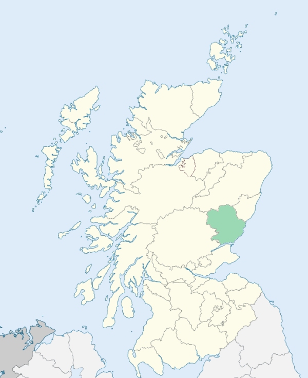
Ezell is a parish partly in Kincardineshire, but chiefly in Forfarshire. It is bounded by Strachan, Fettercairn, Strickathrow, Lethnot, and Lochlee. (1867: The Imperial Gazetteer of Scotland, by John Marius Wilson).
Auchmull, Bonhard, Bonharry, Cannachy Bridge, Colthill, Cowiehill, Dalbog, Dalforth, Dalfouper, Duly, Edzell, Inverescandy, Meikle Tullo, Slateford
The parish of Edzell was situated partly in the county of Forfar and partly in the county of Kincardine. No change has been made in the county boundary, but the Kincardineshire part of the parish has been transferred to the parish of Fettercairn. See affected properties and landholders. (1892: Boundary of counties and parishes in Scotland as settled by the Boundary Commissioners under the Local Government Act, 1889, by Hay Shennan)
PRE-REFORMATION GOVERNANCE:
POST-REFORMATION GOVERNANCE:
The parishes of Edzell and Newdosk were united in 1658.
Edzell. The church of Edzell was dedicated to St Laurence. The parish was a rectory. There were in it Wells of Our Lady and St Laurence. A new church was built in 1818.
Newdosk. The church of Newdosk was dedicated to St Drostan. There was near it a Well of St Drostan.
Includes ministers, licentiates, assistants, readers, and clerks.
Edzell (QO)
Newdosk (QO)
(1928: Fasti Ecclesiæ Scoticanæ, by Hew Scott, D. D.)
Parish registers turned over to the Registrar-General, as a result of the Registration of Births, Deaths, and Marriages (Scotland) Act of 1854. The letters B. D. and M. indicate Births (or Baptisms), Deaths (or Burials), and Marriages (or Proclamations of Banns) respectively. Numbers indicate separate volumes or books. Note: These records are by no means complete or without damage; consult the Detailed List of the Old Parochial Registers of Scotland (1872) to learn more about the condition of the records.
| OPR and RD Numbers | |||
|---|---|---|---|
| Date Range | Name | Number | Type |
| 1641-1854 | Edzell | 285 | OPR |
| 1855-1958 | Edzell | 285 | RD |
| 1959-1971 | Edzell, Lethnot and Lochlee | 285 | RD |
| 1972-1972 | Edzell, Lethnot and Lochlee | 365 | RD |
| 2009 | Angus, Brechin | 366 | RD |
| 2026 | Angus Council; Inveresk Community Council | ||
(2009: Parishes and Registration Districts of Scotland - Old and New, National Records of Scotland)
Local community councils (2026) are provided as a potential source of additional information for settlements within the original boundaries of the parish. (Source)
Statistics from informal and official censuses
Bruce, Carr, Christison, Duncan, Gold, Kidd, Lindsay, Middleton, Robertson, Smith
Note: Names appearing in research materials, other than censuses. Simple names (First name, surname only) have been omitted unless they appear associated with large properties. All women's names, and men's names with occupations, military ranks, or peerage titles are included.
By the Reverend Mr Andrew Hutton.
"Number of souls in 1791-2 was 963, of whom were 470 males and 493 females. There were in the village (Slateford) 117, and in the country 846. There is 1 merchant, 3 shopkeepers, 1 maltman, 1 carter, 66 male farm servants, 50 female farm servants, 17 day labourers, 16 cottarmen, 4 alehouse-keepers, 5 smiths, 9 tailors, 1 waulk-miller, 2 masons, 3 drystone dykers, 2 wheel-wrights and turners, 5 wrights, 5 shoemakers, 4 flax-dressers, 13 weavers, 1 lint-miller, and 205 inhabited houses.
No manufactures are carried on. The only shadow of them is, that the weavers generally make pieces of coarse cloth for country use, which they sell at the different markets in the neighbourhood. The exports are oats, barley, meal, black cattle, sheep, yarn, butter, cheese, fowls, eggs, and coarse cloth.
The people are nearly of one class and condition. Their way of living arises, either wholly or in great part, from the culture of the ground. Their manners are suitable to their condition. Most of the farmers are now in easy circumstances, the consequence of the hard labour, frugality, and attention of the present generation. They have not laid aside those good habits. With few exceptions, they are distinguished for integrity, sobriety, and diligence."
(This section contains excerpts, at times restructured or paraphrased, from an article appearing in Statistical Account of Scotland, Sir John Sinclair, 1791-1799)
Primary Sources:
Statistical Account of Scotland (1791-1799), Volume 10, p. 100
New Statistical Account of Scotland (1834-1845), Volume 11, Section I, p. 621
See Parish Page Sources for all source information and links.