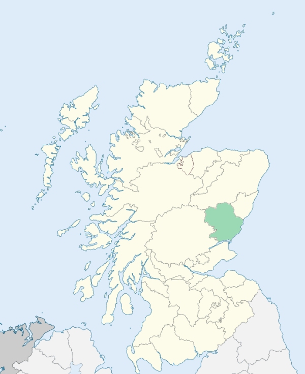
Lethnot is a parish in the Grampian district of Forfarshire. It is bounded by Lochlee, Edzell, Strickathrow, Menmuir, Fearn, Tannadice, and Cortachy. The ancient parishes of Lethnot and Navar lie respectively on the left and the right sides of the West Water. (1867: The Imperial Gazetteer of Scotland, by John Marius Wilson).
Balfield, Lethnott, Newbigging
PRE-REFORMATION GOVERNANCE:
POST-REFORMATION GOVERNANCE:
The parishes of Lethnot and Navar were united on 6 February 1723.
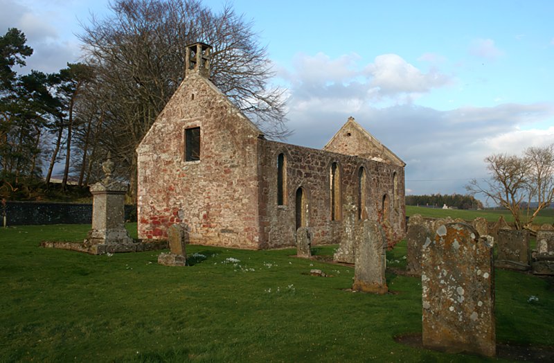
Lethnot. The church of Lethnot was dedicated to St Mary. Near it was Our Lady's Well. Lethnot was a preend of Brechin. A new church was built in 1827.
Navar. The church of Navar was dedicated to St Columba.
Includes ministers, licentiates, assistants, readers, and clerks.
Lethnot and Navar (QO)
Navar (QO)
(1928: Fasti Ecclesiæ Scoticanæ, by Hew Scott, D. D.)
Parish registers turned over to the Registrar-General, as a result of the Registration of Births, Deaths, and Marriages (Scotland) Act of 1854. The letters B. D. and M. indicate Births (or Baptisms), Deaths (or Burials), and Marriages (or Proclamations of Banns) respectively. Numbers indicate separate volumes or books. Note: These records are by no means complete or without damage; consult the Detailed List of the Old Parochial Registers of Scotland (1872) to learn more about the condition of the records.
| OPR and RD Numbers | |||
|---|---|---|---|
| Date Range | Name | Number | Type |
| 1728-1854 | Lethnott and Navar | 300 | OPR |
| 1855-1958 | Lethnot and Navar | 300 | RD |
| 1959-1971 | Edzell, Lethnot and Lochlee | 284 | RD |
| 1972-1972 | Edzell, Lethnot and Lochlee | 365 | RD |
| 2009 | Angus, Brechin | 366 | RD |
| 2026 | Angus Council, Inveresk Community Council | ||
(2009: Parishes and Registration Districts of Scotland - Old and New, National Records of Scotland)
Local community councils (2026) are provided as a potential source of additional information for settlements within the original boundaries of the parish. (Source)
Statistics from informal and official censuses
Clark, Cruickshank, Donald, Duncan, Gordon, Mather, Michie, Mitchell, Philip, Ross
Note: Names appearing in research materials, other than censuses. Simple names (First name, surname only) have been omitted unless they appear associated with large properties. All women's names, and men's names with occupations, military ranks, or peerage titles are included.
By the Reverend Mr John Taylor.
"In 1790 the number of people was 505, of which 256 were males, 249 were females, 62 were under six, and 98 under ten. There are at present six tailors, seven weavers, two smiths, and two wrights, within the parishes. In 1790, the number of Episcopalians was 56. Many of our young people remove from the parish, but not for want of employment. They get higher wages to the southward, and some remove for the sake of learning a particular trade or art, as their genius leads them. None have perished from want, since the end of the last century, when there were seven years of scarcity, and when some persons were found dead with cabbage, kail-roots, &c. in their mouths.
As for tradesmen and artisans, they have small settlements from the farmers, of about 2 acres each. They are generally bound to reap in harvest, and for some days work in the busiest time of summer. Upon the whole, by the accommodation of their small settlements, and the profits of their occupations, they are enabled to live comfortably, and to bring up families.
The lower class of people here, as well as those above them, are, in general, sober, industrious and frugal; and but few of them fail in early life to make provision for the infirmities of old age."
(This section contains excerpts, at times restructured or paraphrased, from an article appearing in Statistical Account of Scotland, Sir John Sinclair, 1791-1799)
Primary Sources:
Statistical Account of Scotland (1791-1799), Volume 4, p. 1
New Statistical Account of Scotland (1834-1845), Volume 11, Section I, p. 687
See Parish Page Sources for all source information and links.