East Kilpatrick, Easter Kilpatrick
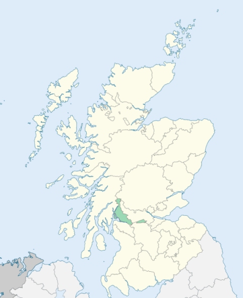
New Kilpatrick is a parish partly in Stirlingshire, but chiefly in Dunbartonshire. It is bounded on the south by Lanarkshire and Renfrewshire, and on other sides by the parishes of West Kilpatrick, Killearn, Strathblane, and Baldernock. (1867: The Imperial Gazetteer of Scotland, by John Marius Wilson).
Bluerow, Canniesburn, Craighton Field, Dalsholm or Dawsholm, Garscadden, Knightswood, Milngavie, New Kilpatrick or East Kilpatrick, Netherton or Netherton Quarry
Balvie, Craigton, Dougalston, Drumry, Garscadden, Garscube, Killermont, Mains House
This parish was situated partly in the county of Dunbarton and partly in the county of Stirling. The parish was placed wholly within the county of Dunbarton. See affected properties and landholders. (1892: Boundary of counties and parishes in Scotland as settled by the Boundary Commissioners under the Local Government Act, 1889, by Hay Shennan)
PRE-REFORMATION GOVERNANCE:
POST-REFORMATION GOVERNANCE:
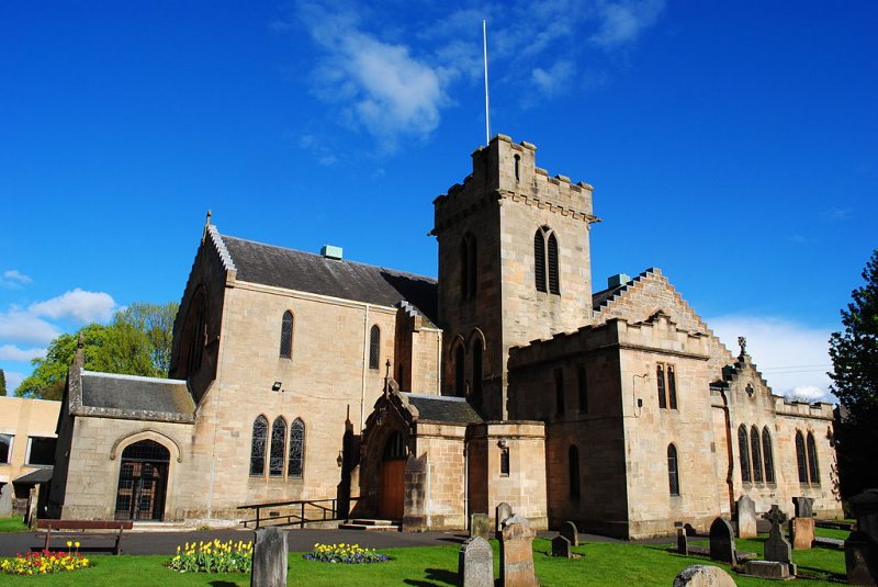
This parish was disjoined from Kilpatrick, 16 Feb 1649. At Drumry, near Garscadden, within the area afterwards assigned to this parish, there was of old a chapel of St Mary. At Lurg also, on the estate of Mains, there was a chapel with a burial ground. Near Bearsden is St Germain's Loch. New Kilpatrick Church was reconstructed and enlarged in 1909. There are two mission chapels within the bounds, at Drumchapel and Westerton.
Disjoined Quoad Sacra Parishes:
Milngavie. A church was built here in 1840. The parish of Milngavie was disjoined from New Kilpatrick, 3 March 1873.
Temple. The parish of Temple was disjoined from New Kilpatrick, Govan, and Renfrew, 13 March 1896.
Includes ministers, licentiates, assistants, readers, and clerks.
New Kilpatrick (QO)
Milngavie (QS)
Temple (QS)
(1928: Fasti Ecclesiæ Scoticanæ, by Hew Scott, D. D.)
Parish registers turned over to the Registrar-General, as a result of the Registration of Births, Deaths, and Marriages (Scotland) Act of 1854. The letters B. D. and M. indicate Births (or Baptisms), Deaths (or Burials), and Marriages (or Proclamations of Banns) respectively. Numbers indicate separate volumes or books. Note: These records are by no means complete or without damage; consult the Detailed List of the Old Parochial Registers of Scotland (1872) to learn more about the condition of the records.
| OPR and RD Numbers | |||
|---|---|---|---|
| Date Range | Name | Number | Type |
| 1691-1854 | New Kilpatrick | 500 | OPR |
| 1855-1920 | New Kilpatrick | 500 | RD |
| 1921-1968 | New Kilpatrick | 500-1 | RD |
| 1921-1968 | Milngavie | 500-2 | RD |
| 1936-1938 | Drumchapel | 500-3 | RD |
| 1969-1971 | New Kilpatrick | 500 | RD |
| 1972-2006 | New Kilpatrick | 507 | RD |
| 2007-2008 | New Kilpatrick, East Dunbartonshire | 507 | RD |
| 2009 | East Dunbartonshire, New Kilpatrick | 507 | RD |
| 2026 | (New Kilpatrick) East Dunbartonshire Council; Bearsden East Community Council Bearsden North Community Council Bearden West Community Council Bishopbriggs Community Council Milngavie Community Council | ||
| 2026 | (Drumchapel) Glasgow City Council; Drumchapel Community Council Blairdardie and Old Drumchapel Community Council | ||
(2009: Parishes and Registration Districts of Scotland - Old and New, National Records of Scotland)
Local community councils (2026) are provided as a potential source of additional information for settlements within the original boundaries of the parish. (Source)
Statistics from informal and official censuses
Brown, Buchanan, Cameron, Campbell, Henderson, Miller, Reid, Robertson, Smith, Wilson
Note: Names appearing in research materials, other than censuses. Simple names (First name, surname only) have been omitted unless they appear associated with large properties. All women's names, and men's names with occupations, military ranks, or peerage titles are included.
By the Reverend Mr George Sym.
"The number of inhabitants, young and old, in the year 1783, when an exact list was taken, was 1664; the number now is about 1700. The only considerable village is Millguy, which contains about 200 inhabitants, who are mostly employed as bleachers, printers, and pencillers of cloth.
There are six bleachfields, of which two are for printed cloths only, and one partly. All these together employ about 220 people. There are four oat mills, two barley mills, one snuff mill, and one paper mill. The paper mill employs about 25 workmen. There are two collieries in the parish, one at Knightswood, which employs about 60 men and boys, and the other at Culloch, which is also the only limework in the parish. At this place the lime and coal works together employ about 70 men."
(This section contains excerpts, at times restructured or paraphrased, from an article appearing in Statistical Account of Scotland, Sir John Sinclair, 1791-1799)
Primary Sources:
Statistical Account of Scotland (1791-1799), Volume 7, p. 99
New Statistical Account of Scotland (1834-1845), Volume 8, Section I, p. 36
See Parish Page Sources for all source information and links.