Glasserton and Kirkmaiden-in-Farines
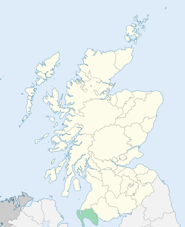
Glasserton is a parish in the south-east of Wigtownshire. It is bounded on the south-west by Luce Bay, and on the other sides by the parishes of Mochrum, Kirkinner, Sorbie, and Whithorn. (1867: The Imperial Gazetteer of Scotland, by John Marius Wilson).
Balcraig, Craiglemine, Drummoddie, Glasserton, Monreith, Myreton or Clachan Myreton, Ravenstone
Physgill
PRE-REFORMATION GOVERNANCE:
POST-REFORMATION GOVERNANCE:
These parishes were united by the Commissioners of Teinds on 20 June 1618.
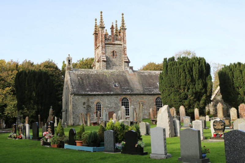
Glasserton. The church of Glasserton belonged to the Priory of Whitern (Whithorn). On the seashore in the parish is St Ninian's Cave, a fine example of the combined chapel and retreat of a medieval anchorite. The parish church was rebuilt in 1732. In 1837 this building was enlarged, and a tower was added to it.
Kirkmaiden-in-Farines. The church of this parish was dedicated to St Medan. It belonged to the Priory of Whitern (Whithorn). On the seashore beside the church, just above tide-mark, there is a holy well.
Includes ministers, licentiates, assistants, readers, and clerks.
(1928: Fasti Ecclesiæ Scoticanæ, by Hew Scott, D. D.)
Parish registers turned over to the Registrar-General, as a result of the Registration of Births, Deaths, and Marriages (Scotland) Act of 1854. The letters B. D. and M. indicate Births (or Baptisms), Deaths (or Burials), and Marriages (or Proclamations of Banns) respectively. Numbers indicate separate volumes or books. Note: These records are by no means complete or without damage; consult the Detailed List of the Old Parochial Registers of Scotland (1872) to learn more about the condition of the records.
| OPR and RD Numbers | |||
|---|---|---|---|
| Date Range | Name | Number | Type |
| 1700-1854 | Glasserton | 855 | OPR |
| 1855-1966 | Glasserton | 855 | RD |
| 2009 | Dumfries and Galloway, Whithorn | 875 | RD |
| 2026 | Dumfries and Galloway Council; Royal Burgh of Wigtown and District Community Council | ||
(2009: Parishes and Registration Districts of Scotland - Old and New, National Records of Scotland)
Local community councils (2026) are provided as a potential source of additional information for settlements within the original boundaries of the parish. (Source)
Statistics from informal and official censuses
Brown, Copeland, Gibson, Gordon, Marshall, More, Murray, Nicholson, Smith, Stewart
Note: Names appearing in research materials, other than censuses. Simple names (First name, surname only) have been omitted unless they appear associated with large properties. All women's names, and men's names with occupations, military ranks, or peerage titles are included.
From Communications obligingly procured for this work, by the Reverend Dr Davidson of Whithorn, from Robert Hawthorn Stewart, Esq., of Physgill, Matthew Campbell, Esq., and other Gentlemen.
"The number of the inhabitants of the parish of Glasserton was, in the year 1755, 809, and may be, at present, about 900 souls. Of these, 151 are resident on the estate of Castle Stewart.
The greater part of the inhabitants are usually employed in the labours of husbandry, as farmers, house-servants, cottagers hired by the year, or day-labourers. In comparison with many parts of the country, the parish of Glasserton cannot be said to be very disadvantageously situated in respect to markets for the exports which it produces, and the imports needed for the use of its inhabitants. Whithorn, the Isle of Whithorn, and Port William, the two last seaports, are the nearest places worthy of being mentioned as seats of merchants, shopkeepers, and artisans."
(This section contains excerpts, at times restructured or paraphrased, from an article appearing in Statistical Account of Scotland, Sir John Sinclair, 1791-1799)
Primary Sources:
Statistical Account of Scotland (1791-1799), Volume 17, p. 581
New Statistical Account of Scotland (1834-1845), Volume 4, Section III, p. 36
See Parish Page Sources for all source information and links.