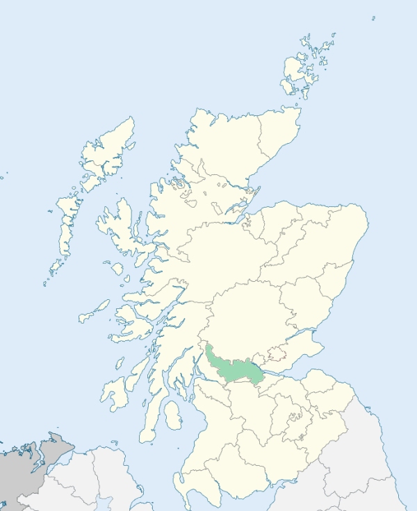
Gargunnock is a parish in the north of Stirlingshire. It is bounded by Perthshire, and by the parishes of St Ninians, Fintry, Balfron, and Kippen. The forth traces all the northern boundary. (1867: The Imperial Gazetteer of Scotland, by John Marius Wilson).
Burntown, Gargunnock, Gurntown, Kirkton
Boquhan
PRE-REFORMATION GOVERNANCE:
POST-REFORMATION GOVERNANCE:
The church of Gargunnock belonged to the Abbey of Cambuskenneth.
Includes ministers, licentiates, assistants, readers, and clerks.
(1928: Fasti Ecclesiæ Scoticanæ, by Hew Scott, D. D.)
Parish registers turned over to the Registrar-General, as a result of the Registration of Births, Deaths, and Marriages (Scotland) Act of 1854. The letters B. D. and M. indicate Births (or Baptisms), Deaths (or Burials), and Marriages (or Proclamations of Banns) respectively. Numbers indicate separate volumes or books. Note: These records are by no means complete or without damage; consult the Detailed List of the Old Parochial Registers of Scotland (1872) to learn more about the condition of the records.
| OPR and RD Numbers | |||
|---|---|---|---|
| Date Range | Name | Number | Type |
| 1615-1854 | Gargunnock | 481 | OPR |
| 1855-1873 | Gargunnock | 481 | RD |
| 1874-1969 | Gargunnock | 481a | RD |
| 1874-1900 | Grangemouth | 481b | RD |
| 1901-1969 | Bothkennar | 481b1 | RD |
| 1901-1970 | Grangemouth | 481b2 | RD |
| 1901-1957 | Polmont | 481b3 | RD |
| 1971-1971 | Grangemouth | 481 | RD |
| 1972-2003 | Grangemouth, Stirling | 484 | RD |
| 2004-2008 | Grangemouth, Falkirk | 484 | RD |
| 2009 | (Gargunnock) Stirling, Gargunnock | 473 | RD |
| 2009 | (Grangemouth) Falkirk, Grangemouth | 484 | |
| 2026 | (Gargunnock) Stirling Council; Gargunnock Community Council | ||
| 2026 | (Grangemouth) Falkirk Council; Grangemouth Community Council | ||
(2009: Parishes and Registration Districts of Scotland - Old and New, National Records of Scotland)
Local community councils (2026) are provided as a potential source of additional information for settlements within the original boundaries of the parish. (Source)
Statistics from informal and official censuses
Arnott, Bain, Hamilton, Kay, Lang, Mitchell, Paterson, Robertson, Rorie, Stewart
Note: Names appearing in research materials, other than censuses. Simple names (First name, surname only) have been omitted unless they appear associated with large properties. All women's names, and men's names with occupations, military ranks, or peerage titles are included.
By the Reverend Mr James Robertson.
"The number of souls in the parish is 830, in 178 families, of whom 403 are males and 427 are females. There are 808 belonging to the Established church, 3 Episcopalians, 14 Seceders, 2 Relief society, and 3 Cameronians. The village of Gargunnock, which in the memory of some still alive, consisted only of 3 or 4 houses, now contains about 400 souls.
There are 55 farmers, 10 weavers, 2 shoemakers, 27 tailors, 3 masons, 4 wrights, 1 baker, 3 innkeepers, 4 smiths, 1 cooper, 28 day-labourers, 2 carriers to Edinburgh and Glasgow, 94 men servants, and 62 maid servants. There is no kind of trade or manufacture in the village; not even a grocery shop that deserves the name. Supplies of all the necessary articles are got from Stirling weekly, or by carriers from Edinburgh or Glasgow. There are some weavers, tailors, and shoemakers, and the other inhabitants are chiefly day labourers."
(This section contains excerpts, at times restructured or paraphrased, from an article appearing in Statistical Account of Scotland, Sir John Sinclair, 1791-1799)
Primary Sources:
Statistical Account of Scotland (1791-1799), Volume 18, p. 90
New Statistical Account of Scotland (1834-1845), Volume 8, Section II, p. 48
See Parish Page Sources for all source information and links.