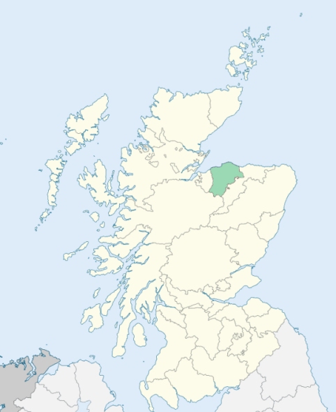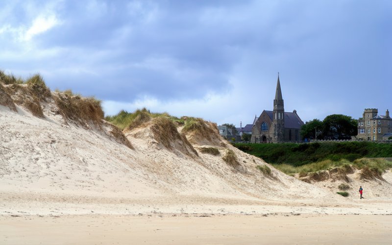
Drainie is a parish on the coast of Morayshire. It is bounded on the north by the Moray Firth, and on other sides by the parishes of Urquhart, St Andrews Lhanbryde, Spynie, and Duffus. (1867: The Imperial Gazetteer of Scotland, by John Marius Wilson).
Branderburgh, Covesea, Lossiemouth, Seatown, Stotfield
Gordonstown
PRE-REFORMATION GOVERNANCE:
POST-REFORMATION GOVERNANCE:
The parishes of Kinedar and Ogston were united on 17 Feb 1669.
Kinedar. Kinedar was a prebend held by the Treasurer of Elgin Cathedral. Its church was dedicated to St Edward the Confessor. Soon after the union of the two parishes, the church was removed from Kinedar to Drainie.
Ogston. The church of Ogston was dedicated to St Michael. In 1642 this parish was united to Kilmolemnock, now called St Andrew's. It was disjoined again on 28 July 1647. This disjunction, however, was annulled on 28 March 1661, and in 1669, Ogston was united to Kinedar.
(1928: Fasti Ecclesiæ Scoticanæ, by Hew Scott, D. D.)
Includes ministers, licentiates, assistants, readers, and clerks.
Drainie (QO)
Ogston (QO)
(1928: Fasti Ecclesiæ Scoticanæ, by Hew Scott, D. D.)
Parish registers turned over to the Registrar-General, as a result of the Registration of Births, Deaths, and Marriages (Scotland) Act of 1854. The letters B. D. and M. indicate Births (or Baptisms), Deaths (or Burials), and Marriages (or Proclamations of Banns) respectively. Numbers indicate separate volumes or books. Note: These records are by no means complete or without damage; consult the Detailed List of the Old Parochial Registers of Scotland (1872) to learn more about the condition of the records.
| OPR and RD Numbers | |||
|---|---|---|---|
| Date Range | Name | Number | Type |
| 1631-1854 | Drainie | 130 | OPR |
| 1855-1967 | Drainie | 130 | RD |
| 2009 | Moray Council, Forres | 281 | RD |
| 2026 | Moray Council; Dyke Landward Community Council | ||
(2009: Parishes and Registration Districts of Scotland - Old and New, National Records of Scotland)
Local community councils (2026) are provided as a potential source of additional information for settlements within the original boundaries of the parish. (Source)
Statistics from informal and official censuses
Anderson, Campbell, Edwards, Main, Mitchell, Reid, Scott, Smith, Souter, Stewart
Note: Names appearing in research materials, other than censuses. Simple names (First name, surname only) have been omitted unless they appear associated with large properties. All women's names, and men's names with occupations, military ranks, or peerage titles are included.
By the Reverend Mr Lewis Gordon.
"At the beginning of the year 1791, in this parish, there were 480 males; 560 females; total 1040. There were 68 farmers, 37 seamen, 13 masons, 5 weavers, 5 tailors, 3 smiths, 4 joiners, 3 merchants, 35 labourers, the remainder being widows, married servants, and persons of mixed professions. There were 159 married couples and 334 children of the above, residing with their parents. In the above list, those only are reckoned farmers who live solely by that occupation: But several other people in the parish rent a few acres of ground for the accommodation of their families. The principal village here is Lossiemouth, a seaport. It contains from 150 to 200 inhabitants.
The inhabitants of this parish, like all others employed in husbandry, are robust and healthy. Their general character is that of a sober, honest, peaceable people, regular in their attendance on the ordinances of religion, rather grave than lively, seldom indulging themselves in any relaxation or diversion, excepting the young people, who sometimes take a dance at Christmas, or at a penny-wedding*.
Crimes of great enormity are unknown here. There has not been an instance of suicide during the 22 years of the present minister's incumbency; nor has any native of this parish been hanged or banished, in the memory of man. This regularity of conduct must in part be ascribed to the poverty and depression of the people; for the situation of the small tenants in this country, in general, is far from being comfortable.
*Penny wedding: A penny-wedding is when the expence of the marriage entertainment is not defrayed by the young couple, or their relations, but by a club among the guests. Two hundred people of both sexes, will sometimes be convened on an occasion of this kind."
(This section contains excerpts, at times restructured or paraphrased, from an article appearing in Statistical Account of Scotland, Sir John Sinclair, 1791-1799)
Primary Sources:
Statistical Account of Scotland (1791-1799), Volume 4, p. 77
New Statistical Account of Scotland (1834-1845), Volume 13, Section II, p. 145
See Parish Page Sources for all source information and links.