Invercruden
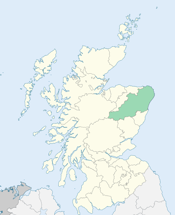
Cruden is a parish in the district of Buchan, Aberdeenshire. It is bounded by Longside and Peterhead parishes on the north, by the North Sea on the east, by Slains and Logie Buchan on the south, and by Ellon on the west. (1867: The Imperial Gazetteer of Scotland, by John Marius Wilson).
Auchleuchries, Auchiries, Bridgend, Buller's-Buchan, Cruden, Finnyfold or Whinnyfold, Hatton, Oldtown, Port Errol or Ward of Cruden, Teuchan, Tillymaud, Ward
Aquharaney or Aquharnie
PRE-REFORMATION GOVERNANCE:
POST-REFORMATION GOVERNANCE:
The church of Invercruden was dedicated to St Olaf, and was a prebend of Old Machar. A fair of St Olaf was held at Invercruden.
Disjoined Quoad Sacra Parishes:
Ardallie. The parish of Ardallie was disjoined from Deer, Longside, Ellon, and Cruden on 11 July 1862. The erection of Ardallie was largely the work of William Yeats of Auquharney, and John Morrison, minister of Old Deer.
Blackhill. The parish of Blackhill was disjoined from Peterhead, Longside, and Cruden on 13 January 1879.
Boddam. A chapel was built here in 1865. The parish of Boddam was disjoined from Peterhead and Cruden on 14 March 1881.
Includes ministers, licentiates, assistants, readers, and clerks.
Cruden (QO)
Ardallie (QS)
Blackhill (QS)
Boddam (QS)
(1928: Fasti Ecclesiæ Scoticanæ, by Hew Scott, D. D.)
Parish registers turned over to the Registrar-General, as a result of the Registration of Births, Deaths, and Marriages (Scotland) Act of 1854. The letters B. D. and M. indicate Births (or Baptisms), Deaths (or Burials), and Marriages (or Proclamations of Banns) respectively. Numbers indicate separate volumes or books. Note: These records are by no means complete or without damage; consult the Detailed List of the Old Parochial Registers of Scotland (1872) to learn more about the condition of the records.
| OPR and RD Numbers | |||
|---|---|---|---|
| Date Range | Name | Number | Type |
| 1707-1854 | Cruden | 185 | OPR |
| 1855-1967 | Cruden | 185 | RD |
| 2009 | Aberdeenshire, Ellon | 316 | RD |
| 2026 | Aberdeenshire Council; Cruden Community Council | ||
(2009: Parishes and Registration Districts of Scotland - Old and New, National Records of Scotland)
Local community councils (2026) are provided as a potential source of additional information for settlements within the original boundaries of the parish. (Source)
Statistics from informal and official censuses
Alexander, Cruickshank, Davidson, Milne, Mitchell, Robertson, Smith, Summers, Taylor, Wallace
Note: Names appearing in research materials, other than censuses. Simple names (First name, surname only) have been omitted unless they appear associated with large properties. All women's names, and men's names with occupations, military ranks, or peerage titles are included.
By the Reverend Mr Alexander Cock.
"The number of inhabitants amounts to 2028. In 1778, the number was 2120, but the malignant distempers, which have prevailed since 1788, account in some measure for the difference.
Husbandry can only be said to be in its infancy here. There are but few farms in good order. The spirit of farming seems, however, to be spreading abroad. The crops are barley, oats, pease, and turnips; with wheat and potatoes, for domestic use.
There are 4 villages or sea towns, altogether occupied by sea-faring people, and consequently situated along the coast, viz. Long-haven, Buller's Buchan, Ward and Whinnyfold. None of them are very populous, having been much neglected of late. The whole only employ 8 boats, with 6 men and a boy to each boat when fully manned; but at present, few of them have their full complement of men, and some are laid up.
The people are sober and industrious. Except one smuggling business, there has been no trial, before the Court of Justiciary, of any one belonging to the parish, these 14 years. Some time ago smuggling was carried on to a great extent, but it is now almost entirely given up."
(This section contains excerpts, at times restructured or paraphrased, from an article appearing in Statistical Account of Scotland, Sir John Sinclair, 1791-1799)
Primary Sources:
Statistical Account of Scotland (1791-1799), Volume 5, p. 431
New Statistical Account of Scotland (1834-1845), Volume 12, p. 978
See Parish Page Sources for all source information and links.