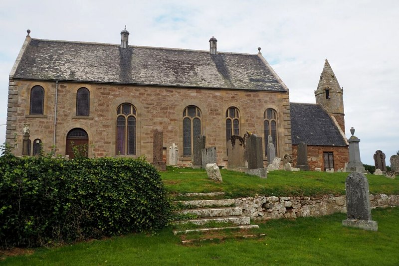
Kilmoremethet
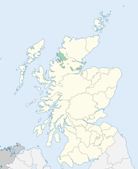
Kilmuir Easter is a parish partly lying in Ross-shire, partly comprising a small detached district of Cromartyshire, along the west side of the north part of the Cromarty Firth. It is bounded by Eddertoun, Kincardine, Nigg, the Cromarty Firth, Rosskeen, and Logie-Easter. (1867: The Imperial Gazetteer of Scotland, by John Marius Wilson).
Balnagown, Barbaraville, Delny, Kildary, Milntown or Milton of New Tarbat, Parkhill, Portlich
PRE-REFORMATION GOVERNANCE:
POST-REFORMATION GOVERNANCE:
The church of this parish was dedicated to St Mary. There was a prebend of Kilmuir in the Chapter of Fortrose Cathedral. At Delny in the parish there was a chapel of St Mary. At Balnagowan also there was a chapel.
Includes ministers, licentiates, assistants, readers, and clerks.
(1928: Fasti Ecclesiæ Scoticanæ, by Hew Scott, D. D.)
Parish registers turned over to the Registrar-General, as a result of the Registration of Births, Deaths, and Marriages (Scotland) Act of 1854. The letters B. D. and M. indicate Births (or Baptisms), Deaths (or Burials), and Marriages (or Proclamations of Banns) respectively. Numbers indicate separate volumes or books. Note: These records are by no means complete or without damage; consult the Detailed List of the Old Parochial Registers of Scotland (1872) to learn more about the condition of the records.
| OPR and RD Numbers | |||
|---|---|---|---|
| Date Range | Name | Number | Type |
| 1738-1854 | Kilmuir Easter | 69 | OPR |
| 1855-1967 | Kilmuir Easter | 69 | RD |
| 2009 | Highland, Rosskeen | 195 | RD |
| 2026 | Highland Council; Kilmuir and Logie Easter Community Council | ||
(2009: Parishes and Registration Districts of Scotland - Old and New, National Records of Scotland)
Local community councils (2026) are provided as a potential source of additional information for settlements within the original boundaries of the parish. (Source)
Statistics from informal and official censuses
Cameron, Campbell, Fraser, MacDonald, Mackenzie, MacLeod, Munro, Rose, Ross, Urquhart
Note: Names appearing in research materials, other than censuses. Simple names (First name, surname only) have been omitted unless they appear associated with large properties. All women's names, and men's names with occupations, military ranks, or peerage titles are included.
By the Reverend Mr John Matheson.
"It is certain that the number of inhabitants, in this parish, is triple what it was 50 years ago. This increase is ascribed to the great extent of improvable waste ground in the parish, the easy access to fuel, and the encouragement given by proprietors and tenants to day-labourers: these inducements led many emigrants from the Highland parishes to settle here. And, in the year 1763, the commissioners for managing the annexed states, settled 48 families of disbanded soldiers and sailors at once in the parish; allowing to each a house and three acres of arable land, expecting, that in process of time these families would prove a nursery for the army and navy; but, in the course of 10 years, there remained in the parish no more than 2 families of these strangers, all the rest having deserted their lots, which are now occupied by a more industrious set of people.
The people are sober, regular, and industrious; though it is to be lamented, that there are many among them whose morals are corrupted by having too easy access to spirits, there being upwards of 30 tippling houses in the parish, and only one principal inn; an evil that, (in the opinion of many), might in a great measure be prevented, were the proprietors to make the retail of spirit an irritancy in all the leases they grant, as nothing would contribute more to introduce sobriety among the people, than to have the number of whisky retailer circumscribed. Three retailing houses in the parish would be more than sufficient to answer all the necessary demands of the public. But it deserves to be remarked, that, notwithstanding the free use of spirits among the people, few feuds and quarrels are heard of in the parish."
(This section contains excerpts, at times restructured or paraphrased, from an article appearing in Statistical Account of Scotland, Sir John Sinclair, 1791-1799)
Primary Sources:
Statistical Account of Scotland (1791-1799), Volume 6, p. 183
New Statistical Account of Scotland (1834-1845), Volume 14, Section II, p. 300
See Parish Page Sources for all source information and links.