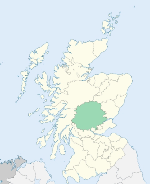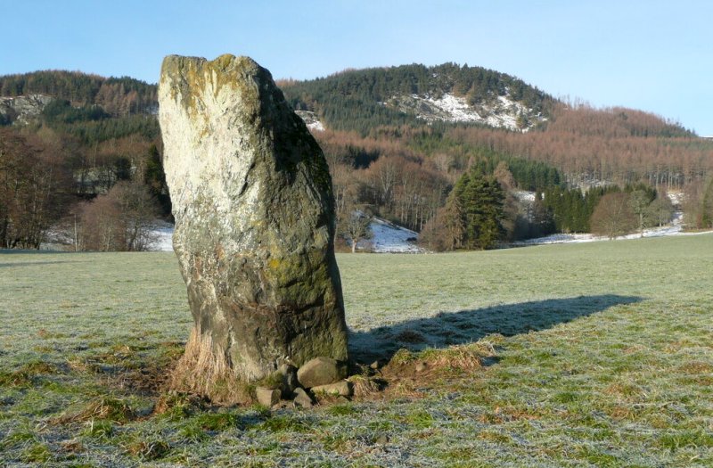
Moulin is a Highland parish in the north-east of Perthshire. It is bounded by Blair-Atholl, Kirkmichael, Dowally, Logierait, and Dull. (1867: The Imperial Gazetteer of Scotland, by John Marius Wilson).
Auldclune, Auldgirnaig, Edradour, Enochdhu, Killiecrankie, Kinnaird, Milton of Edradour, Moulin, Pitlochry, Portnacraig
Faskally, Fonab, Kindrogan, Strathgarry
The parish of Moulin had two detached parts:
No. 1. Ballyoukan, surrounded by the parish of Logierait
No. 2. Strathgarry, south of Blair-Atholl village
Moulin detached No. 2 was transferred to the parish of Blair Atholl. Moulin detached No. 1 was transferred to the parish of Logierait. The estate of Reinakyllich, in Blair Atholl, was annexed to Moulin. The estate of Fonab, in Logierait, was annexed to Moulin. See affected properties and landholders. (1892: Boundary of counties and parishes in Scotland as settled by the Boundary Commissioners under the Local Government Act, 1889, by Hay Shennan)
PRE-REFORMATION GOVERNANCE:
POST-REFORMATION GOVERNANCE:
The church of Moulin was dedicated to St Colmog. It belonged to the Abbey of Dunfermline. At the Knock of Moulin, in the parish, a yearly market was long held, called Feill Mo Cholmoig (St Colmog's Fair). There is now a mission chapel at Straloch.
Includes ministers, licentiates, assistants, readers, and clerks.
(1928: Fasti Ecclesiæ Scoticanæ, by Hew Scott, D. D.)
Parish registers turned over to the Registrar-General, as a result of the Registration of Births, Deaths, and Marriages (Scotland) Act of 1854. The letters B. D. and M. indicate Births (or Baptisms), Deaths (or Burials), and Marriages (or Proclamations of Banns) respectively. Numbers indicate separate volumes or books. Note: These records are by no means complete or without damage; consult the Detailed List of the Old Parochial Registers of Scotland (1872) to learn more about the condition of the records.
| OPR and RD Numbers | |||
|---|---|---|---|
| Date Range | Name | Number | Type |
| 1740-1854 | Moulin | 384 | OPR |
| 1855-1881 | Moulin | 384 | RD |
| 1882-1953 | Moulin | 384-1 | RD |
| 1882-1968 | Strathloch, or Straloch | 384-2 | RD |
| 1954-1968 | Pitlochry | 384-1 | RD |
| 1969-1971 | Pitlochry | 384 | RD |
| 1972-2003 | Pitlochry | 384 | RD |
| 2009 | (Straloch) Perth and Kinross, Blairgowrie | 381 | RD |
| 2009 | (Pitlochry) Perth and Kinross, Pitlochry | 383 | RD |
| 2026 | (Moulin) Perth and Kinross Council; Pitlochry and Moulin Community Council | ||
| 2026 | (Straloch) Perth and Kinross Council; Mount Blair Community Council | ||
(2009: Parishes and Registration Districts of Scotland - Old and New, National Records of Scotland)
Local community councils (2026) are provided as a potential source of additional information for settlements within the original boundaries of the parish. (Source)
Statistics from informal and official censuses
Cameron, Campbell, Ferguson, Forbes, Fraser, Grant, Robertson, Scott, Seaton, Stewart
Note: Names appearing in research materials, other than censuses. Simple names (First name, surname only) have been omitted unless they appear associated with large properties. All women's names, and men's names with occupations, military ranks, or peerage titles are included.
By the Reverend Mr Alexander Stewart.
"By an exact enumeration made in September 1791, the number of persons in the parish was found to be 817 males, and 932 females; total, 1749. The number of farmers, ascertained by survey, is 194. There are in the parish 28 weavers, 10 tailors, 8 carpenters, 7 shoemakers, 6 shopkeepers, 5 blacksmiths, 5 masons, 4 flax-dressers, 4 coopers, 3 sieve-makers, and 1 dyer. Of labouring servants, there are 17 males, and 18 females in gentlemen's families; the number of both sexes, among the tenants, may be estimated at 89. All the inhabitants are of the Established Church.
The number of inhabited houses is 440, but it is to be observed that many are possessed by widows and widowers, who have no family, and by unmarried tradesmen. There are no houses uninhabited, nor any farms unoccupied. There are two villages in the parish; one called Pitlochry, containing about 30 families; the other Moulin, containing 37 families.
The people are in general industrious. The principal branch of manufacture, carried on in the parish, is the spinning of linen yarn, the staple commodity of the country. In winter, it is the only employment of the women. In summer the women spin woollen yarn. Woollen cloths, for common wear, such as hooding for men's coats and waistcoats, tartan for hose, breeches, kilts and plaids, &c. are entirely manufactured in the country. The number of mills in the parish is 10 meal-mills, 3 fulling mills, and 7 lint-mills.
The language principally spoken is the Gaelic. Most of the people, however, understand so much of English, as to be able to transact ordinary business with their neighbours of the low country. The general size of the men is 5 feet 5 or 6 inches; of the women 5 feet. The people have no idea of a seafaring life, and are very averse to a military one. They are humane, very obliging, well enough contented; enjoy the necessaries of life in a tolerable degree, and comforts of society in abundance; are frugal in their diet, but study a neat and showy appearance in their dress and furniture. None are known to have emigrated beyond sea from the parish; there are no instances, for many years past, of any person dying for want; and but one has been banished."
(This section contains excerpts, at times restructured or paraphrased, from an article appearing in Statistical Account of Scotland, Sir John Sinclair, 1791-1799)
Primary Sources:
Statistical Account of Scotland (1791-1799), Volume 5, p. 50
New Statistical Account of Scotland (1834-1845), Volume 10, p. 637
See Parish Page Sources for all source information and links.