Dowallie
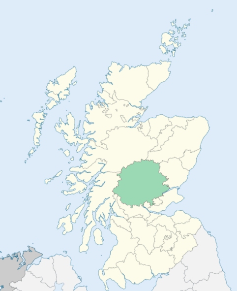
Dowally is a parish in the Strathtay district of Perthshire. It consists of a main body and a detached district. The main body extends 6 miles down the left bank of the Tay, about a mile from the town of Dunkeld, yet is bounded at that end by a portion of Caputh; it marches with Kirkmichael on the east, and with Logierait on the north. The detached district is situated on the left bank of the Tummel, and is separated from the main body by Logierait. (1867: The Imperial Gazetteer of Scotland, by John Marius Wilson)
Dowally
The parish of Dunkeld and Dowally had two detached parts:
No. 1. Dalcapon, nearly surrounded by the parish of Logierait
No. 2. Dowally, being the old parish of Dowally
(a.) Dunkeld and Dowally detached No. 1 was transferred to the parish of Logierait.
(b.) Part of the parish of Caputh was annexed to Dunkeld and Dowally, and in this way the main portion and detached No. 1 of the parish of Dunkeld and Dowally were united. See affected properties and landholders. (1892: Boundary of counties and parishes in Scotland as settled by the Boundary Commissioners under the Local Government Act, 1889, by Hay Shennan)
PRE-REFORMATION GOVERNANCE:
POST-REFORMATION GOVERNANCE:
The parishes of Dowally and Dunkeld were united before the middle of the seventeenth century. It is unclear at what point they were disjoined. In early times St Muireach made Dowallie the seat of his mission work among the Picts. In 1500 Bishop Broun rebuilt the ancient chapel of St Muireach, and gave the new building the name of St Anne. In that year, too, the bishop disjoined the parish of Dowallie from Caputh. At Guay, within the bounds, a hospital was founded in 1340. Farther north, at Dalcapon, there was a chapel with its sacred well. At the Crues Hill, near Dunkeld, but in this parish, a well of the Holy Rood was much frequented on the first Sunday in May. The church of Dowallie was restored in 1818, and is now in use as a mission chapel.
Includes ministers, licentiates, assistants, readers, and clerks.
(1928: Fasti Ecclesiæ Scoticanæ, by Hew Scott, D. D.)
Parish registers turned over to the Registrar-General, as a result of the Registration of Births, Deaths, and Marriages (Scotland) Act of 1854. The letters B. D. and M. indicate Births (or Baptisms), Deaths (or Burials), and Marriages (or Proclamations of Banns) respectively. Numbers indicate separate volumes or books. Note: These records are by no means complete or without damage; consult the Detailed List of the Old Parochial Registers of Scotland (1872) to learn more about the condition of the records.
| OPR and RD Numbers | |||
|---|---|---|---|
| Date Range | Name | Number | Type |
| 1704-1854 | Dowally | 344 | OPR |
| 1855-1953 | Dowally | 344 | RD |
| 1854-1971 | Dunkeld | 349 | RD |
| 1972-2003 | Dunkeld | 388 | RD |
| 2009 | Perth and Kinross, Dunkeld | 388 | RD |
| 2026 | Perth and Kinross Council; Dunkeld and Birname Community Council | ||
(2009: Parishes and Registration Districts of Scotland - Old and New, National Records of Scotland)
Local community councils (2026) are provided as a potential source of additional information for settlements within the original boundaries of the parish. (Source)
Statistics from informal and official censuses
Butter, Cameron, Campbell, Douglas, Forbes, Kennedy, Reid, Robertson, Sim, Stewart
Note: Names appearing in research materials, other than censuses. Simple names (First name, surname only) have been omitted unless they appear associated with large properties. All women's names, and men's names with occupations, military ranks, or peerage titles are included.
Compiled from authentic materials, by Sir John Sinclair, compiler of the Statistical Account of Scotland.
"By a very accurate list of the inhabitants, taken in 1790, it appeared there were 687 souls, of which 307 were males and 380 were females. The whole inhabitants may be considered as employed in agriculture; for though there is a smith, two wrights, and two tailors in the parish, yet all of them, to some small extent are concerned in labouring the ground. There are no separate manufactures yet established here.
The Gaelic language is spoken universally in this parish, though all the people, at the same time, understand more or less perfectly the English. The people are hardy, laborious, temperate, and sensible. They are regular and devout in their attendance on the ordinances of religion; cheerful in their intercourse with each other; and humane to the needy."
(This section contains excerpts, at times restructured or paraphrased, from an article appearing in Statistical Account of Scotland, Sir John Sinclair, 1791-1799)
Primary Sources:
Statistical Account of Scotland (1791-1799), Volume 20, p. 459
New Statistical Account of Scotland (1834-1845), Volume 10, p. 958
See Parish Page Sources for all source information and links.