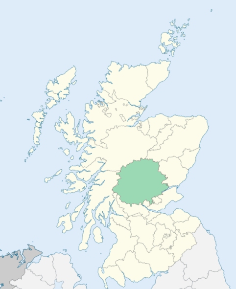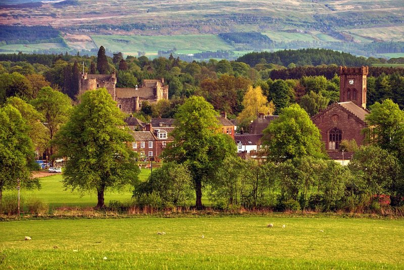
Kilmadock is a parish nearly in the middle of the southern border of Perthshire. It is bounded by Stirlingshire, and by the parishes of Port-of-Monteith, Callander, Strowan, Dunblane, Lecropt, and Kincardine. (1867: The Imperial Gazetteer of Scotland, by John Marius Wilson).
Bridge of Teith, Buchany, Burn of Cambus, Coune, Deanston, Delvorich, Doune, Drumvaich, Kilmadock, Ramoth
Cambusmore, Coldoch, Craighead, Doune, Lanrick
Part of the parish of Kincardine situated at Thornhill was separated from the main portion of the parish by the southern part of the parish of Kilmadock. An exchange of territory was effected between these two parishes. Part of the detached part and part of the main portion of Kincardine were given to Kilmadock, and the remainder of the detached part was united to the main portion of Kincardine by the annexation to Kincardine of a small intervening part of Kilmadock. See affected properties and landholders. (1892: Boundary of counties and parishes in Scotland as settled by the Boundary Commissioners under the Local Government Act, 1889, by Hay Shennan)
PRE-REFORMATION GOVERNANCE:
POST-REFORMATION GOVERNANCE:
The church of Kilmadock was dedicated to St Aedh. It belonged to the Priory of Inchmahome.
Disjoined Quoad Sacra Parishes:
Norrieston. A chapel was built here in 1650 on a site gifted by Gilbert Norrie of Norrieston. The parish of Norrieston was disjoined from Port of Menteith, Kincardine-in-Menteith, and Kilmadock on 16 July 1877. A new church was built in 1879.
Includes ministers, licentiates, assistants, readers, and clerks.
Kilmadock (QO)
Norrieston (QS)
(1928: Fasti Ecclesiæ Scoticanæ, by Hew Scott, D. D.)
Parish registers turned over to the Registrar-General, as a result of the Registration of Births, Deaths, and Marriages (Scotland) Act of 1854. The letters B. D. and M. indicate Births (or Baptisms), Deaths (or Burials), and Marriages (or Proclamations of Banns) respectively. Numbers indicate separate volumes or books. Note: These records are by no means complete or without damage; consult the Detailed List of the Old Parochial Registers of Scotland (1872) to learn more about the condition of the records.
| OPR and RD Numbers | |||
|---|---|---|---|
| Date Range | Name | Number | Type |
| 1623-1854 | Kilmadock | 362 | OPR |
| 1855-1968 | Kilmadock | 362 | RD |
| 1954-1971 | Doune | 362 | RD |
| 1972-1978 | Doune | 398 | RD |
| 2009 | Stirling Council, Stirling | 473 | RD |
| 2026 | Stirling Council; Kilmadock Community Council | ||
(2009: Parishes and Registration Districts of Scotland - Old and New, National Records of Scotland)
Local community councils (2026) are provided as a potential source of additional information for settlements within the original boundaries of the parish. (Source)
Statistics from informal and official censuses
Bain, Brown, Buchanan, Campbell, Dewar, Ferguson, Graham, Morrison, Stewart, Young
Note: Names appearing in research materials, other than censuses. Simple names (First name, surname only) have been omitted unless they appear associated with large properties. All women's names, and men's names with occupations, military ranks, or peerage titles are included.
By Mr Alexander MacGibbon.
"The population at present amounts to 3209, including those employed at the Adelphi cotton-works. The Adelphi cotton-works being lately burnt, about 20 families left the parish. The language of the common people in this parish, like many of the parishes in the neighbourhood, is a mixture of Scotch and English.
The only town in the parish is Doune. The name originates from the town being situated near by the ancient castle known by that name.
There are 529 families in the parish, 190 farmers, 32 cottars, 8 merchants, 15 weavers, 13 shoemakers, 11 tailors, 2 gardeners, 16 masons, 12 wrights and glaziers, 6 slaters, 7 smiths, 3 wheel-wrights, 2 stocking-makers, 1 cooper, 1 dyer, 3 flax-dressers, 2 stocking-makers, 12 butchers, 2 bakers, 2 watch-makers, 1 pistol-maker, 1 saddler, 5 vintners, and 3 distillers and brewers.
In this district a simplicity of manners, peculiar to rural felicity, has, for a long time, prevailed. A stranger to deceit, the honest farmer is quite careless of modern refinement, trusting his success and prosperity to the kind hand of providence, and the faithful bosom of the earth."
(This section contains excerpts, at times restructured or paraphrased, from an article appearing in Statistical Account of Scotland, Sir John Sinclair, 1791-1799)
Primary Sources:
Statistical Account of Scotland (1791-1799), Volume 20, p. 40
New Statistical Account of Scotland (1834-1845), Volume 10, p. 1224
See Parish Page Sources for all source information and links.