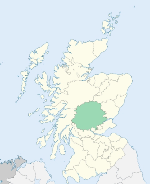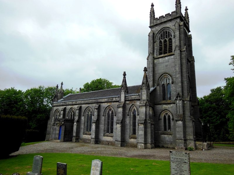
Lecropt is a parish on the mutual border of Perthshire and Stirlingshire. It is bounded by Dunblane, Logie, St Ninians, Kincardine, and Kilmadock. (1867: The Imperial Gazetteer of Scotland, by John Marius Wilson).
Blairlogie, Bridge of Allan, Craigmill, Lecropt, Logie
The parish of Lecropt was situated partly in the county of Perth and partly in the county of Stirling. That part of the parish which lay to the east of the west boundary of the Scottish Central Railway line was transferred to the parish of Logie. At the same time a small part of the parish of Logie which lay to the west of the west boundary of that railway, and on the right bank of the Allan Water, was transferred to the parish of Lecropt. Then the parish of Lecropt, as thus altered in area, was placed wholly in the county of Perth. See affected properties and landholders. (1892: Boundary of counties and parishes in Scotland as settled by the Boundary Commissioners under the Local Government Act, 1889, by Hay Shennan)
PRE-REFORMATION GOVERNANCE:
POST-REFORMATION GOVERNANCE:
The church of Lecropt was dedicated to St Muireach. It belonged to the Abbey of Cambuskenneth.
Includes ministers, licentiates, assistants, readers, and clerks.
(1928: Fasti Ecclesiæ Scoticanæ, by Hew Scott, D. D.)
Parish registers turned over to the Registrar-General, as a result of the Registration of Births, Deaths, and Marriages (Scotland) Act of 1854. The letters B. D. and M. indicate Births (or Baptisms), Deaths (or Burials), and Marriages (or Proclamations of Banns) respectively. Numbers indicate separate volumes or books. Note: These records are by no means complete or without damage; consult the Detailed List of the Old Parochial Registers of Scotland (1872) to learn more about the condition of the records.
| OPR and RD Numbers | |||
|---|---|---|---|
| Date Range | Name | Number | Type |
| 1720-1854 | Lecropt | 371 | RD |
| 1855-1898 | Lecropt | 371 | RD |
| 1899-1899 | Lecropt | 348-2 | RD |
| 1900-1968 | Dunblane and Lecropt | 348 | RD |
| 2009 | Stirling, Dunblane | 399 | RD |
| 2026 | Stirling Council; Kilmadock Community Council | ||
(2009: Parishes and Registration Districts of Scotland - Old and New, National Records of Scotland)
Local community councils (2026) are provided as a potential source of additional information for settlements within the original boundaries of the parish. (Source)
Statistics from informal and official censuses
Carmichael, Ferguson, Mitchell, Oliver, Reid, Robertson, Russell, Stewart, Williams, Wilson
Note: Names appearing in research materials, other than censuses. Simple names (First name, surname only) have been omitted unless they appear associated with large properties. All women's names, and men's names with occupations, military ranks, or peerage titles are included.
By the Reverend Dr James Robertson, Minister of Callander, from Materials furnished by the Reverend Mr John Kinross, Minister of Lecropt.
"The number of souls at present (1794) is 420; the number of families is 80. The people are employed, for the most part, in the various operations of husbandry, as farmers, servants, and labourers. There are 2 weavers, 1 smith, and 1 millwright; but neither tailor, shoemaker, surgeon, nor lawyer in the parish. There is only one village, called the Bridge of Allan, which consists of 28 families. The villagers are variously employed, ministering to the convenience of the country. There is, particularly, a brewery for malt liquor, where strong ale, small beer, and porter, are made.
The people are remarkable for their decency and sobriety. None have been banished, or have suffered the higher pains of law, in any other respect, for misconduct, in the memory of man."
(This section contains excerpts, at times restructured or paraphrased, from an article appearing in Statistical Account of Scotland, Sir John Sinclair, 1791-1799)
Primary Sources:
Statistical Account of Scotland (1791-1799), Volume 17, p. 45
New Statistical Account of Scotland (1834-1845), Volume 10, p. 1160
See Parish Page Sources for all source information and links.