Glendovan
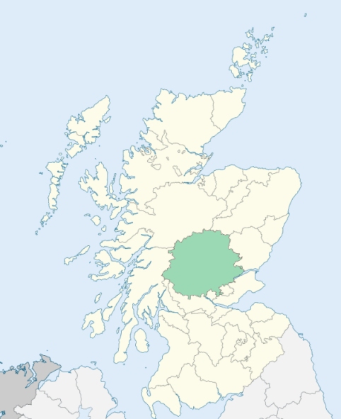
Glendevon is a parish in the Ochil district of Perthshire. It is bounded by Blackford, Auchterarder, Fossoway, Muckhart, and Clackmannanshire. (1867: The Imperial Gazetteer of Scotland, by John Marius Wilson).
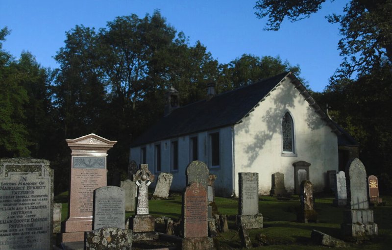
Burnfoot, Glendvon
(1) The parish of Fossoway & Tulliebole was situated partly in the county of Kinross and partly in the county of Perth. A small portion of the Perthshire part of the parish was transferred to the parish of Glendevon, and the parish of Fossoway & Tulliebole, as thus altered in area, was placed wholly in the county of Kinross. See affected properties and landholders. (1892: Boundary of counties and parishes in Scotland as settled by the Boundary Commissioners under the Local Government Act, 1889, by Hay Shennan)
(2) A detached, or nearly detached, part of the parish of Blackford was annexed to Glendevon. See affected properties and landholders. (1892: Boundary of counties and parishes in Scotland as settled by the Boundary Commissioners under the Local Government Act, 1889, by Hay Shennan)
PRE-REFORMATION GOVERNANCE:
POST-REFORMATION GOVERNANCE:
The ancient church of Glendevon was dedicated to St Mungo. Its site is not in the Glen of Devon, but in Glen Eagles (Gleann na h-Eaglais = the Valley of the Church). Near that place is St Mungo's Well.
Includes ministers, licentiates, assistants, readers, and clerks.
(1928: Fasti Ecclesiæ Scoticanæ, by Hew Scott, D. D.)
Parish registers turned over to the Registrar-General, as a result of the Registration of Births, Deaths, and Marriages (Scotland) Act of 1854. The letters B. D. and M. indicate Births (or Baptisms), Deaths (or Burials), and Marriages (or Proclamations of Banns) respectively. Numbers indicate separate volumes or books. Note: These records are by no means complete or without damage; consult the Detailed List of the Old Parochial Registers of Scotland (1872) to learn more about the condition of the records.
| OPR and RD Numbers | |||
|---|---|---|---|
| Date Range | Name | Number | Type |
| 1710-1854 | Glendevon | 358 | OPR |
| 1855-1954 | Glendevon | 358 | RD |
| 1955-1971 | Muckhart and Glendevon | 385 | RD |
| 1972 | Muckhart and Glendevon | 396 | RD |
| 2009 | Perth and Kinross | 396 | RD |
| 2026 | Perth and Kinross Council; Auchterarder and District Community Council | ||
(2009: Parishes and Registration Districts of Scotland - Old and New, National Records of Scotland)
Local community councils (2026) are provided as a potential source of additional information for settlements within the original boundaries of the parish. (Source)
Statistics from informal and official censuses
Baillie, Clayton, Cram, French, Guild, Johnstone, Martin, Pate, Ramsay, Sinclair
Note: Names appearing in research materials, other than censuses. Simple names (First name, surname only) have been omitted unless they appear associated with large properties. All women's names, and men's names with occupations, military ranks, or peerage titles are included.
By the Reverend Mr John Brown.
"Pasture farms requiring few hands, and there being no towns, or what may be termed villages, within the parish, the number of inhabitants are few, scarcely amounting to 200 of the established church. Besides those of the Established Church there are 5 Burghers and 35 Antiburghers; there are one smith, one mason, and 5 day labourers. Most of the work is performed by servants hired by the year.
The people are sober, industrious, and happy in their situation. The grain produced in the parish is not sufficient to support the inhabitants, who are supplied with this article from Strathearn."
(This section contains excerpts, at times restructured or paraphrased, from an article appearing in Statistical Account of Scotland, Sir John Sinclair, 1791-1799)
Primary Sources:
Statistical Account of Scotland (1791-1799), Volume 10, p. 229
New Statistical Account of Scotland (1834-1845), Volume 10, p. 333
See Parish Page Sources for all source information and links.