Minigaff, Monigaff
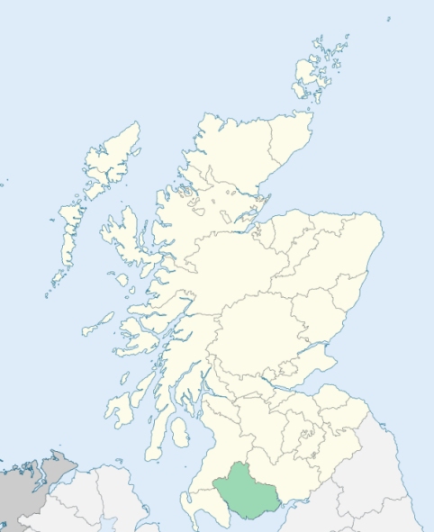
Minnigaff is a parish in the extreme west of Kirkcudbrightshire. It is bounded by the counties of Wigtown and Ayr, and by the parishes of Carsphairn, Kells, Girthon, and Kirkmabreck. (1867: The Imperial Gazetteer of Scotland, by John Marius Wilson).
Bargrennan, Blackcraig, Creebridge, Millcroft, Mines, Minnigaff, Palnure or Palnure Bridge
Bargaly
PRE-REFORMATION GOVERNANCE:
POST-REFORMATION GOVERNANCE:
Before the Reformation the church of Monigaff belonged to the Bishop of Galloway. At Kirkennan, in this parish, there was a Chapel of St Inan.
Disjoined Quoad Sacra Parishes:
Bargrennan. A chapel-of-ease was opened at Bargrennan, 17 March 1839. The parish was disjoined from Monigaff, Penninghame, and Colmonell, 16 July 1862.
Includes ministers, licentiates, assistants, readers, and clerks.
Minnigaff (QO)
Bargrennan (QS)
(1928: Fasti Ecclesiæ Scoticanæ, by Hew Scott, D. D.)
Parish registers turned over to the Registrar-General, as a result of the Registration of Births, Deaths, and Marriages (Scotland) Act of 1854. The letters B. D. and M. indicate Births (or Baptisms), Deaths (or Burials), and Marriages (or Proclamations of Banns) respectively. Numbers indicate separate volumes or books. Note: These records are by no means complete or without damage; consult the Detailed List of the Old Parochial Registers of Scotland (1872) to learn more about the condition of the records.
| OPR and RD Numbers | |||
|---|---|---|---|
| Date Range | Name | Number | Type |
| 1694-1854 | Minnigaff | 876 | OPR |
| 1855-1971 | Minnigaff | 876 | RD |
| 1972-1989 | Minnigaff | 861 | RD |
| 2009 | Dumfries and Galloway, Dumfries | 834 | RD |
| 2026 | Dumfries and Galloway Council; Cree Valley Community Council | ||
(2009: Parishes and Registration Districts of Scotland - Old and New, National Records of Scotland)
Local community councils (2026) are provided as a potential source of additional information for settlements within the original boundaries of the parish. (Source)
Statistics from informal and official censuses
Callander, Campbell, Crawford, Gibson, Hannah, Kelly, Kenna, Smith, Walker, Wilson
Note: Names appearing in research materials, other than censuses. Simple names (First name, surname only) have been omitted unless they appear associated with large properties. All women's names, and men's names with occupations, military ranks, or peerage titles are included.
By the Reverend Mr John Garlies Maitland.
"The population in 1792 was 1420. The people of this parish are, in general, sober and industrious. They have been even able, in a great measure, to withstand the pernicious influence of British spirits, which, to the misfortune of this country, are too commonly in use. The lower classes possess a degree of information which is unusual among peasants. While engaged in tending their sheep they have long intervals of leisure. Many of them fill up these with reading and reflection. Hence they are always better informed than the mechanics, or even the labourers who are engaged in agriculture. Many of the farmers are decent and intelligent men. They are mostly wealthy, and live in a very comfortable style."
(This section contains excerpts, at times restructured or paraphrased, from an article appearing in Statistical Account of Scotland, Sir John Sinclair, 1791-1799)
Primary Sources:
Statistical Account of Scotland (1791-1799), Volume 7, p. 52
New Statistical Account of Scotland (1834-1845), Volume 4, Section II, p. 117
See Parish Page Sources for all source information and links.