Rhu
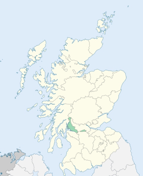
Row is a parish in the western extremity of Dunbartonshire. It is bounded on the north and north-east by Luss, on the east by Luss and Cardross, on the south by the Firth of Clyde, which divides it from Renfrewshire, on the south-west by Gairloch, and an artificial line of 1¼ mile, which divides it from Rosneath, and on the west by Loch Long, which divides it from Argyleshire. (1867: The Imperial Gazetteer of Scotland, by John Marius Wilson).
Gairlochhead, Helensburgh, Kirkton, Row
Ardenconnel, Finart
PRE-REFORMATION GOVERNANCE:
POST-REFORMATION GOVERNANCE:
The parish of Row was disjoined from Rosneath on 22 February 1643. Within the bounds of this modern parish there were of old five chapels - St Michael's at Faslane; St Diarmad's in Glen Fruin; St Bride's at Kilbride, in Glen Fruin; St Michael's at Millig; and St Diarmad's at Balnock. St Diarmad, thus honoured here, was Abbot of Iona from 815 to 831.
Disjoined Quoad Sacra Parishes:
Garelochhead. A church was built here in 1838. The parish of Garelochhead was disjoined from Row and Rosneath on 17 March 1873.
Helensburgh. Mission work was begun here in 1839. A church was built in 1847. The parish of Helensburgh was disjoined from Row, 16 July 1862.
West Helensburgh. An iron chapel was erected here in 1868. The church was built in 1877. The parish of West Helensburgh was disjoined from Row and Helensburgh on 29 Oct 1883.
Includes ministers, licentiates, assistants, readers, and clerks.
Row (QO)
Garelochhead (QS)
Helensburgh (QS)
West Helensburgh (QS)
(1928: Fasti Ecclesiæ Scoticanæ, by Hew Scott, D. D.)
Parish registers turned over to the Registrar-General, as a result of the Registration of Births, Deaths, and Marriages (Scotland) Act of 1854. The letters B. D. and M. indicate Births (or Baptisms), Deaths (or Burials), and Marriages (or Proclamations of Banns) respectively. Numbers indicate separate volumes or books. Note: These records are by no means complete or without damage; consult the Detailed List of the Old Parochial Registers of Scotland (1872) to learn more about the condition of the records.
| OPR and RD Numbers | |||
|---|---|---|---|
| Date Range | Name | Number | Type |
| 1760-1854 | Row | 503 | OPR |
| 1855-1926 | Row | 503 | RD |
| 1927-1968 | Row | 503 | RD |
| 1969-1971 | Vale of Leven | 503 | RD |
| 1972-2005 | Vale of Leven | 503 | RD |
| 2006-2006 | Vale of Leven, West Dunbartonshire | 503 | RD |
| 2007-2011 | West Dunbartonshire, Alexandria | 503 | RD |
| 2026 | West Dunbartonshire Council; Alexandria Community Council | ||
(2009: Parishes and Registration Districts of Scotland - Old and New, National Records of Scotland)
Local community councils (2026) are provided as a potential source of additional information for settlements within the original boundaries of the parish. (Source)
Statistics from informal and official censuses
Brown, Buchanan, Cameron, Campbell, Hamilton, Robertson, Smith, Stewart, Thomson, Wilson
Note: Names appearing in research materials, other than censuses. Simple names (First name, surname only) have been omitted unless they appear associated with large properties. All women's names, and men's names with occupations, military ranks, or peerage titles are included.
By the Reverend Mr John Allan.
"The present amount of the population is about 1000. The number of males 486, of females 514. Many young men leave the parish in quest of employment, some as sailors, others as tradesmen or servants. There is one village in the parish, lately built, which contains about 100 souls. There are in the parish 65 farmers, their families are about 325 in number. There is only 1 family of Seceders.
The people are fond of a seafaring life; during the last war, from 25 to 30 able bodied seamen, from this parish, were employed in the navy. The people in general are not expensive, a few individuals are much addicted to dram drinking; and the young people, especially the females, fond of dress, and more expensive in that way than their circumstances can well afford. There are about 11 ale or rather whisky houses; one properly called an inn. English is generally spoken, but many understand and frequently converse in Gaelic."
(This section contains excerpts, at times restructured or paraphrased, from an article appearing in Statistical Account of Scotland, Sir John Sinclair, 1791-1799)
Primary Sources:
Statistical Account of Scotland (1791-1799), Volume 4, p. 405
New Statistical Account of Scotland (1834-1845), Volume 8, Section I, p. 65
See Parish Page Sources for all source information and links.