Geirloch
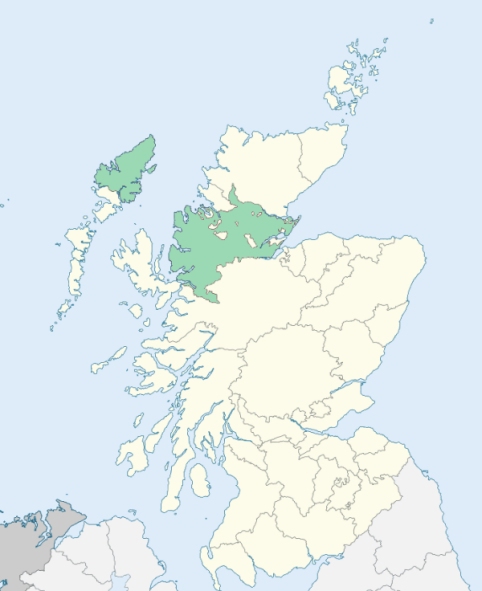
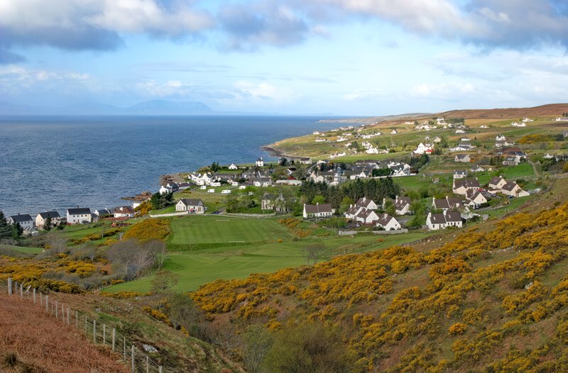
Gairloch is a parish on the west coast of Ross-shire. It is bounded on the north by the River Gruinard, which separates it from the parish of Lochbroom, on the east by the summit line of mountains which divides the waters flowing to the eastern sea from those flowing to the west, on the south by Loch Torridon, which separates it from the parish of Applecross, and on the west, by the Minch or that part of the Caledonian sea which divides the Scottish mainland from the Outer Hebrides. (1867: The Imperial Gazetteer of Scotland, by John Marius Wilson).
Achtercairn or Auchtercairn, Aultbea, Bualnaluib, Dibaig, Gairloch, Kinlochewe, Melloncharles, Poolewe
Letterewe
PRE-REFORMATION GOVERNANCE:
POST-REFORMATION GOVERNANCE:
The old church of Gairloch stood at Kinlochewe. It was dedicated to St Malrubh, and was a commune kirk of the Cathedral of Ross. Within the bounds lies Loch Maree, named after the patron saint of the parish. At Innis Mhalruibh, an island in the Loch, are the remains of St Malrubh's chapel, where pilgrims came in large numbers to see his relics.
Disjoined Quoad Sacra Parishes:
Poolewe. A parliamentary church was built here in 1828 and the district declared a quoad sacra parish by Act of Assembly 25 May 1833. The parish of Poolewe was disjoined from Gairloch by the Court of Teinds on 3 December 1851. There is a mission chapel within the bounds at Aultbea.
Includes ministers, licentiates, assistants, readers, and clerks.
Gairloch (QO)
Poolewe (QS)
(1928: Fasti Ecclesiæ Scoticanæ, by Hew Scott, D. D.)
Parish registers turned over to the Registrar-General, as a result of the Registration of Births, Deaths, and Marriages (Scotland) Act of 1854. The letters B. D. and M. indicate Births (or Baptisms), Deaths (or Burials), and Marriages (or Proclamations of Banns) respectively. Numbers indicate separate volumes or books. Note: These records are by no means complete or without damage; consult the Detailed List of the Old Parochial Registers of Scotland (1872) to learn more about the condition of the records.
| OPR and RD Numbers | |||
|---|---|---|---|
| Date Range | Name | Number | Type |
| 1781-1854 | Gairloch | 66 | OPR |
| 1855-1857 | Gairloch | 66 | RD |
| 1858-1971 | Gairloch, Northern | 66-1 | RD |
| 1858-1971 | Gairloch, Southern | 66-2 | RD |
| 1972-2001 | Gairloch, Northern | 203 | RD |
| 1972-2001 | Gairloch, Southern | 202 | RD |
| 2006-2006 | Gairloch | 202 | RD |
| 2009 | Highland, Gairloch | 202 | RD |
| 2026 | Highland Council; Gairloch Community Council | ||
(2009: Parishes and Registration Districts of Scotland - Old and New, National Records of Scotland)
Local community councils (2026) are provided as a potential source of additional information for settlements within the original boundaries of the parish. (Source)
Statistics from informal and official censuses
Fraser, MacDonald, MacIver, Mackenzie, MacLean, MacLennan, MacLeod, MacPherson, MacRae, Urquhart
Note: Names appearing in research materials, other than censuses. Simple names (First name, surname only) have been omitted unless they appear associated with large properties. All women's names, and men's names with occupations, military ranks, or peerage titles are included.
By the Reverend Mr Daniel M'Intosh.
"There were in this parish in the year 1774, of examinable persons about 2000. And from that period to the present, there is an increase of 200 souls, and upwards. There are a few people in the parish at the age of 86 and 87. Two died lately who arrived at the age of 100 years. The people are in general sober, regular, industrious, and pious. They have always been remarked and esteemed for their civility, and hospitality to strangers."
(This section contains excerpts, at times restructured or paraphrased, from an article appearing in Statistical Account of Scotland, Sir John Sinclair, 1791-1799)
Primary Sources:
Statistical Account of Scotland (1791-1799), Volume 3, p. 89
New Statistical Account of Scotland (1834-1845), Volume 14, Section II, p. 90
See Parish Page Sources for all source information and links.