Cardross and Kilmahew
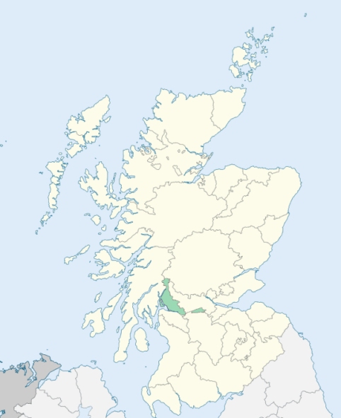
Cardross is a parish containing a suburb of Dumbarton in Dunbartonshire. (1867: The Imperial Gazetteer of Scotland, by John Marius Wilson).
Cardross, Geilstone Bridge, Renton
Bloomhill, Camus Eskan, Keppoch, Kilmahew
PRE-REFORMATION GOVERNANCE:
POST-REFORMATION GOVERNANCE:
The parishes of Cardross and Kilmahew were united towards the end of the sixteenth century.
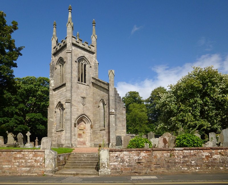
Cardross. The church of Cardross was a prebend of Glasgow, being a mensal church of the Archbishop. Cardross Church was rebuilt on a new site in 1826.
Kilmahew. The church of Kilmahew was dedicated to St Machuit. Its ruins still stand at the Kirkton of Kilmahew, with St Machuit's Well near them.
Disjoined Quoad Sacra Parishes:
Dalreoch. A church was built here in 1871. The parish of Dalreoch was disjoined from Cardross on 17 March 1873.
Renton. The parish of Renton was disjoined from Cardross, 28 February 1870.
Includes ministers, licentiates, assistants, readers, and clerks.
Cardross (QO)
Kilmahew (QO)
Dalreoch (QS)
Renton (QS)
(1928: Fasti Ecclesiæ Scoticanæ, by Hew Scott, D. D.)
Parish registers turned over to the Registrar-General, as a result of the Registration of Births, Deaths, and Marriages (Scotland) Act of 1854. The letters B. D. and M. indicate Births (or Baptisms), Deaths (or Burials), and Marriages (or Proclamations of Banns) respectively. Numbers indicate separate volumes or books. Note: These records are by no means complete or without damage; consult the Detailed List of the Old Parochial Registers of Scotland (1872) to learn more about the condition of the records.
| OPR and RD Numbers | |||
|---|---|---|---|
| Date Range | Name | Number | Type |
| 1681-1854 | Cardross | 494 | OPR |
| 1855-1882 | Cardross | 494 | RD |
| 1883-1968 | Cardross | 494-1 | RD |
| 1883-1953 | Renton | 494-2 | RD |
| 2009 | Argyll and Bute, Helensburgh | 501 | RD |
| 2026 | (Cardross) Argyll and Bute Council; Cardross Community Council | ||
| 2026 | (Renton) West Dunbartonshire Council; Renton Community Council | ||
(2009: Parishes and Registration Districts of Scotland - Old and New, National Records of Scotland)
Local community councils (2026) are provided as a potential source of additional information for settlements within the original boundaries of the parish. (Source)
Statistics from informal and official censuses
Brown, Campbell, Graham, Kelly, Kennedy, King, Murray, Smith, Stewart, Wilson
Note: Names appearing in research materials, other than censuses. Simple names (First name, surname only) have been omitted unless they appear associated with large properties. All women's names, and men's names with occupations, military ranks, or peerage titles are included.
By the Reverend Mr Alexander M'Aulay, Minister.
"From a list taken in November 1793, it appears there were no fewer than 2194 souls. Of the above number there are 614 children under 10 years of age, 847 heads of families, including both husbands and wives, and 251 hired servants. In the village of Renton, there are about 1200; in the rest of the parish, 994.
The print-fields of Dalquburn and Cordale employed, in summer 1792, 876 persons. Of these 300 were girls (pencillers), and about 130 were boys, from 8 to 15 years of age. It may be proper to observe, that the boys are in general healthy, active, and lively, having nothing of that pale and sickly look, which too often marks those boys who are employed in the cotton spinning.
The people in general are sober and industrious. The introduction of manufactures has, no doubt, produced some change in their habits and manners; and whether this change may operate more in the end to their advantage or hurt, time alone can determine."
(This section contains excerpts, at times restructured or paraphrased, from an article appearing in Statistical Account of Scotland, Sir John Sinclair, 1791-1799)
Primary Sources:
Statistical Account of Scotland (1791-1799), Volume 17, p. 209
New Statistical Account of Scotland (1834-1845), Volume 8, Section I, p. 83
See Parish Page Sources for all source information and links.