Drysdale
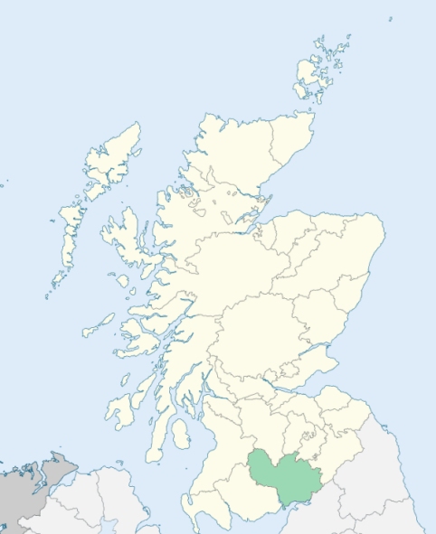
Dryfesdale is a parish in the centre of Annandale, Dumfriesshire. The name is locally pronounced Drysdale. The parish is bounded by Applegarth, Hutton, Tundergarth, St Mungo, Dalton, and Lochmaben. (1867: The Imperial Gazetteer of Scotland, by John Marius Wilson).
Bengall, Blackford, Dryfesdale, Lockerbie or Lockerby, South Corriedale
PRE-REFORMATION GOVERNANCE:
POST-REFORMATION GOVERNANCE:
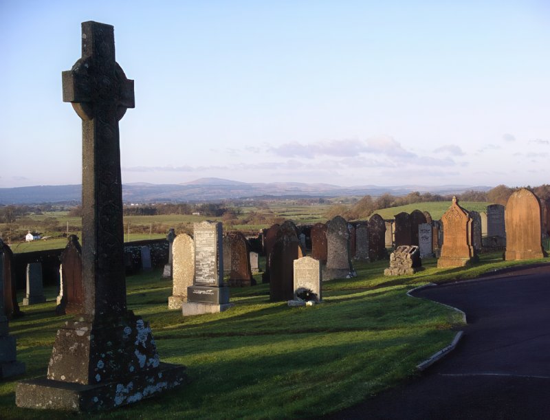
The church of Dryfesdale was dedicated to St Cuthbert. In 1116 it belonged to the See of Glasgow. The old church at the Kirkhill was carried away by a flood of the river Dryfe. A new church, built in 1671, was swept off also, with a great part of the churchyard. The church was then built in Lockerbie, and has since been rebuilt there. At Beckton, in the parish, the Knights Templars had a chapel of St Mary, with chapel lands. There was also a chapel of St Michael at Hillside of Quaas.
Includes ministers, licentiates, assistants, readers, and clerks.
(1928: Fasti Ecclesiæ Scoticanæ, by Hew Scott, D. D.)
Parish registers turned over to the Registrar-General, as a result of the Registration of Births, Deaths, and Marriages (Scotland) Act of 1854. The letters B. D. and M. indicate Births (or Baptisms), Deaths (or Burials), and Marriages (or Proclamations of Banns) respectively. Numbers indicate separate volumes or books. Note: These records are by no means complete or without damage; consult the Detailed List of the Old Parochial Registers of Scotland (1872) to learn more about the condition of the records.
| OPR and RD Numbers | |||
|---|---|---|---|
| Date Range | Name | Number | Type |
| 1732-1854 | Dryfesdale | 820 | OPR |
| 1855-1947 | Dryfesdale | 820 | RD |
| 1948-1968 | Dryfesdale and Tundergarth | 820 | RD |
| 2009 | Dumfries and Galloway, Lockerbie | 837 | RD |
| 2026 | (Dryfesdale) Dumfries and Galloway Council; Lockerbie and District Community Council | ||
| 2026 | (Tundergarth) Dumfries and Galloway Council; North Milk Community Council | ||
(2009: Parishes and Registration Districts of Scotland - Old and New, National Records of Scotland)
Local community councils (2026) are provided as a potential source of additional information for settlements within the original boundaries of the parish. (Source)
Statistics from informal and official censuses
Bell, Carruthers, Gardiner, Graham, Irving, Jardine, Johnstone, Richardson, Scott, Wilson
Note: Names appearing in research materials, other than censuses. Simple names (First name, surname only) have been omitted unless they appear associated with large properties. All women's names, and men's names with occupations, military ranks, or peerage titles are included.
By the Reverend Mr Thomas Henderson.
"The number of inhabitants now is about 1600; 700 in the thriving town of Lockerbie, and 900 in the country part of the parish. In the town there are about 150 inhabited houses; 2 fairs, and 10 markets yearly. There are no public manufactures established as yet; but a great deal of foreign and inland flax is given out to be spun from the shops.
There are in Lockerbie, 12 large shops, 6 lesser ones, 2 surgeons and apothecaries, 2 midwives, 2 writers, 2 messengers, 6 weavers, 10 tailors, 5 wrights, 3 blacksmiths, 1 nailer, one principal inn where carriages and horses may be hired, 3 lesser inns, 2 watch-makers, 2 bakers, 3 butchers, 2 barbers, 11 carters, 3 wheel-wrights, 1 gardener, 2 cloggers, 2 saddlers, 2 tanners, and in the town and parish jointly, there are about 80 ploughs, 3 millers, and 200 horses.
The people are honest, sober, industrious in their respective occupations; well affected to the present government, both ecclesiastical and civil; peaceable and pious, regular in attending church ordinances on the Lord's day, are well acquainted with the principles of Christianity, are devoid of bigotry and hypocrisy, are moderate and humane, and delight to favour one another."
(This section contains excerpts, at times restructured or paraphrased, from an article appearing in Statistical Account of Scotland, Sir John Sinclair, 1791-1799)
Primary Sources:
Statistical Account of Scotland (1791-1799), Volume 9, p. 418
New Statistical Account of Scotland (1834-1845), Volume 4, Section I, p. 451
See Parish Page Sources for all source information and links.