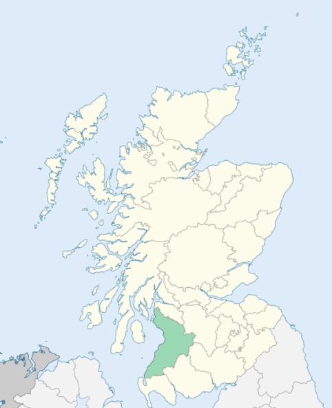
Craigie is a parish in the district of Kyle, Ayrshire. It is bounded by Dundonald, Riccarton, Galston, Mauchline, Tarbolton, Monkton, and Symington. (1867: The Imperial Gazetteer of Scotland, by John Marius Wilson).
Craigie
Cairn Hill
PRE-REFORMATION GOVERNANCE:
POST-REFORMATION GOVERNANCE:
Craigie. The vicarage of Craigie belonged to the Abbey of Paisley. In 1673 part of the parish of Barnweil was annexed to Craigie. The church was rebuilt in 1776.
Barnweil. The church of Barnweil belonged to the ministry of Fail within the parish. Of this religious house, founded in 1252, there are now but very scanty remains. It was the chief Scottish convent of the Order of the Red Friars, or Friars of the Holy Trinity. The parish was suppressed by the Commissioners of Teinds, 9 July 1673, and annexed to the parishes of Tarbolton and Craigie.
Includes ministers, licentiates, assistants, readers, and clerks.
Craigie (QO)
Barnweil (QO)
(1928: Fasti Ecclesiæ Scoticanæ, by Hew Scott, D. D.)
Parish registers turned over to the Registrar-General, as a result of the Registration of Births, Deaths, and Marriages (Scotland) Act of 1854. The letters B. D. and M. indicate Births (or Baptisms), Deaths (or Burials), and Marriages (or Proclamations of Banns) respectively. Numbers indicate separate volumes or books. Note: These records are by no means complete or without damage; consult the Detailed List of the Old Parochial Registers of Scotland (1872) to learn more about the condition of the records.
| OPR and RD Numbers | |||
|---|---|---|---|
| Date Range | Name | Number | Type |
| 1679-1854 | Craigie | 584 | OPR |
| 1855-1878 | Craigie | 584 | RD |
| 1879-1962 | Craigie | 584a | RD |
| 1879-1968 | Crosshill | 584b | RD |
| 2009 | (Craigie) East Ayrshire | 666 | RD |
| 2009 | (Crosshill) South Ayrshire | 683 | RD |
| 2026 | (Craigie) South Ayrshire Council; Craigie Village Community Council | ||
| 2026 | (Crosshill) South Ayrshire Council; Crosshill, Straiton and Kirkmichael Community Council | ||
(2009: Parishes and Registration Districts of Scotland - Old and New, National Records of Scotland)
Local community councils (2026) are provided as a potential source of additional information for settlements within the original boundaries of the parish. (Source)
Statistics from informal and official censuses
Allan, Brown, Calderwood, Drummond, Hopkin, Hunter, Morrison, Smith, Taylor, Wilson
Note: Names appearing in research materials, other than censuses. Simple names (First name, surname only) have been omitted unless they appear associated with large properties. All women's names, and men's names with occupations, military ranks, or peerage titles are included.
By the Reverend Mr Andrew Shaw.
"At present, the number of parishioners, young and old, are not under 700, 156 of whom are under 10 years of age. They are mostly farmers, some are lime quarriers, some day-labourers, and there are a few of those tradesmen, who are essentially necessary in every country parish.
The people are regular, peaceable, and industrious; anxious, in their several occupations, to provide for themselves and their families; and what they acquire by active labour, they enjoy with moderation. Few of them may be called rich, though almost all of them are far removed from poverty. When circumstances occur, that call forth their humanity, they are charitable. They enjoy, in a reasonable degree, the benefits and comforts of society, and are, in general, contented with their circumstances and situation in life."
(This section contains excerpts, at times restructured or paraphrased, from an article appearing in Statistical Account of Scotland, Sir John Sinclair, 1791-1799)
Primary Sources:
Statistical Account of Scotland (1791-1799), Volume 5, p. 369
New Statistical Account of Scotland (1834-1845), Volume 5, Section I, p. 764
See Parish Page Sources for all source information and links.