I awaken with a song running through my head: Frank Sinatra's "Fairytales Can Come True" (it can happen to you, if you're young at heart.) A warm comforting glow lights the room. I stretch like a cat napping in the sun then come suddenly and completely awake. The mental music stops. Today I am going to Fountains Abbey.
Until April 1999 I had been unaware that there was a river in Yorkshire named for me. Okay, it wasn't named for me but it does bear the same name as my online moniker – Skell – and the ruins of Fountains Abbey, a 13th century Cistercian abbey, lay upon the banks. But first, there is Castle Howard to visit.
Our itinerary is comprised of two lists: the "must see" list and the "if we have time list" (which we later change to the "if we don't get lost" list.) Dana and I both have our own personal "must sees" and Castle Howard is at the top of Dana's. I really have no interest at all in seeing Castle Howard. Ruins of abbeys and priories, raided by the Scots in England and ravaged by the English in Scotland during the Scottish War of Independence, make up the bulk of my list.
Weekly online planning chats confirmed that neither Dana or I were opposed to going with the flow on days that we visited sites on the others' list; we were both just thrilled that we had made this trip happen. But as I lie in bed admiring the shafts of sunlight slanting through the window, visions of Fountains and the Skell tease me and I think of Castle Howard as just something to get through until I am rewarded with my river.
I take a peek at the clock and am surprised to see it's only 5:00AM. Breakfast won't be served for another three hours, so I make a pot of tea, scribble in my journal (from which I decipher this, and not easily, now) and organize my belongings for the remainder of my stay at Feversham. Two hours later I hear movement outside my door and find Dana just leaving her room.
We go downstairs and outside to smoke the day's first cigarettes (cough), admiring the urns and troughs filled with bright colorful flowers just outside the entryway. Finally it is time for breakfast – my first "full-cooked" English breakfast. Plates of eggs, sausages, bacon (which is like our Canadian bacon), potatoes, grilled mushrooms and tomatoes, toast, coffee and juice cover the table. On a side table are cereals, fruits and yogurts. We thoroughly enjoy our meal, and soon after, in a state of bliss, I climb back up the three flights of stairs to collect my camera and bag for our day out.
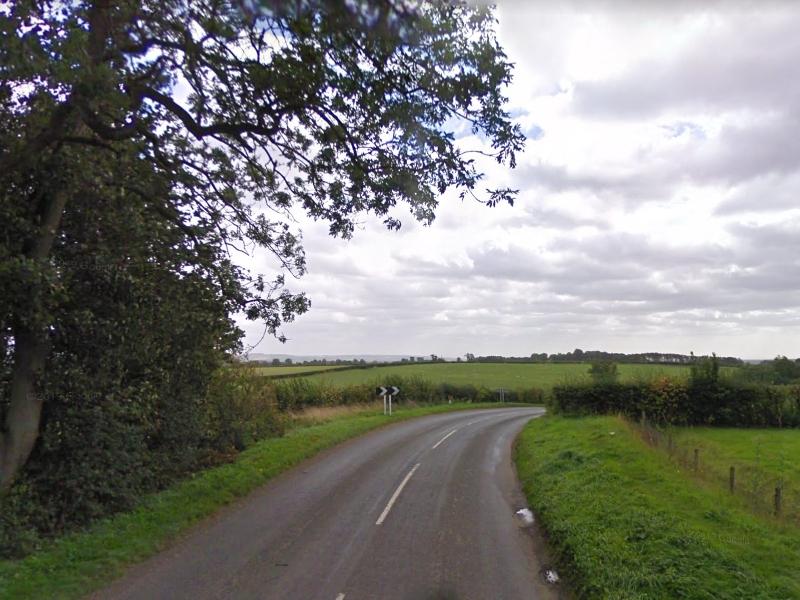
It rains off and on (mostly off) as we wind our way through picturesque Yorkshire countryside and villages. Robin has a great road atlas to ease our way. We quickly dub the roads according to the legend in the atlas: The motorways (the M roads) are now the blue roads, the A roads become the red roads, the B roads are yellow – and then there are the "clear roads," roads with, apparently, no name or number and no color on the map.
Over time we come to establish a love-hate relationship with the clear roads. We make some of our most amazing discoveries while traveling them, but they often turn into single track lanes full of Rover-wielding residents, who seem to know instinctively that we are tourists – probably because we aren't driving 90 mph.

Map of the day's travel in North Yorkshire. Marked sites include Castle Howard, Byland Abbey, Fountains Abbey, Pateley Bridge, and York. All map data and images © 2019, Google.
View full size map.
North Yorkshire is a non-metropolitan county (or shire county) and largest ceremonial county in England. Within the county are the North York Moors and most of the Yorkshire Dales, two of eleven areas of countryside within England and Wales to be officially designated as national parks.
Between the North York Moors in the east and the Pennine Hills in the west lie the Vales of Mowbray and York. The Tees Lowlands lie to the north of the North York Moors and the Vale of Pickering lies to the south. Its eastern border is the North sea coast.
The highest point is Whernside, on the Cumbrian border, at 2,415 ft. The two major rivers in the county are the River Swale and the River Ure. The Swale and the Ure form the River Ouse which flows through York and into the Humber Estuary. The River Tees forms part of the border between North Yorkshire and County Durham and flows from upper Teesdale through Middlesbrough and Stockton and to the coast.
Read more about North Yorkshire at Wikipedia.