Malkariston, Makerston
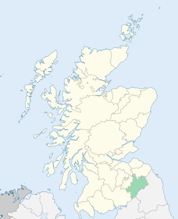
Makerston is a parish on the northern border of Roxburghshire. It is bounded by Berwickshire, and by Smailholm, Kelso, Roxburgh, and Maxton. (1867: The Imperial Gazetteer of Scotland, by John Marius Wilson).
Makerston, Manorhill
PRE-REFORMATION GOVERNANCE:
POST-REFORMATION GOVERNANCE:
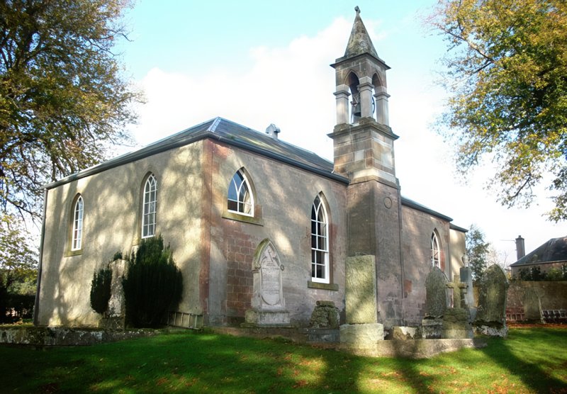
A church existed here in the middle of the twelfth century, when Walter Corbet, who then possessed the barony, gave to the monks of Kelso "the church of Malkariston with the tithes thereof." The present building dates from 1807.
Includes ministers, licentiates, assistants, readers, and clerks.
(1928: Fasti Ecclesiæ Scoticanæ, by Hew Scott, D. D.)
Parish registers turned over to the Registrar-General, as a result of the Registration of Births, Deaths, and Marriages (Scotland) Act of 1854. The letters B. D. and M. indicate Births (or Baptisms), Deaths (or Burials), and Marriages (or Proclamations of Banns) respectively. Numbers indicate separate volumes or books. Note: These records are by no means complete or without damage; consult the Detailed List of the Old Parochial Registers of Scotland (1872) to learn more about the condition of the records.
| OPR and RD Numbers | |||
|---|---|---|---|
| Date Range | Name | Number | Type |
| 1692-1854 | Makerstoun | 797 | OPR |
| 1855-1967 | Makerstoun | 797 | RD |
| 2009 | Scottish Borders, Kelso | 821 | RD |
| 2026 | Scottish Borders Council; Floors, Makerstoun, Nenthorn and Smailholm Community Council | ||
(2009: Parishes and Registration Districts of Scotland - Old and New, National Records of Scotland)
Local community councils (2026) are provided as a potential source of additional information for settlements within the original boundaries of the parish. (Source)
Statistics from informal and official censuses
Goodfellow, Henderson, Inglis, Luke, Mack, Oliver, Renwick, Todd, Turnbull, White
Note: Names appearing in research materials, other than censuses. Simple names (First name, surname only) have been omitted unless they appear associated with large properties. All women's names, and men's names with occupations, military ranks, or peerage titles are included.
By the Reverend Mr James Richardson.
"About 50 years ago, there were 16 small farmers in the village of Makerston, where now there is not one. It contains only 12 old cottages. There were formerly 24 farmers in this parish, with their families and servants, where we can now reckon only 9. I presume, that the number of inhabitants must then have exceeded 1000, where I can hardly find above one fourth of that number, viz. 250 or 255. Of these there is nearly an equal number of males and females, of whom about 60 are under 10 years of age."
(This section contains excerpts, at times restructured or paraphrased, from an article appearing in Statistical Account of Scotland, Sir John Sinclair, 1791-1799)
Primary Sources:
Statistical Account of Scotland (1791-1799), Volume 3, p. 262
New Statistical Account of Scotland (1834-1845), Volume 3, Section I, p. 137
See Parish Page Sources for all source information and links.