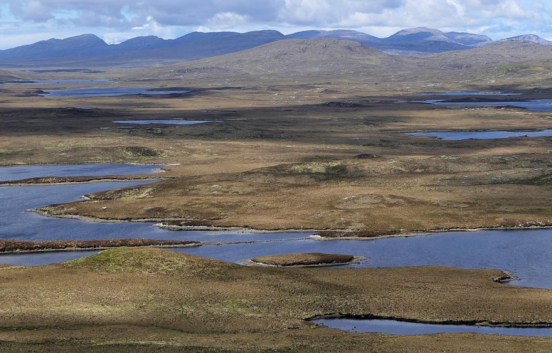
Lochan
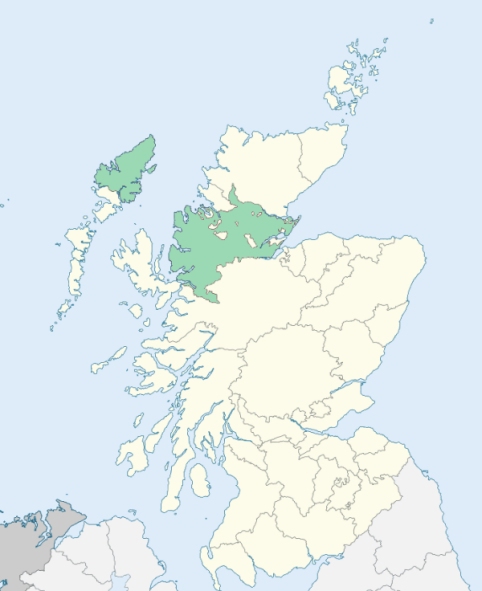
Lochs is a parish in the south-east of Lewis, Ross-shire. It comprehends a district of the mainland of Lewis, and a number of islets, the chief of which are the Shiant Isles. The mainland district is bounded by Harris, Uig, Stornoway, and the Minch. (1867: The Imperial Gazetteer of Scotland, by John Marius Wilson).
Balallan, Crossbost, Garrabost, Gruver, Knock, Leurbost, North Shawbost or North Seabost, South Shawbost or South Seabost
The parish of Lochs had a detached part situated at Carloway, and lying between the parishes of Barvas and Uig. This detached part has been divided between the parishes of Barvas and Uig. See affected properties and landholders. (1892: Boundary of counties and parishes in Scotland as settled by the Boundary Commissioners under the Local Government Act, 1889, by Hay Shennan)
PRE-REFORMATION GOVERNANCE:
POST-REFORMATION GOVERNANCE:
The church of Lochs was dedicated to St Columba. In the sixteenth century the parishes of Stornoway, Gress, Ey, Lochs, and Uig were all united in one charge. On 19 December 1722 the Lords Commissioners of Teinds disjoined the parish of Lochs from Stornoway, Gress, and Ey. On Eilean Chaluimchille, an island in Loch Erisort, there was a chapel of St Columba.
Disjoined Quoad Sacra Parishes:
Knock, previously Kilcholuimcill. The church of Ey, now roofless, was dedicated to St Columba. About the year 1828 a parliamentary church for the district of Ey was built at Knock. On 27 May 1857 this ancient parish was disjoined quoad sacra from Stornoway, Lochs, and Gress. The name of Knock was given it from the site of its modern church. At Garrabost, within the bounds, there was a chapel of St Constantine, and beside it lay St Constantine's Well.
Includes ministers, licentiates, assistants, readers, and clerks.
Lochs (QO)
Knock, or Kilcholuimcill (QS)
(1928: Fasti Ecclesiæ Scoticanæ, by Hew Scott, D. D.)
Parish registers turned over to the Registrar-General, as a result of the Registration of Births, Deaths, and Marriages (Scotland) Act of 1854. The letters B. D. and M. indicate Births (or Baptisms), Deaths (or Burials), and Marriages (or Proclamations of Banns) respectively. Numbers indicate separate volumes or books. Note: These records are by no means complete or without damage; consult the Detailed List of the Old Parochial Registers of Scotland (1872) to learn more about the condition of the records.
| OPR and RD Numbers | |||
|---|---|---|---|
| Date Range | Name | Number | Type |
| 1831-1854 | Lochs | 87 | OPR |
| 1855-1953 | Lochs | 87 | RD |
| 1954-1967 | Lochs, North | 87-1 | RD |
| 1954-1971 | Lochs, South | 87-2 | RD |
| 1968-1971 | Stornoway and North Lochs | 88 | RD |
| 1972-2002 | Lochs, South | 224 | RD |
| 2009 | Comhairle Nan Eilean Siar, Stornoway | 221 | RD |
| 2026 | (North Lochs) Comhairle Nan Eilean Siar; North Lochs Community Council | ||
| 2026 | (South Lochs) Comhairle Nan Eilean Siar; Pairc Community Council | ||
(2009: Parishes and Registration Districts of Scotland - Old and New, National Records of Scotland)
Local community councils (2026) are provided as a potential source of additional information for settlements within the original boundaries of the parish. (Source)
Statistics from informal and official censuses
MacAulay, MacDonald, MacIver, MacKay, Mackenzie, MacLean, MacLeod, MacPhail, Morrison, Smith
Note: Names appearing in research materials, other than censuses. Simple names (First name, surname only) have been omitted unless they appear associated with large properties. All women's names, and men's names with occupations, military ranks, or peerage titles are included.
By the Reverend Mr Alexander Simson.
"The whole amount of the population in this parish is 1768 persons, of which number, 845 are males, and 923 females. Instances of longevity occur often; a woman died a few days ago aged 104. The number of families is 366. Most of the inhabitants are fishers and net-makers. There are 38 kelp-makers, 16 weavers of coarse cloth, 2 boat-carpenters, 3 tailors, and a blacksmith in the parish. Every individual here is of the Established Church. There are 70 fishing-boats belonging to the parish. The people from their youth are accustomed to a sea-faring life; they are of humane dispositions, and shew great hospitality to strangers. There is no doubt that the condition of the inhabitants of this poor parish might be greatly meliorated by the introduction of manufactures."
(This section contains excerpts, at times restructured or paraphrased, from an article appearing in Statistical Account of Scotland, Sir John Sinclair, 1791-1799)
Primary Sources:
Statistical Account of Scotland (1791-1799), Volume 19, p. 274
New Statistical Account of Scotland (1834-1845), Volume 14, Section II, p. 157
See Parish Page Sources for all source information and links.