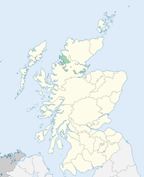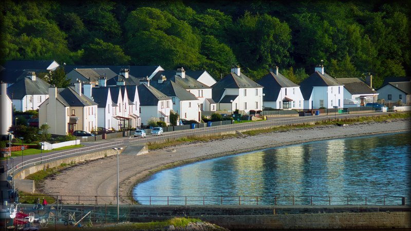
Cromarty is a parish in the north-east of the county of Cromartyshire. It is bounded by the Cromarty Firth on the north, the Moray Firth on the east, and the parishes of Rosemarkie and Resolis on the south and west. (1867: The Imperial Gazetteer of Scotland, by John Marius Wilson).
Cromarty, Jamima or Jemimaville
PRE-REFORMATION GOVERNANCE:
POST-REFORMATION GOVERNANCE:
The old church of Cromarty was dedicated to St Benet. Its site has been overflowed, and is now covered by the sea. A convent of the Red Friars was founded at Cromarty by Sir Patrick Murray in 1271. There were in this parish chapels of St Duthac, St Rule, and St Michael. Cromarty had also Wells of Our Lady, St Benet, and St Duthac. The Gaelic chapel in the town was built by George Ross of Cromarty in 1783.
Includes ministers, licentiates, assistants, readers, and clerks.
Cromarty (QO)
Gaelic Chapel (QO)
(1928: Fasti Ecclesiæ Scoticanæ, by Hew Scott, D. D.)
Parish registers turned over to the Registrar-General, as a result of the Registration of Births, Deaths, and Marriages (Scotland) Act of 1854. The letters B. D. and M. indicate Births (or Baptisms), Deaths (or Burials), and Marriages (or Proclamations of Banns) respectively. Numbers indicate separate volumes or books. Note: These records are by no means complete or without damage; consult the Detailed List of the Old Parochial Registers of Scotland (1872) to learn more about the condition of the records.
| OPR and RD Numbers | |||
|---|---|---|---|
| Date Range | Name | Number | Type |
| 1675-1854 | Cromarty | 61 | OPR |
| 1855-1855 | Cromarty Burgh | 61-1 | RD |
| 1855-1855 | Cromarty Landward | 61-2 | RD |
| 1856-1967 | Cromarty | 61 | RD |
| 1968-1971 | Black Isle, North | 61 | RD |
| 1972-2001 | Black Isle, North | 201 | RD |
| 2002-2006 | Black Isle, Highland | 200 | RD |
| 2009 | Highland, Black Isle | 200 | RD |
| 2026 | Highland Council; Cromarty and District Community Council | ||
(2009: Parishes and Registration Districts of Scotland - Old and New, National Records of Scotland)
Local community councils (2026) are provided as a potential source of additional information for settlements within the original boundaries of the parish. (Source)
Statistics from informal and official censuses
Finlayson, Fraser, Hogg, Hossack, Mackenzie, MacLeman, Munro, Ross, Skinner, Watson
Note: Names appearing in research materials, other than censuses. Simple names (First name, surname only) have been omitted unless they appear associated with large properties. All women's names, and men's names with occupations, military ranks, or peerage titles are included.
By the Reverend Mr Robert Smith.
"The present incumbent finished a survey of the population of the parish on the 1st day of April 1790, since which time no alteration as to number has taken place. The number of souls in the country party of the parish, amount to 727, and in the town, to 1457, making in all 2184. There was a list of the inhabitants in the country, taken by the former incumbent in the year 1785, from which it appears, that there is a decrease of about 40 since that period; this, probably has been occasioned by several small farms being joined into larger, though, upon the whole, no great change, of this nature, has taken place in this parish; another cause, is the emigration of labourers to the south country, some of whom do not again return. The inhabitants of the town have, without doubt, increased considerably within these last 18 years, which has been occasioned by the extensive manufacture of hemp, erected here by the late Mr. George Ross. The number of males in the parish amounts to 1020, the number of females to 1163."
(This section contains excerpts, at times restructured or paraphrased, from an article appearing in Statistical Account of Scotland, Sir John Sinclair, 1791-1799)
Primary Sources:
Statistical Account of Scotland (1791-1799), Volume 12, p. 245
New Statistical Account of Scotland (1834-1845), Volume 14, Section II, p. 1
See Parish Page Sources for all source information and links.