Troquire, Troqueer and Kirkconnel
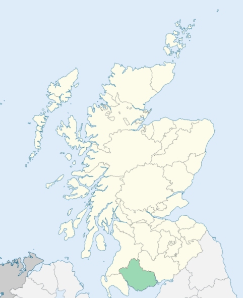
Troqueer is a parish on the east border of Kirkcudbrightshire. It is bounded on the north by Terregles, on the east by the River Nith, which divides it from Dumfriesshire, on the south and south-west by New Abbey, and on the west by Lochrutton. (1867: The Imperial Gazetteer of Scotland, by John Marius Wilson).
Cargen Bridge, Carruchan, Dalscairth, Goldielea, Maxwelltown or Bridgend, Newabbey
Carruchan, Dalskaith, Goldielea, Mabie, Ryedale
PRE-REFORMATION GOVERNANCE:
POST-REFORMATION GOVERNANCE:
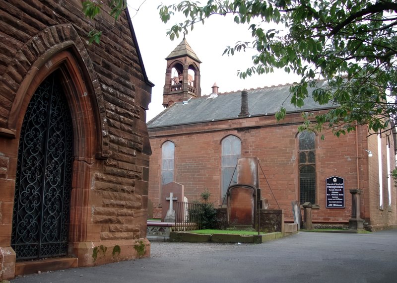
Troqueer. The church was dedicated to Curadan. In early times it belonged to the Abbey of Tongland. Later it was in the possession of the Priory of Whitern (Whithorn), and from 1574 to 1608 it was held, along with the rectory of Dumfries, by the bishops of Galloway. St Querdan's Well is in the parish.
Kirkconnel. The church of Kirkconnel was dedicated to St Conal. It belonged to the Abbey of Holyrood.
Disjoined Quoad Sacra Parishes:
Maxwelltown. A church was built here in 1829. On 28 September 1842 it was destroyed by fire, and a new church was erected in 1843. The parish was disjoined from Troqueer, 17 July 1871.
Includes ministers, licentiates, assistants, readers, and clerks.
Troqueer and Kirkconnel (QO)
Maxwelltown (QS)
(1928: Fasti Ecclesiæ Scoticanæ, by Hew Scott, D. D.)
Parish registers turned over to the Registrar-General, as a result of the Registration of Births, Deaths, and Marriages (Scotland) Act of 1854. The letters B. D. and M. indicate Births (or Baptisms), Deaths (or Burials), and Marriages (or Proclamations of Banns) respectively. Numbers indicate separate volumes or books. Note: These records are by no means complete or without damage; consult the Detailed List of the Old Parochial Registers of Scotland (1872) to learn more about the condition of the records.
| OPR and RD Numbers | |||
|---|---|---|---|
| Date Range | Name | Number | Type |
| 1690-1854 | Troqueer | 882 | OPR |
| 1855-1971 | Troqueer | 882 | RD |
| 1972-1976 | Troqueer | 860 | RD |
| 2009 | Dumfries and Galloway, Dumfries | 834 | RD |
| 2026 | Dumfries and Galloway Council; Loreburn Community Council Corbery and Laurieknowe Community Council | ||
(2009: Parishes and Registration Districts of Scotland - Old and New, National Records of Scotland)
Local community councils (2026) are provided as a potential source of additional information for settlements within the original boundaries of the parish. (Source)
Statistics from informal and official censuses
Anderson, Bell, Brown, Grierson, Johnstone, Kerr, Maxwell, Scott, Smith, Thomson
Note: Names appearing in research materials, other than censuses. Simple names (First name, surname only) have been omitted unless they appear associated with large properties. All women's names, and men's names with occupations, military ranks, or peerage titles are included.
By the Reverend Mr John Ewart.
"The inhabitants of Bridgend, of all ages, are 1302. The inhabitants of other parts of the parish are 1298. Total inhabitants of all ages and denominations, 2600. Of the above number of inhabitants there are 200 Papists, including the children of Papists. About a fourth part of that number is an influx of Irish Papists, who within these few years have settled in Troquire. There are some Seceders, Relief people, and M'Millanites, who have places of worship in Dumfries.
Mechanics in the village of Bridgend: 84 shoemakers, 4 smiths, 3 coopers, 6 clogmakers, 3 bakers, 26 tailors, 20 weavers, 11 wrights and carpenters, 3 masons, 4 sawyers of wood, 5 bricklayers, 2 maltsters, 3 ropemakers, 8 butchers, 1 barber, 2 brewers, and 1 bleacher.
Mechanics in other parts of the parish: 7 smiths, 13 weavers, 9 shoemakers, 3 tailors, and 5 wrights. Total mechanics in Troquire, 233.
The village of Bridgend contains many beggars. One female has been executed for child murder. Two persons have been banished. Only one has been guilty of suicide in the course of 47 years. A few young men go to sea: Several enlist in the army. The mode of living and dress is much improved."
(This section contains excerpts, at times restructured or paraphrased, from an article appearing in Statistical Account of Scotland, Sir John Sinclair, 1791-1799)
Primary Sources:
Statistical Account of Scotland (1791-1799), Volume 1, p. 194
New Statistical Account of Scotland (1834-1845), Volume 4, Section II, p. 223
See Parish Page Sources for all source information and links.