Avonwaith
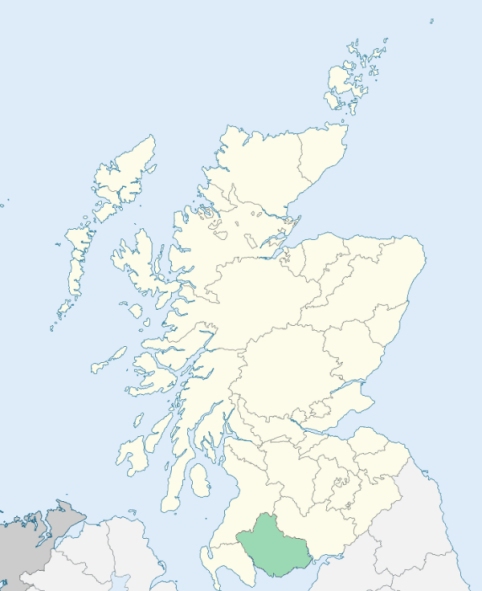
Anwoth is a parish on the coast of Kirkcudbrightshire. It comprises the peninsula between Wigtown Bay and Fleet Bay, and has its extreme length then to the north. (1867: The Imperial Gazetteer of Scotland, by John Marius Wilson).
Anwoth, Gatehouse
Cardoness
PRE-REFORMATION GOVERNANCE:
POST-REFORMATION GOVERNANCE:
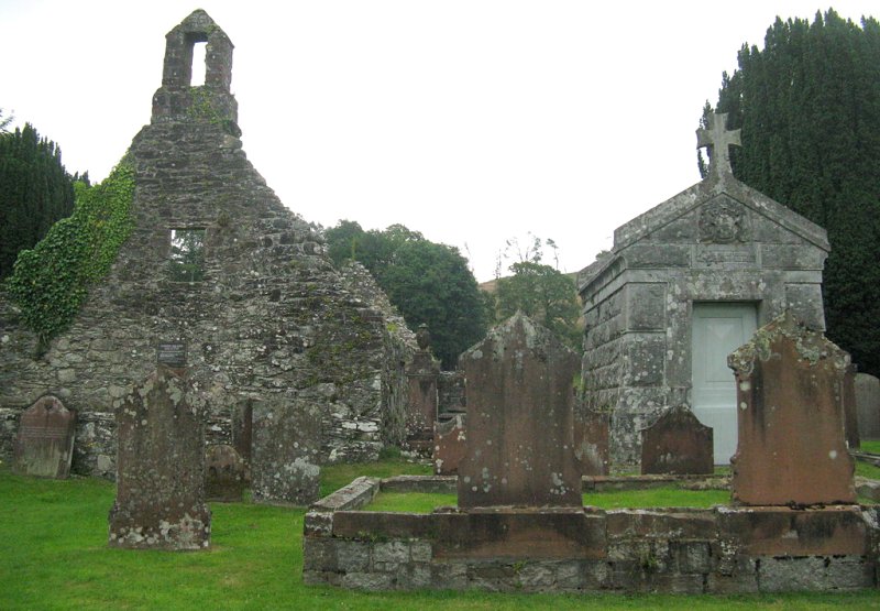
At the time of the Reformation the church of this parish was in the possession of the Priory of St Mary's Isle. At an earlier time it had belonged to the Abbey of Holyrood. There were in the parish two chapels: St Bride's, at Kirkbride, near the Skyre Burn; and another at Culeness. The parish church was rebuilt in 1626. That building is now roofless, but otherwise in very good condition. A new church close to it was erected in 1828.
Includes ministers, licentiates, assistants, readers, and clerks.
(1928: Fasti Ecclesiæ Scoticanæ, by Hew Scott, D. D.)
Parish registers turned over to the Registrar-General, as a result of the Registration of Births, Deaths, and Marriages (Scotland) Act of 1854. The letters B. D. and M. indicate Births (or Baptisms), Deaths (or Burials), and Marriages (or Proclamations of Banns) respectively. Numbers indicate separate volumes or books. Note: These records are by no means complete or without damage; consult the Detailed List of the Old Parochial Registers of Scotland (1872) to learn more about the condition of the records.
| OPR and RD Numbers | |||
|---|---|---|---|
| Date Range | Name | Number | Type |
| 1727-1854 | Anwoth | 855 | OPR |
| 1855-1937 | Anwoth | 855 | RD |
| 1938-1971 | Girthon and Anwoth | 866 | RD |
| 1972-2004 | Girthon and Anwoth | 857 | RD |
| 2006-2009 | Dumfries and Galloway, Girthon and Anwoth | 857 | RD |
| 2026 | Dumfries and Galloway Council; Gatehouse of Fleet Community Council | ||
(2009: Parishes and Registration Districts of Scotland - Old and New, National Records of Scotland)
Local community councils (2026) are provided as a potential source of additional information for settlements within the original boundaries of the parish. (Source)
Statistics from informal and official censuses
Davidson, Gordon, Hamilton, Hannah, Hume, Johnstone, Maxwell, Robertson, Stewart, Wilson
Note: Names appearing in research materials, other than censuses. Simple names (First name, surname only) have been omitted unless they appear associated with large properties. All women's names, and men's names with occupations, military ranks, or peerage titles are included.
By the Reverend Mr Hugh Gordon.
"Last year (1792) an exact enumeration of the inhabitants, of all ages, was made, when they amounted to 495; 270 of whom were males, and 225 females. About 450 inhabitants live in the country part of the parish, and the rest in a village, which is in its infant state. All the inhabitants are of the Established Church.
The inhabitants in the village are mostly employed in manufacturing cotton, which a few months ago was carried on with spirit and success, but like many other branches of trade, it is now almost given up. By far the greater number of the inhabitants are tenants or cottagers. There are 6 weavers, 4 tailors, 2 shoemakers, 5 wrights, 6 masons, 3 smiths, and 2 millers.
In every parish in which no town is situated, and where few people of fortune reside, the inhabitants must be nearly similar in manners to their neighbours. I shall only observe, that they are in general sober and industrious, and, with several exceptions, enjoy in a moderate degree the comforts and conveniences of life."
(This section contains excerpts, at times restructured or paraphrased, from an article appearing in Statistical Account of Scotland, Sir John Sinclair, 1791-1799)
Primary Sources:
Statistical Account of Scotland (1791-1799), Volume 13, p. 343
New Statistical Account of Scotland (1834-1845), Volume 4, Section II, p. 373
See Parish Page Sources for all source information and links.