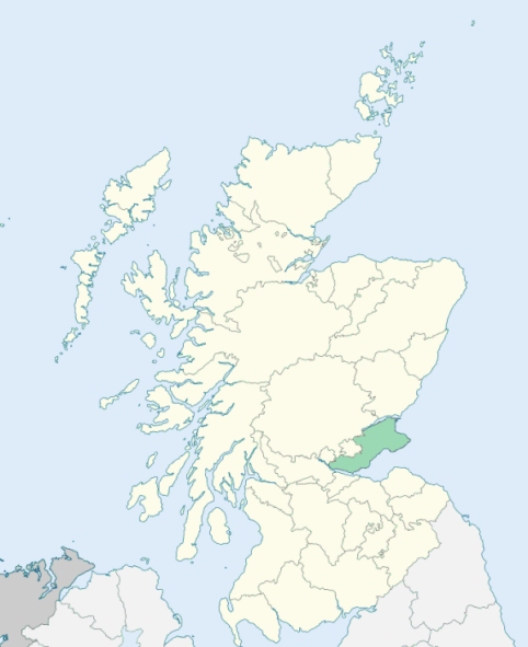
Saline is a parish on the west border of Fife. It is bounded by the counties of Clackmannan, Perth, and Kinross, and by the parishes of Dunfermline and Carnock. (1867: The Imperial Gazetteer of Scotland, by John Marius Wilson).
Blairsgreen, Bonnington, Broomhill, Cadgerford, Devonside, Killernie, Langfauld, Lynellen, Midfield, Piperpool, Rhynd, Saline, Sheardrum, Steelend, Sunnyside, West Balgonar
Balgonar, Bandrum, Hillside, Kinedder
The parish of Saline had a detached part adjoining the parish of Torryburn, and the parish of Torryburn had a detached part lying to the north of the parish of Saline. These parishes were made to exchange their detached parts. See affected properties and landholders. (1892: Boundary of counties and parishes in Scotland as settled by the Boundary Commissioners under the Local Government Act, 1889, by Hay Shennan)
PRE-REFORMATION GOVERNANCE:
POST-REFORMATION GOVERNANCE:
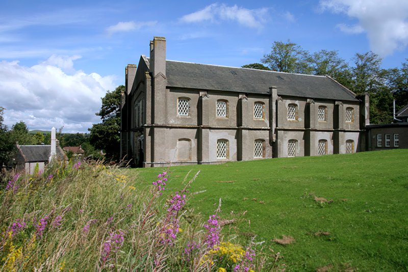
Previous to the Reformation the church was "ane common Kirk of Dunkeld." In 1890 a considerable part of the area of the parish of Saline was added to Torryburn. In return, the lands of Bonnington, Cultmill, Cults, Hallcroft, Hallburn, Hillend, Hillside, Meadowland, Pow, and Wellwood were taken from Torryburn and annexed to Saline. The present church was built in 1810. (1928: Fasti Ecclesiæ Scoticanæ, by Hew Scott, D. D.)
Includes ministers, licentiates, assistants, readers, and clerks.
(1928: Fasti Ecclesiæ Scoticanæ, by Hew Scott, D. D.)
Parish registers turned over to the Registrar-General, as a result of the Registration of Births, Deaths, and Marriages (Scotland) Act of 1854. The letters B. D. and M. indicate Births (or Baptisms), Deaths (or Burials), and Marriages (or Proclamations of Banns) respectively. Numbers indicate separate volumes or books. Note: These records are by no means complete or without damage; consult the Detailed List of the Old Parochial Registers of Scotland (1872) to learn more about the condition of the records.
| OPR and RD Numbers | |||
|---|---|---|---|
| Date Range | Name | Number | Type |
| 1746-1854 | Saline | 455 | OPR |
| 1855-1971 | Saline | 455 | RD |
| 1972-1975 | Saline | 431 | RD |
| 2009 | Fife, Dunfermline | 432 | RD |
| 2026 | Fife Council; Saline and Steelend Community Council | ||
(2009: Parishes and Registration Districts of Scotland - Old and New, National Records of Scotland)
Local community councils (2026) are provided as a potential source of additional information for settlements within the original boundaries of the parish. (Source)
Statistics from informal and official censuses
Anderson, Edward, Harley, Hunter, Mercer, Morgan, Stobie, Taylor, Wardlaw, Wilson
Note: Names appearing in research materials, other than censuses. Simple names (First name, surname only) have been omitted unless they appear associated with large properties. All women's names, and men's names with occupations, military ranks, or peerage titles are included.
By the Reverend Mr William Forfar.
"The number of inhabitants in whole, including the sectaries, who do not exceed 20 or 30 persons, is 950. Some farms are wholly let for grass, which, in the hilly parts of the parish, are found to raise much better rents than tillage. There are only 2 farmers who keep sheep. There are no manufactories. There are 3 wrights, 4 tailors, 3 shoemakers, 3 smiths, 11 weavers, 8 masons, 1 brewer, and 1 maltster. There are three corn-mills, and one fulling-mill.
The people, a few excepted, are sober, industrious, sensible, discreet, and peaceable, of as little superstition and as much religion as their neighbours. They have been long distinguished for their regular and decent attendance on public worship, and have not yet forfeited the praise which is due on them on this account."
(This section contains excerpts, at times restructured or paraphrased, from an article appearing in Statistical Account of Scotland, Sir John Sinclair, 1791-1799)
Primary Sources:
Statistical Account of Scotland (1791-1799), Volume 10, p. 307
New Statistical Account of Scotland (1834-1845), Volume 9, Section I, p. 798
See Parish Page Sources for all source information and links.