Dumbarton, Alcluid, Alcluyth
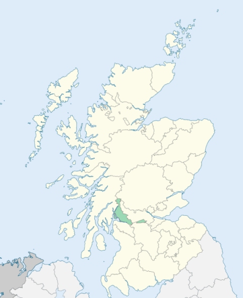
Dunbarton is a parish in Dunbartonshire. It is bounded over a brief distance on the south-west by the Firth of Clyde, over 2½ miles on the north-east by Stirlingshire, and everywhere else by the parishes of Cardross, Bonhill, and West Kilpatrick. (1867: The Imperial Gazetteer of Scotland, by John Marius Wilson).
Bellsmyre, Dumbarton, Silverton, Townend
PRE-REFORMATION GOVERNANCE:
POST-REFORMATION GOVERNANCE:
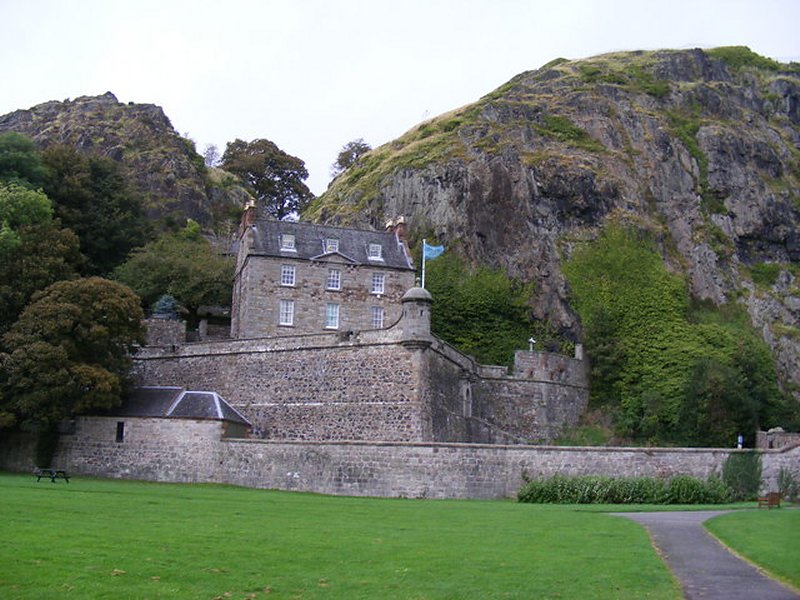
The church of Dunbarton was dedicated to St Patrick, and belonged to the Abbey of Kilwinning. It had a chapel of St James and an altar of St Ninian. About the year 1450, the Collegiate Church of St Mary at Dunbarton was founded by Isobel, Countess of Lennox, widow of the Regent, Murdoch, Duke of Albany. The town contained a hospital of Bedesmen, a chapel of St Peter, and a Well of St Serf. In Dunbarton Castle was a chapel of St Patrick. At the Chapeltoun, outside the town, stood a chapel of St Mary. Dunbarton had a Lammas Fair, and two others in the year, on the festivals of St John the Baptist and St Patrick. The parish church, rebuilt in 1811, has undergone considerable renovation since.
Disjoined Quoad Sacra Parishes:
Knoxland. The parish of Knoxland was disjoined from Dunbarton, 24 May 1886.
Includes ministers, licentiates, assistants, readers, and clerks.
Dunbarton (QO)
Knoxland (QS)
(1928: Fasti Ecclesiæ Scoticanæ, by Hew Scott, D. D.)
Parish registers turned over to the Registrar-General, as a result of the Registration of Births, Deaths, and Marriages (Scotland) Act of 1854. The letters B. D. and M. indicate Births (or Baptisms), Deaths (or Burials), and Marriages (or Proclamations of Banns) respectively. Numbers indicate separate volumes or books. Note: These records are by no means complete or without damage; consult the Detailed List of the Old Parochial Registers of Scotland (1872) to learn more about the condition of the records.
| OPR and RD Numbers | |||
|---|---|---|---|
| Date Range | Name | Number | Type |
| 1642-1854 | Dumbarton | 496 | OPR |
| 1855-1855 | Dumbarton Burgh | 496-1 | RD |
| 1855-1855 | Dumbarton Landward | 496-2 | RD |
| 1856-1971 | Dumbarton | 496 | RD |
| 1972-2006 | Dumbarton | 505 | RD |
| 2007 | Dumbarton, West Dunbartonshire | 505 | RD |
| 2009 | West Dunbartonshire, Dumbarton | 505 | RD |
| 2026 | West Dunbartonshire Council; Dumbarton East and Central Community Council Dumbarton West Community Council Dumbarton North Community Council Silverton and Overtoun Community Council | ||
(2009: Parishes and Registration Districts of Scotland - Old and New, National Records of Scotland)
Local community councils (2026) are provided as a potential source of additional information for settlements within the original boundaries of the parish. (Source)
Statistics from informal and official censuses
Brown, Cameron, Campbell, Lang, Miller, Robertson, Smith, Stewart, Thomson, Wilson
Note: Names appearing in research materials, other than censuses. Simple names (First name, surname only) have been omitted unless they appear associated with large properties. All women's names, and men's names with occupations, military ranks, or peerage titles are included.
By the Reverend Mr James Oliphant.
"In 1790, the number of examinable persons above six years of age was found to amount to about 2000, of whom 1850 resided in the town of Dunbarton, and 153 in the country part of the parish. Almost the whole of the inhabitants are of the established church, there not being above half a dozen seceders in the parish.
There is in the town a considerable crown and bottle glass manufactory, which employs 130 hands. The extensive printfields in the neighbouring parishes employ about 86 inhabitants of the town of Dunbarton. There are about 130 handicraftsmen in the town of Dunbarton, freemen of the burgh, besides the masters of the tailor, hammerman, shoemaker, weaver, and cooper trades.
The people are very fond of a seafaring life; many enlist in the army, chiefly in the artillery, and in the highland regiments. The advantages of society are enjoyed; but here, as in many other places, a murmuring spirit often appears, and a disposition to censure public measures. Many of the people are expensive, especially in the article of whisky."
(This section contains excerpts, at times restructured or paraphrased, from an article appearing in Statistical Account of Scotland, Sir John Sinclair, 1791-1799)
Primary Sources:
Statistical Account of Scotland (1791-1799), Volume 4, p. 21
New Statistical Account of Scotland (1834-1845), Volume 8, Section I, p. 1
See Parish Page Sources for all source information and links.