Carlaverock
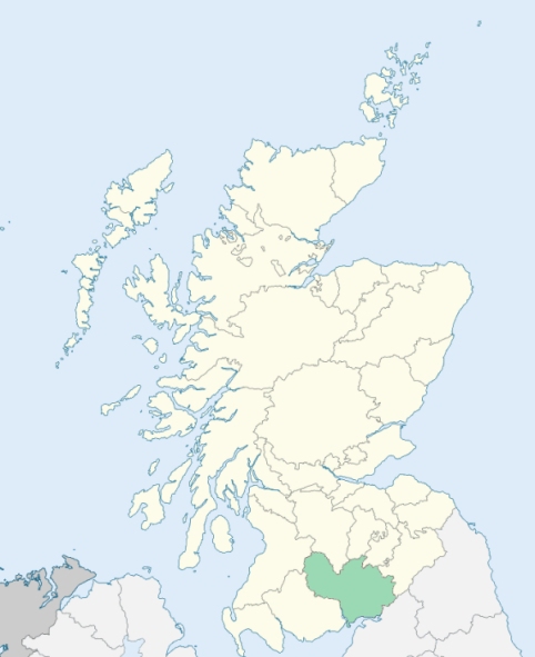
Caerlaverock is a parish on the coast of Dumfriesshire. It is bounded on the north by Dumfries parish, on the east by Lochar Water, which divides it from Ruthwell, and on the south and west by the Solway Firth and the River Nith. (1867: The Imperial Gazetteer of Scotland, by John Marius Wilson).
Bankend, Blackshaw, Glencaple, Glenhowan, Greenhead, Greenmill, Kelton, Shearington
Conheath
PRE-REFORMATION GOVERNANCE:
POST-REFORMATION GOVERNANCE:
The parish contained a chapel of St Columba. Part of the ancient parish of Kilblane has been annexed to Caerlaverock.
Includes ministers, licentiates, assistants, readers, and clerks.
(1928: Fasti Ecclesiæ Scoticanæ, by Hew Scott, D. D.)
Parish registers turned over to the Registrar-General, as a result of the Registration of Births, Deaths, and Marriages (Scotland) Act of 1854. The letters B. D. and M. indicate Births (or Baptisms), Deaths (or Burials), and Marriages (or Proclamations of Banns) respectively. Numbers indicate separate volumes or books. Note: These records are by no means complete or without damage; consult the Detailed List of the Old Parochial Registers of Scotland (1872) to learn more about the condition of the records.
| OPR and RD Numbers | |||
|---|---|---|---|
| Date Range | Name | Number | Type |
| 1749-1854 | Caerlaverock | 815 | OPR |
| 1855-1968 | Caerlaverock | 815 | RD |
| 2009 | Dumfries and Galloway, Dumfries | 834 | RD |
| 2026 | Dumfries & Galloway Council; Caerlaverock Community Council | ||
(2009: Parishes and Registration Districts of Scotland - Old and New, National Records of Scotland)
Local community councils (2026) are provided as a potential source of additional information for settlements within the original boundaries of the parish. (Source)
Statistics from informal and official censuses
Carruthers, Cowan, Crosbie, Edgar, Hunter, Jardine, Kelly, Little, Milligan, Scott
Note: Names appearing in research materials, other than censuses. Simple names (First name, surname only) have been omitted unless they appear associated with large properties. All women's names, and men's names with occupations, military ranks, or peerage titles are included.
By the Reverend Mr William M'Morine.
"In 1791 there were in the parish 955 inhabitants, of whom 454 were males, 501 were females, and 230 were under 10 years of age. There were 45 families of farmers, and 166 families of labourers and tradesmen; total 222 families. There were 3 Roman Catholics and 3 families of dissenters.
There were 25 ship carpenters and sailors, 7 house carpenters and wrights, 3 masons, 2 quarrymen, 5 smiths, 9 shoemakers, 20 weavers, and 5 tailors. Almost all the inhabitants are employed in agriculture; even a great part of the tradesmen occasionally take up that employment, particularly in harvest time.
There are four schools in the parish, at Bankened, Blackshaw, Highmains, and Keltown, at which no less than 150 boys and girls are instructed in reading, writing, and arithmetic; and at one of them a few boys are taught Latin and Greek.
The inhabitants of Caerlaverock are in general plain, honest, sober, industrious, and charitable. From their vicinity to Dumfries and the shore, they are more polished and liberal than some of their inland neighbours. The farmers, though none of them rich, are yet, in general, in comfortable circumstances. This they owe to their own frugality, skill, and industry; but, in some measure, also to the advantages of being near a considerable market town; the vicinity of two seaports; and the circumstances of their bordering upon Lochar moss, which supplies them with abundance of fuel.
The farmers of this parish, and indeed, generally speaking, almost all its inhabitants, are natives of it. Excepting two Irish families, also, they are all of Scotch extraction. Here the fathers, for some generations back, have possessed the same farms which their children now cultivate."
(This section contains excerpts, at times restructured or paraphrased, from an article appearing in Statistical Account of Scotland, Sir John Sinclair, 1791-1799)
Primary Sources:
Statistical Account of Scotland (1791-1799), Volume 6, p. 21
New Statistical Account of Scotland (1834-1845), Volume 4, Section I, p. 349
See Parish Page Sources for all source information and links.