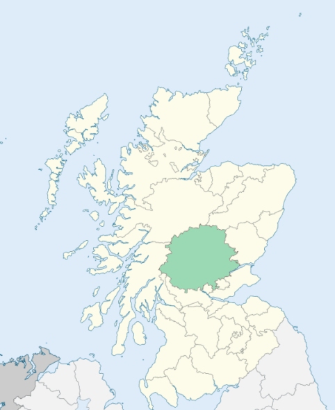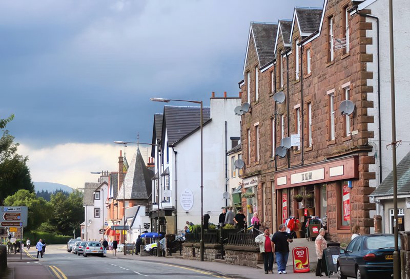
Aberfoyle is a parish in the south-west corner of Perthshire. It is bounded on the north by Lock Catrine and Loch Achray, which separate it from Callander parish, on the east by the parish of Port-of-Menteith, and on the south and west by Stirlingshire. (1867: The Imperial Gazetteer of Scotland, by John Marius Wilson).
Aberfoyle, Drumlean, Kinlochard
PRE-REFORMATION GOVERNANCE:
POST-REFORMATION GOVERNANCE:
The church of Aberfoyle belonged to the Abbey of Inchmahome. There is now in this parish a mission chapel at Kinlochard.
Disjoined Quoad Sacra Parishes:
Trossachs. The parish of Trossachs was disjoined from Callander, Aberfoyle, and Port of Menteith, and erected 6 June 1866.
Includes ministers, licentiates, assistants, readers, and clerks.
Aberfoyle (QO)
Trossachs (QS)
(1928: Fasti Ecclesiæ Scoticanæ, by Hew Scott, D. D.)
Parish registers turned over to the Registrar-General, as a result of the Registration of Births, Deaths, and Marriages (Scotland) Act of 1854. The letters B. D. and M. indicate Births (or Baptisms), Deaths (or Burials), and Marriages (or Proclamations of Banns) respectively. Numbers indicate separate volumes or books. Note: These records are by no means complete or without damage; consult the Detailed List of the Old Parochial Registers of Scotland (1872) to learn more about the condition of the records.
| OPR and RD Numbers | |||
|---|---|---|---|
| Date Range | Name | Number | Type |
| 1692-1854 | Aberfoyle | 325 | OPR |
| 1855-1953 | Aberfoyle | 325 | RD |
| 1954-1971 | Aberfoyle and Menteith | 325 | RD |
| 1972-2003 | Aberfoyle and Menteith | 397 | RD |
| 2004-2008 | Stirling, Aberfoyle and Menteith | 397 | RD |
| 2009 | Stirling, Aberfoyle | 397 | RD |
| 2026 | Stirling Council; Strathard Community Council | ||
(2009: Parishes and Registration Districts of Scotland - Old and New, National Records of Scotland)
Local community councils (2026) are provided as a potential source of additional information for settlements within the original boundaries of the parish. (Source)
Statistics from informal and official censuses
Blair, Buchanan, Campbell, Cleland, Ferguson, Keir, Menzies, Robertson, Sinclair, Stewart
Note: Names appearing in research materials, other than censuses. Simple names (First name, surname only) have been omitted unless they appear associated with large properties. All women's names, and men's names with occupations, military ranks, or peerage titles are included.
By Patrick Graham, Assistant Minister.
"About the year 1770, almost all the upper part of this parish was converted into sheep farms, from which the nature of the soil is peculiarly adapted. Since that period, the population of this parish has been, no doubt, considerably diminished, but in what proportion, it is not now easy to ascertain.
In 1790 the population was 790 total, of whom 359 were males, and 431 were females. Within these two years, however, several families of cottagers have emigrated to Balfron, a thriving village about 8 miles distant, where a cotton manufactory is carried on upon an extensive scale.
All the inhabitants of Aberfoyle consist of farmers, or tacksmen (whose number is about 38), a few subtenants, shepherds, cottagers, and handicraftsmen, with their respective families. Of handicraftsmen, viz. smiths, tailors, shoemakers, weavers, masons, and carpenters, the number is about 16. The number of inhabited houses is 157.
The people are, in general, sober, industrious, and courteous to strangers. They are contented with their condition, and firmly attached to our Government. It is but justice to add, that, in the late ferment which prevailed in some parts of the country, they continued to express a uniform abhorrence of all seditious and levelling principles."
(This section contains excerpts, at times restructured or paraphrased, from an article appearing in Statistical Account of Scotland, Sir John Sinclair, 1791-1799)
Primary Sources:
Statistical Account of Scotland (1791-1799), Volume 10, p. 113
New Statistical Account of Scotland (1834-1845), Volume 10, p. 1150
See Parish Page Sources for all source information and links.