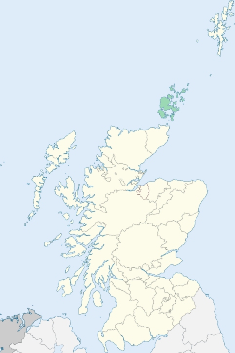
Westray is a parish at the north-west extremity of the North Isles of Orkney. It comprehends the islands of Westray and Papa-Westray, together with some adjacent islets of the kind called holms. (1867: The Imperial Gazetteer of Scotland, by John Marius Wilson).
Pierwall, Rapness, Westray
Cleat, Holland
PRE-REFORMATION GOVERNANCE:
POST-REFORMATION GOVERNANCE:
The Lady Kirk of Westray and The Cross Kirk of Westray were united in the sixteenth century.
The Lady Kirk of Westray. This parish is the northern part of the island of Westray. Its church, built on the Bay of Pierowal, was dedicated to St Mary. On the island of Papa Westray, in this parish, there was a chapel of St Curadan, known as the Kirk of How. On that island also were chapels of St Tridwal and St Nicholas.
The Cross Kirk of Westray. The ruins of the Cross Kirk of Westray still stand on the Bay of Tuquoy. As its name implies, it was dedicated to the Holy Rood. At Rapness, within this parish, there is now a mission chapel.
Includes ministers, licentiates, assistants, readers, and clerks.
(1928: Fasti Ecclesiæ Scoticanæ, by Hew Scott, D. D.)
Parish registers turned over to the Registrar-General, as a result of the Registration of Births, Deaths, and Marriages (Scotland) Act of 1854. The letters B. D. and M. indicate Births (or Baptisms), Deaths (or Burials), and Marriages (or Proclamations of Banns) respectively. Numbers indicate separate volumes or books. Note: These records are by no means complete or without damage; consult the Detailed List of the Old Parochial Registers of Scotland (1872) to learn more about the condition of the records.
| OPR and RD Numbers | |||
|---|---|---|---|
| Date Range | Name | Number | Type |
| 1733-1854 | Westray | 33 | OPR |
| 1760-1854 | Papa Westray | 33 | OPR |
| 1855-1859 | Westray and Papa Westray | 33 | RD |
| 1860-1971 | Westray | 33-1 | RD |
| 1860-1971 | Papa Westray | 33-2 | RD |
| 1972-2003 | Papa Westray | 131 | RD |
| 1972-2003 | Westray | 132 | RD |
| 2009 | (Westray) Orkney Islands, Westray | 132 | RD |
| 2009 | (Papa Westray) Orkney Islands, Papa Westray | 131 | RD |
| 2026 | (Westray) Orkney Islands Council; Westray Community Council | ||
| 2026 | (Papa Westray) Orkney Islands Council; Papa Westray Community Council | ||
(2009: Parishes and Registration Districts of Scotland - Old and New, National Records of Scotland)
Local community councils (2026) are provided as a potential source of additional information for settlements within the original boundaries of the parish. (Source)
Statistics from informal and official censuses
Groat, Harcus, Leslie, Logie, Miller, Paterson, Reid, Rendall, Stevenson, Stout
Note: Names appearing in research materials, other than censuses. Simple names (First name, surname only) have been omitted unless they appear associated with large properties. All women's names, and men's names with occupations, military ranks, or peerage titles are included.
By the Reverend Mr James Izat, Minister.
"Tradesmen of different kinds in the parish of Westray: 23 weavers, 5 shoemakers, 5 tailors, 3 wrights, 5 boatbuilders, 2 blacksmiths, 4 merchants. Perhaps it may appear pretty odd that the list of shoemakers is so small, and that there is no mention of coopers. The reason is this, that many in the parish can make shoes of a coarser kind, yet they do not live by this business; so in like manner there are several who can work in the cooper business, though none do it solely for their subsistence."
(This section contains excerpts, at times restructured or paraphrased, from an article appearing in Statistical Account of Scotland, Sir John Sinclair, 1791-1799)
Primary Sources:
Statistical Account of Scotland (1791-1799), Volume 16, p. 251
New Statistical Account of Scotland (1834-1845), Volume 15, Section III, p. 114
See Parish Page Sources for all source information and links.