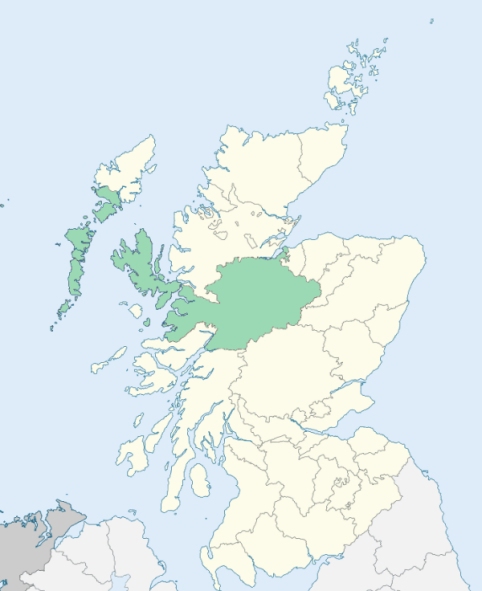
Sleat is a parish at the south-east end of the island of Skye, Inverness-shire. (1867: The Imperial Gazetteer of Scotland, by John Marius Wilson).
Aird, Achnachloich, Ardvasar, Armadale, Calligarry, Drumfearn, Duisdalemore, Ferindonald, Isleornsay or Isle Ornsay, Kilbeg, Kilmore, Saasaig, Tarskavaig, Teangue, Tokavaig
The parish of Sleat had a detached part containing 7,186 acres, and situated at Kylerhea. This detached part was separated from the main portion of the parish by part of the parish of Strath. An exchange of territory was effected between the two parishes. The northern portion of the detached part of Sleat was given to Strath, while at the same time a portion of Strath was given to Sleat, so as to connect the remainder of the detached part of Sleat with the main portion of the parish. See affected properties and landholders. (1892: Boundary of counties and parishes in Scotland as settled by the Boundary Commissioners under the Local Government Act, 1889, by Hay Shennan)
PRE-REFORMATION GOVERNANCE:
POST-REFORMATION GOVERNANCE:
The church of Sleat was dedicated to St Mary. About 1662 the parishes of Sleat and Strathswordale or Strath were united. They were severed again on 16 February 1726. At Isle Oronsay in the parish of Sleat there is a mission chapel.
Includes ministers, licentiates, assistants, readers, and clerks.
(1928: Fasti Ecclesiæ Scoticanæ, by Hew Scott, D. D.)
Parish registers turned over to the Registrar-General, as a result of the Registration of Births, Deaths, and Marriages (Scotland) Act of 1854. The letters B. D. and M. indicate Births (or Baptisms), Deaths (or Burials), and Marriages (or Proclamations of Banns) respectively. Numbers indicate separate volumes or books. Note: These records are by no means complete or without damage; consult the Detailed List of the Old Parochial Registers of Scotland (1872) to learn more about the condition of the records.
| OPR and RD Numbers | |||
|---|---|---|---|
| Date Range | Name | Number | Type |
| 1813-1854 | Sleat | 115 | OPR |
| 1855-1970 | Sleat | 115 | RD |
| 2009 | Highland, Broadford | 259 | RD |
| 2026 | Highland Council; Sleat Community Council | ||
(2009: Parishes and Registration Districts of Scotland - Old and New, National Records of Scotland)
Local community councils (2026) are provided as a potential source of additional information for settlements within the original boundaries of the parish. (Source)
Statistics from informal and official censuses
Anderson, Beaton, Campbell, Kennedy, MacDonald, MacGillivray, MacInnes, MacPherson, Nicolson, Robertson
Note: Names appearing in research materials, other than censuses. Simple names (First name, surname only) have been omitted unless they appear associated with large properties. All women's names, and men's names with occupations, military ranks, or peerage titles are included.
By the Reverend Mr Martin MacPherson, Minister.
"In the year 1755, the number of souls in the parish was 1250; and now, notwithstanding emigrations, and repeated drains to the army, the inhabitants amount to 1788. The proportion of males to females is as 5 to 6. There are now eight men in the parish upwards of 80; of women above that age, five; of that number, one is 98 and another 95.
I conceive it unnecessary to give any sort of general character of the genius or temper of the inhabitants; it is probable that some of my neighbouring brethren may have favoured the public with such disquisitions, of course their information may satisfy the reader as to the manners and customs of the parishioners of Sleat, there being naturally much similarity, by reason of the contiguity of the parishes. I deem it likewise superfluous, if not impertinent, to give any opinion as to the manner in which this part of the country is treated by the Legislature, or more properly speaking, by those in power, as it is to be supposed, that in a proportionate degree the same attention is paid to it, as the rest of the empire."
(This section contains excerpts, at times restructured or paraphrased, from an article appearing in Statistical Account of Scotland, Sir John Sinclair, 1791-1799)
Primary Sources:
Statistical Account of Scotland (1791-1799), Volume 16, p. 534
New Statistical Account of Scotland (1834-1845), Volume 14, Section I, p. 31
See Parish Page Sources for all source information and links.