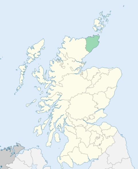
Thurso is a parish on the north coast of Caithness-shire. It is bounded by the German Ocean (North Sea), and by the parishes of Olrig, Bower, Halkirk, and Reay. (1867: The Imperial Gazetteer of Scotland, by John Marius Wilson).
Brims, Murkle, Pennylands, Thurso
Forss, Murkle
The parish of Thurso had one detached part which extended to 7,074 acres, and was bounded on the north-west by the parish of Reay, and on the east and south by the parish of Halkirk. It consisted of the Crown lands of Dorrery. This detached part was disjoined from the parish of Thurso and annexed to the parish of Halkirk. See affected properties and landholders. (1892: Boundary of counties and parishes in Scotland as settled by the Boundary Commissioners under the Local Government Act, 1889, by Hay Shennan)
PRE-REFORMATION GOVERNANCE:
POST-REFORMATION GOVERNANCE:
The church of Thurso was dedicated to St Peter. It belonged to the Bishop of Caithness. The ancient church was rebuilt in the earlier part of the seventeenth century and was then made the Cathedral of the restored See of Caithness. There was in this parish a chapel of the Holy Rood, known as the Cross Kirk. Other chapels stood at Pennyland, Brims, and Murkle. There was another chapel, Kirk Ebb, which stood on the seashore, but all vestiges of it have been swept away by the sea. There was also a chapel between Stainland and Bleachfield. Thurso held fairs on Petermas, Georgemas, and Marymas.
Includes ministers, licentiates, assistants, readers, and clerks.
(1928: Fasti Ecclesiæ Scoticanæ, by Hew Scott, D. D.)
Parish registers turned over to the Registrar-General, as a result of the Registration of Births, Deaths, and Marriages (Scotland) Act of 1854. The letters B. D. and M. indicate Births (or Baptisms), Deaths (or Burials), and Marriages (or Proclamations of Banns) respectively. Numbers indicate separate volumes or books. Note: These records are by no means complete or without damage; consult the Detailed List of the Old Parochial Registers of Scotland (1872) to learn more about the condition of the records.
| OPR and RD Numbers | |||
|---|---|---|---|
| Date Range | Name | Number | Type |
| 1647-1854 | Thurso | 41 | OPR |
| 1855-1971 | Thurso | 41 | RD |
| 1972-2001 | Thurso | 161 | RD |
| 2002-2006 | Thurso, Strathy and Mey | 161 | RD |
| 2009 | Highland; Thurso, Strathy and Mey | 161 | RD |
| 2026 | Highland Council; Thurso Community Council | ||
(2009: Parishes and Registration Districts of Scotland - Old and New, National Records of Scotland)
Local community councils (2026) are provided as a potential source of additional information for settlements within the original boundaries of the parish. (Source)
Statistics from informal and official censuses
Campbell, Gunn, Henderson, MacKay, Manson, Miller, Munro, Sinclair, Sutherland, Swanson
Note: Names appearing in research materials, other than censuses. Simple names (First name, surname only) have been omitted unless they appear associated with large properties. All women's names, and men's names with occupations, military ranks, or peerage titles are included.
By the Author of the Statistical Account of Scotland.
"The people in general are remarkably sober, regular, and attentive to business. Their favourite, and indeed only public amusement, is dancing, in which they are excellent proficients. They have no clubs, but there are four friendly societies in town, each of which has its peculiar rules and regulations, and a fund for the relief of indigent members, &c. These are, the Society of Weavers, Fishers, Trades, and United Craftsmen. The last is only lately established, but promises to be the richest society of the four."
(This section contains excerpts, at times restructured or paraphrased, from an article appearing in Statistical Account of Scotland, Sir John Sinclair, 1791-1799)
Primary Sources:
Statistical Account of Scotland (1791-1799), Volume 20, p. 493
New Statistical Account of Scotland (1834-1845), Volume 15, Section II, p. 1
See Parish Page Sources for all source information and links.